File talk:Tunisian Republic location map.svg
Jump to navigation
Jump to search
Dry lakes[edit]
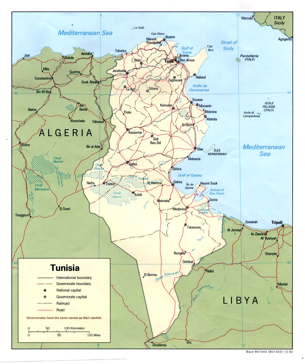
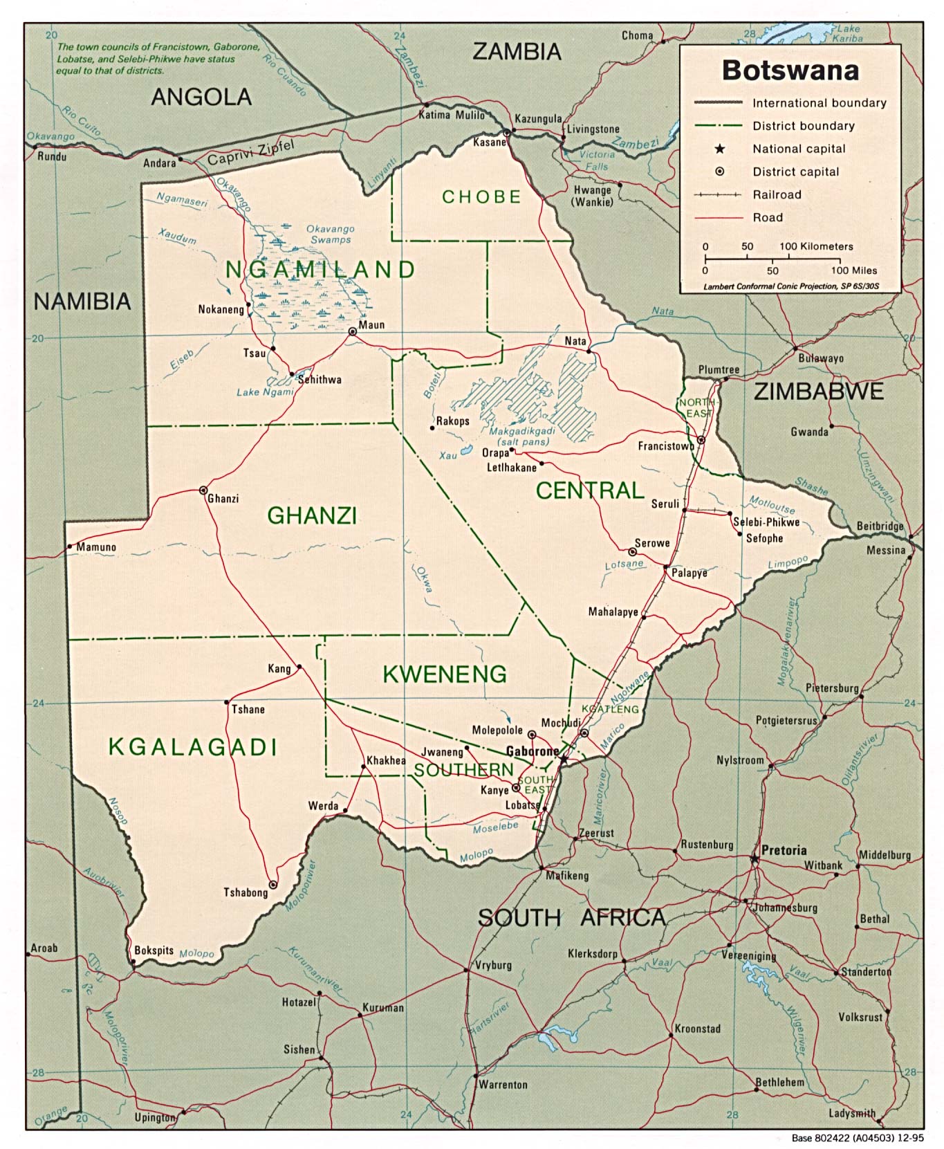
You used at Botswana map different sign for the temporal lakes. May be it will be logic use this sign at Tunisia? Bogomolov.PL (talk) 16:41, 28 August 2008 (UTC)
- Here are only freshwater and salt lakes. In Botswana it's salt pans what is shown differently. --NNW (talk) 18:19, 29 August 2008 (UTC)
- There was no special legend at Kartenwerkstatt so salt pans sing was never described. It is a problem with dry lakes - they are dry for the decades or centuries, but noted at the maps as real lakes.Bogomolov.PL (talk) 05:55, 1 September 2008 (UTC)
- en:Chott el Djerid is described as a salt pan, so may be it is reasonable to show it with the salt pans sign. Bogomolov.PL (talk) 06:56, 1 September 2008 (UTC)
- No, it isn't. See infobox: Lake type: salt lake. Appearance of "salt pan" in the article: 1x. Appearance of "lake": 5x. Btw this project is a work in progress and is still discussed so it might happen that some signs aren't described yet. Time might tell... --NNW (talk) 17:51, 1 September 2008 (UTC)
- de:Salztonebene claimes shott as arab definition of salt pan. What to do with this? It is possible to interprete the same object as both a lake (temporal) and a salt pan. But Wiki tells us Chott el Djerid is shott and so predominantly dry salt temporal lake = salt pan. Bogomolov.PL (talk) 12:20, 2 September 2008 (UTC)
- What to do with this? I will ignore it. You came with article en:Chott el Djerid and it didn't changed anything and now you try it with de:Salztonebene and it won't change a thing, either. What will be the third article, I ask myself? I have German, English and Russian atlases and they all show the Chotts and the pans in Botswana differently. Generations of international mapmakers can't go that wrong. They probably (and me definitely) have their reason to do so. --NNW (talk) 14:07, 2 September 2008 (UTC)
- I have the large "Атлас Офицера"(Officer's Atlas) 1984, USSR Min. of Def. where Botswana and Chotts have exactely the same sign of solonchak. I have a huge Physical Geography World Atlas ("Физико-географический атлас мира") 1964, USSR Acad. of Sc. where Botswana and Chotts have exactely the same sign of solonchak. The other map of the same atlas (soil map) signs them both with en:solonchak color, not lake. At home I will look for more atlases. I have 4-language Encyclopedic Vocabulary on Physical Geography where шотт/shott/Chott/chott is the same as себха/sebkha/Sebcha=Pfanne/sebkha also called такыр/takyr/Takyr/takyr or playa/Salztonebene/etc. Geographic Encyclopedic Vocabulary (geographic features)("Географический энциклопедический словарь"), 1986, tells us about the Chott el Djerid: "Endorheic depression in the central part of Tunisia. In winter becomes shallow-water saline lake, in summer dries." It is not present at Tunisia map as solonchaks are not depicted.Geographic Encyclopedic Vocabulary (geographic terms)("Географический энциклопедический словарь"), 1988 tells us that chott is:"Enclosed endorheic depression with solonchaks in humid season covered with saline lakes". Bogomolov.PL (talk) 16:09, 2 September 2008 (UTC)
- The Haack (Gotha) Atlas signes Chott (as Botswana salt pans) with swamp/salt swamp sign. Budapest Cartographia Atlas - as swamp. USSR Geod.&Cartogr. A-cy "Africa Atlas" - as temporal saline lake (as Botswana salt pans too). Soviet military topo maps (1:500 000 I-32-В sheet, available here) as solonchak (in central lower parts - impassable solonchak).Just now all accesible for me sources show that Botswana Kalahari desertal temporal lakes (or salt pans, or solonchaks) are depicted with the same sign as chotts in N.Africa Bogomolov.PL (talk) 06:29, 3 September 2008 (UTC)
- Here is American C.I.A. map where chotts are not lakes, but at this C.I.A. map with the same sign for the salt pans. Here is U.S. military topo maps where sebkha (not lake) sign is in use.Bogomolov.PL (talk) 06:23, 4 September 2008 (UTC)
- I did not found any maps where chotts have different sign from the salt pans in Botswana. May be you have different atlases? "Generations of international mapmakers can't go that wrong. They probably (and me definitely) have their reason to do so" you wrote, but it was impossible for me be sure with this position. Too many professional cartographic maps and atlases I've listed don't support your point of view. I think it is possible to find map or atlas with cartographic signing situation you claim, but it was impossible for me. Even if it is chott=lake on a map in WikiCommons, the original map used for such kind of map has not chott=lake. What to do with this? Now you know - there are maps/atlases where chotts are not lakes, or this lakes are the same type as used for the salt pans. Bogomolov.PL (talk) 07:03, 4 September 2008 (UTC)
- I have the large "Атлас Офицера"(Officer's Atlas) 1984, USSR Min. of Def. where Botswana and Chotts have exactely the same sign of solonchak. I have a huge Physical Geography World Atlas ("Физико-географический атлас мира") 1964, USSR Acad. of Sc. where Botswana and Chotts have exactely the same sign of solonchak. The other map of the same atlas (soil map) signs them both with en:solonchak color, not lake. At home I will look for more atlases. I have 4-language Encyclopedic Vocabulary on Physical Geography where шотт/shott/Chott/chott is the same as себха/sebkha/Sebcha=Pfanne/sebkha also called такыр/takyr/Takyr/takyr or playa/Salztonebene/etc. Geographic Encyclopedic Vocabulary (geographic features)("Географический энциклопедический словарь"), 1986, tells us about the Chott el Djerid: "Endorheic depression in the central part of Tunisia. In winter becomes shallow-water saline lake, in summer dries." It is not present at Tunisia map as solonchaks are not depicted.Geographic Encyclopedic Vocabulary (geographic terms)("Географический энциклопедический словарь"), 1988 tells us that chott is:"Enclosed endorheic depression with solonchaks in humid season covered with saline lakes". Bogomolov.PL (talk) 16:09, 2 September 2008 (UTC)
- What to do with this? I will ignore it. You came with article en:Chott el Djerid and it didn't changed anything and now you try it with de:Salztonebene and it won't change a thing, either. What will be the third article, I ask myself? I have German, English and Russian atlases and they all show the Chotts and the pans in Botswana differently. Generations of international mapmakers can't go that wrong. They probably (and me definitely) have their reason to do so. --NNW (talk) 14:07, 2 September 2008 (UTC)
- de:Salztonebene claimes shott as arab definition of salt pan. What to do with this? It is possible to interprete the same object as both a lake (temporal) and a salt pan. But Wiki tells us Chott el Djerid is shott and so predominantly dry salt temporal lake = salt pan. Bogomolov.PL (talk) 12:20, 2 September 2008 (UTC)
- No, it isn't. See infobox: Lake type: salt lake. Appearance of "salt pan" in the article: 1x. Appearance of "lake": 5x. Btw this project is a work in progress and is still discussed so it might happen that some signs aren't described yet. Time might tell... --NNW (talk) 17:51, 1 September 2008 (UTC)