File talk:Syria location map.svg
 | This file was nominated for deletion on 28 February 2010 but was kept. If you are thinking about re-nominating it for deletion, please read that discussion first. |
Shouldn't the Golan Heights be in a different color? Drork (talk) 03:34, 25 November 2008 (UTC)
- Correct. I forgot to do it. Thanks! --NNW (talk) 18:31, 29 November 2008 (UTC)
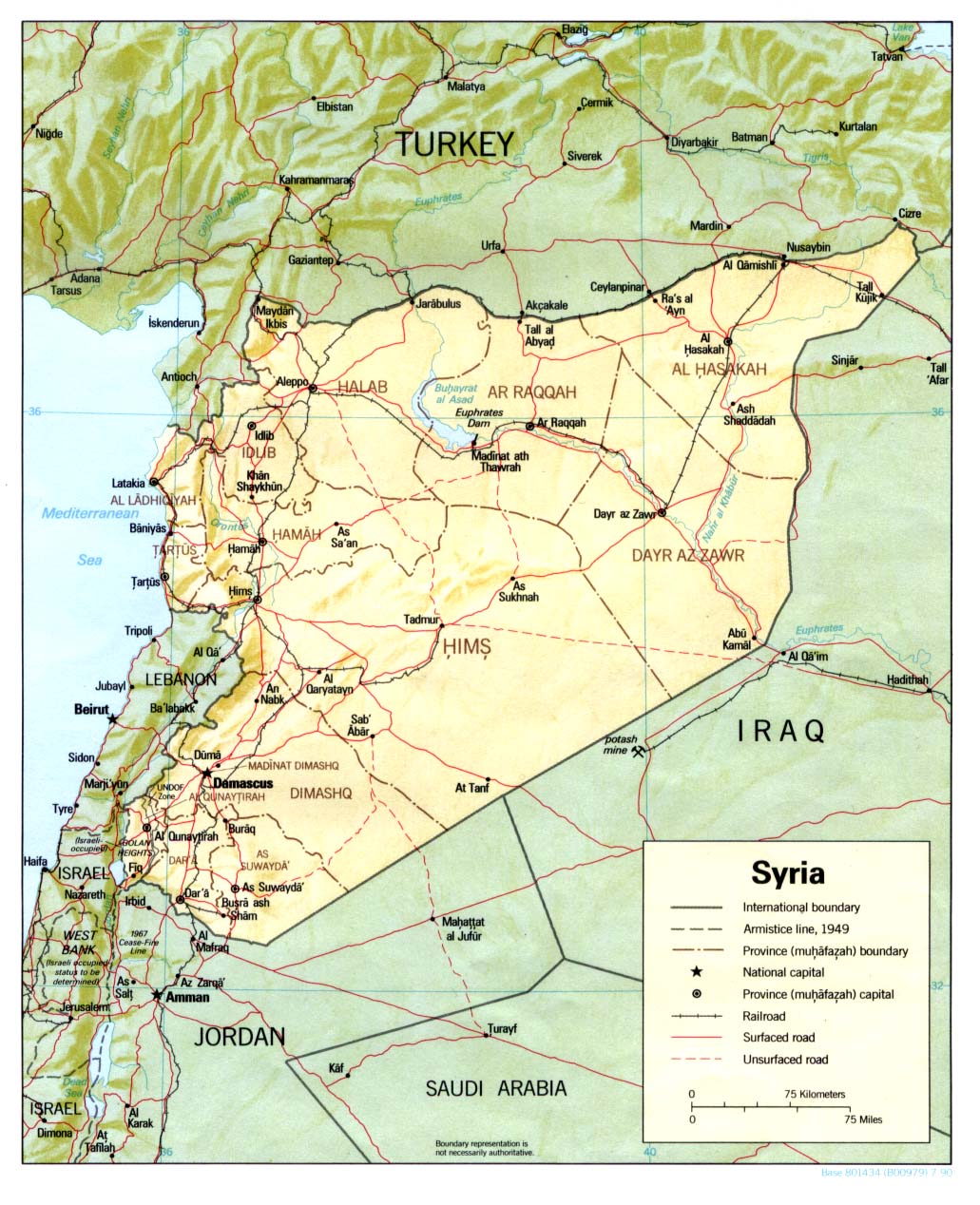
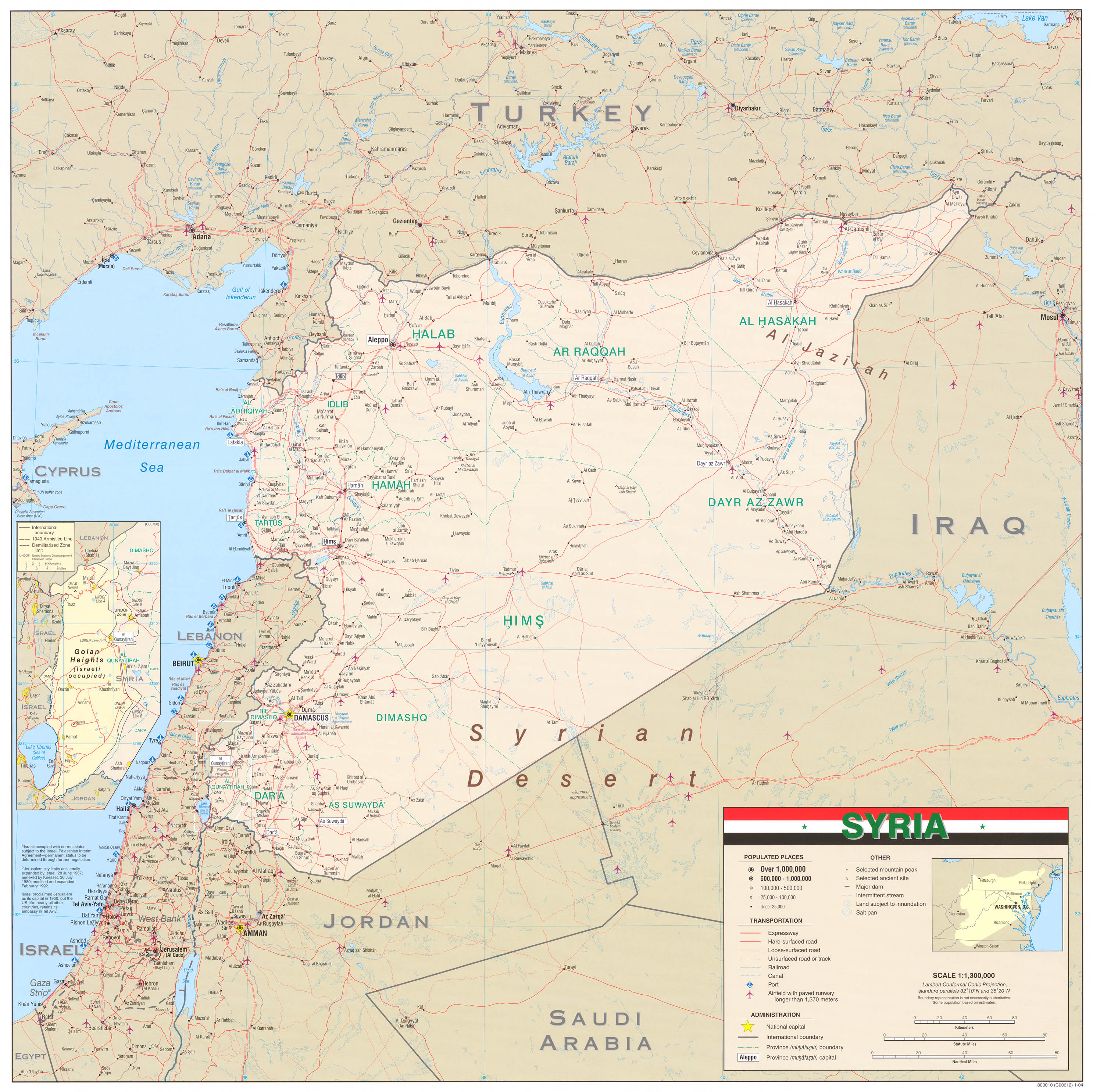
Why should the Golan heights be in a different color? All these maps show it with the same color:
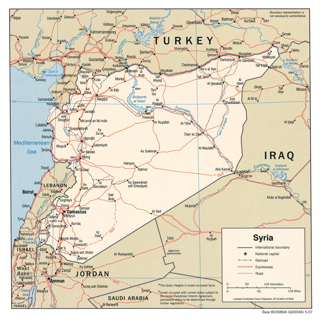
- http://www.lib.utexas.edu/maps/middle_east_and_asia/syria_pol_2007.jpg
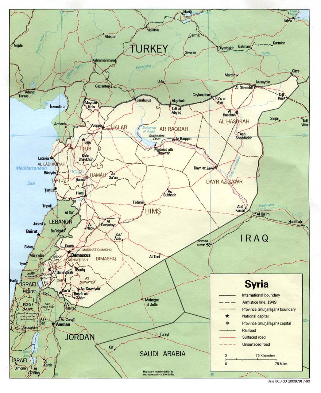
- http://www.lib.utexas.edu/maps/middle_east_and_asia/syria_pol90.jpg
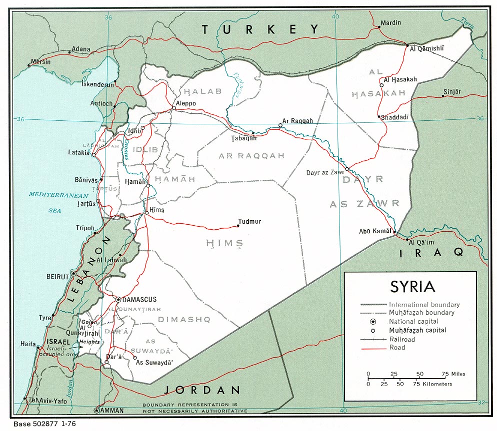
- http://www.lib.utexas.edu/maps/middle_east_and_asia/syria_pol_1976.jpg
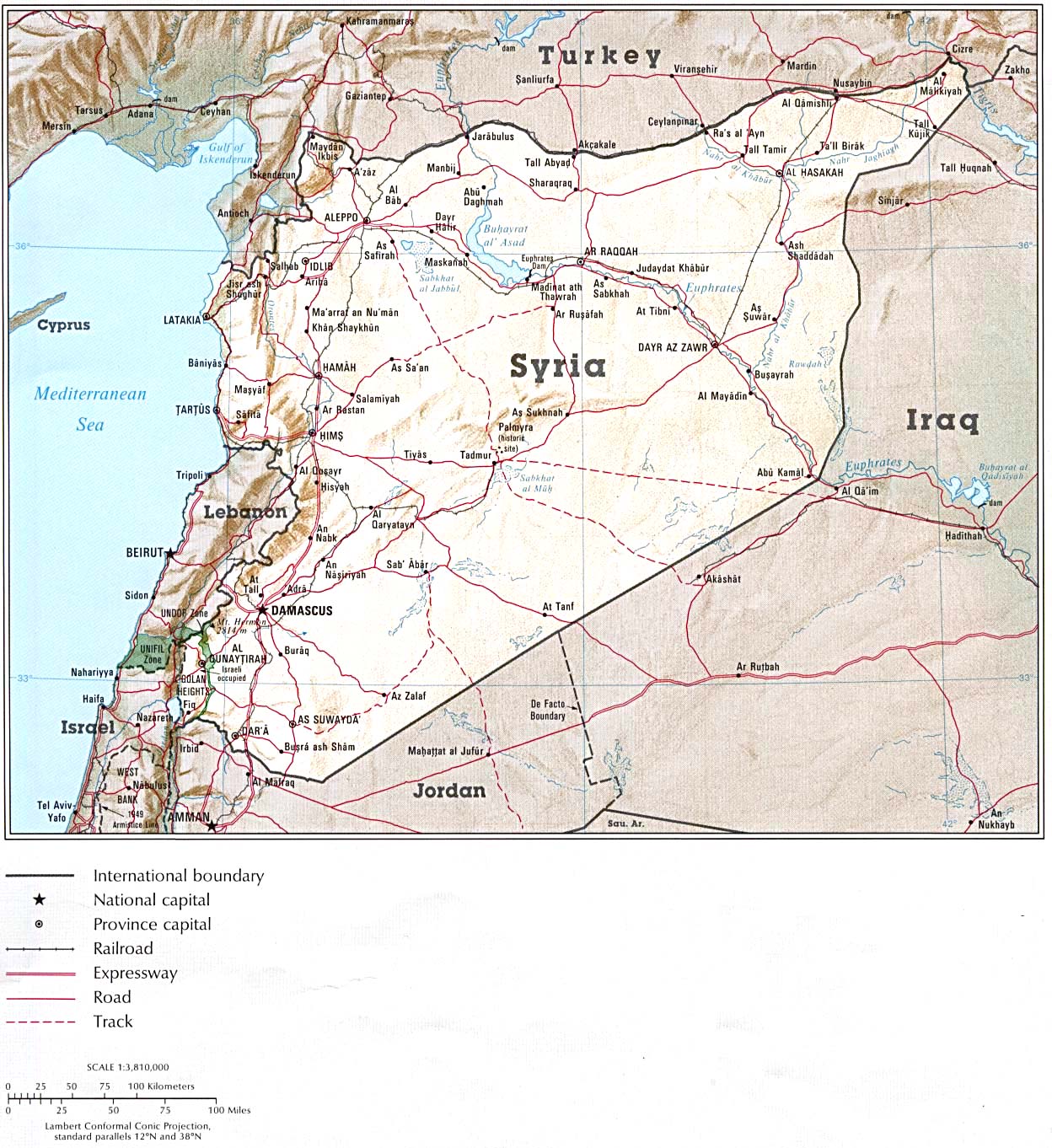
- http://www.lib.utexas.edu/maps/atlas_middle_east/syria_map.jpg
- http://www.lib.utexas.edu/maps/middle_east_and_asia/syria_rel90.jpg
- http://www.lib.utexas.edu/maps/cia10/syria_sm_2010.gif
- http://www.lib.utexas.edu/maps/middle_east_and_asia/syria_wall_2004.jpg
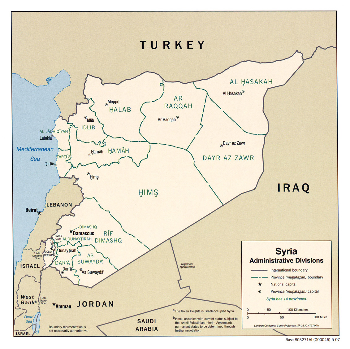
- http://www.lib.utexas.edu/maps/middle_east_and_asia/syria_admin_2007.jpg
- http://www.lib.utexas.edu/maps/atlas_middle_east/syria_divisions.jpg
- http://www.lib.utexas.edu/maps/atlas_middle_east/syria_econ.jpg
- http://www.un.org/Depts/Cartographic/map/profile/syria.pdf
--Supreme Deliciousness (talk) 11:07, 29 September 2010 (UTC)
- It shows the de facto situation. The Golan Heights are occupied by Israel and the UNDOF zone isn't controlled by Syria, either. Btw the UNDOF zone is shown in a different way as Syria in maps 4, 9 and 10 and if you look at the inserted map of map 7 you will see that both areas are presented differently. That doesn't mean that it is not Syria as seen by UN, it just wants to show that it is not controlled by Syria right now. NNW (talk) 15:24, 29 September 2010 (UTC)
- Just because Syria doesn't control it doesn't mean its not a part of Syria. The Afghan government doesn't control region close to Pakistan, does this mean the map of Afghanistan should have different colors? Yes three maps has different colors on the Undof region, but not on the rest of GH, all maps show GH with same color as rest of Syria, why create or own "wiki-reality" against the sources? --Supreme Deliciousness (talk) 19:08, 30 September 2010 (UTC)
- Why do think the maps you listed above are my sources? I never said so. Israel has annexed the Golan Heights (see en:Golan Heights Law, so that area is disputed, so it is shown gray. If you revert again you'll find your name at Commons:Administrators' noticeboard/Vandalism. NNW (talk) 19:41, 30 September 2010 (UTC)
- Israel extending its laws was declared "null and void" by the UN and "without international legal effect" [1] I brought you 11 maps. Show me reliable maps of Syria and the region that show Golan in a different color then the rest of Syria. Here is also the CIA factbook, [2]. --Supreme Deliciousness (talk) 22:16, 30 September 2010 (UTC)
- Why do think the maps you listed above are my sources? I never said so. Israel has annexed the Golan Heights (see en:Golan Heights Law, so that area is disputed, so it is shown gray. If you revert again you'll find your name at Commons:Administrators' noticeboard/Vandalism. NNW (talk) 19:41, 30 September 2010 (UTC)
- Nice declaration by the UN but de facto the Golan Heights are governed by Israel. This map doesn't show the UN status, I told you this before. And it is not the only map not showing the UN view. De jure there is no Northern Cyprus but it exists de facto, so it is shown on maps. NNW (talk) 17:12, 1 October 2010 (UTC)
- Even if it is occupied it doesn't make it part of another country. The map of Cyprus has the same color on both North and southern Cyprus: [3], as I said before, I have shown you many sources, you have not brought one single source.--Supreme Deliciousness (talk) 12:27, 2 October 2010 (UTC)
- Nice declaration by the UN but de facto the Golan Heights are governed by Israel. This map doesn't show the UN status, I told you this before. And it is not the only map not showing the UN view. De jure there is no Northern Cyprus but it exists de facto, so it is shown on maps. NNW (talk) 17:12, 1 October 2010 (UTC)
![[3]](https://en.wikipedia.org/wiki/File:Cyprus_location_map.svg)
- Even if it is occupied it doesn't make it part of another country: read en:Golan Heights Law, Israel has got a different view – despite you or me or the UN like it or not. Golan Heights are gray because it is occupied by another internationally accepted country. Northern Cyprus remains yellow because it is not internationally accepted. It is the same with Transnistria that is shown yellow within the county of Moldova; and it is the same with Abchasia in Georgia. The Israel/Syria conflict follows international rules, so it is shown in other colours than internal conflicts. I just try to explain to you the rules which colour is used for which actual situation. This is an cartographic issue and a cartographic decision. That's why southern Russia here is shown in blue. It was not officially part of the German Empire but de facto it was occupied by the German Empire at this time. That's why I don't need to show you maps. You just have to understand and accept how cartography works. NNW (talk) 13:13, 2 October 2010 (UTC)
- Israel is an internationally accepted country, but its occupation of Golan is not internationally accepted, its internationally accepted as part of Syria. Listen, I showed you elven reliable official maps here above, all of them show Golan's color as the same as the rest of Syria. You have not shown me one single map. If not showing Golan in the same color as the rest of Syria is "how cartography works.", then how come all these maps above have the same color? Or are they all wrong and you a guy with a wikimedia account is more authoritative then them? You have no reason here to create a fake image against what all these sources show. --Supreme Deliciousness (talk) 09:37, 10 October 2010 (UTC)
- Again: The maps listed above show the situation DE JURE, this map here shows it DE FACTO. Both is correct because both is the result of a cartographic decision like using the colour dark grey for boundaries. I have told you three times and I won't do it a fourth time. This discussion is going round in circles and has come to an end. Especially as your contributions become rude. I am definitely not in need of this. NNW (talk) 12:16, 13 October 2010 (UTC)
- Israel is an internationally accepted country, but its occupation of Golan is not internationally accepted, its internationally accepted as part of Syria. Listen, I showed you elven reliable official maps here above, all of them show Golan's color as the same as the rest of Syria. You have not shown me one single map. If not showing Golan in the same color as the rest of Syria is "how cartography works.", then how come all these maps above have the same color? Or are they all wrong and you a guy with a wikimedia account is more authoritative then them? You have no reason here to create a fake image against what all these sources show. --Supreme Deliciousness (talk) 09:37, 10 October 2010 (UTC)
- Even if it is occupied it doesn't make it part of another country: read en:Golan Heights Law, Israel has got a different view – despite you or me or the UN like it or not. Golan Heights are gray because it is occupied by another internationally accepted country. Northern Cyprus remains yellow because it is not internationally accepted. It is the same with Transnistria that is shown yellow within the county of Moldova; and it is the same with Abchasia in Georgia. The Israel/Syria conflict follows international rules, so it is shown in other colours than internal conflicts. I just try to explain to you the rules which colour is used for which actual situation. This is an cartographic issue and a cartographic decision. That's why southern Russia here is shown in blue. It was not officially part of the German Empire but de facto it was occupied by the German Empire at this time. That's why I don't need to show you maps. You just have to understand and accept how cartography works. NNW (talk) 13:13, 2 October 2010 (UTC)
On Commons the answer is simple. Upload two versions under different filenames with clear descriptions and an "other versions" link to one another. Either version could be useful in different educational contexts. The Wikipedias will have to decide for themselves which to use. --99of9 (talk) 02:38, 14 October 2010 (UTC)
- This is acceptable, we will have this image to represent the Israeli pov, and then the other image to represent the entire world view and also following all the maps I provided above. --Supreme Deliciousness (talk) 10:21, 14 October 2010 (UTC)
- Perhaps a better idea would be to convince your superiors to release more Syrian Governmental material under free license? This would be a real contribution to the Free Content movement. Kàkhvelokákh (talk) 10:32, 14 October 2010 (UTC)
- This is acceptable, we will have this image to represent the Israeli pov, and then the other image to represent the entire world view and also following all the maps I provided above. --Supreme Deliciousness (talk) 10:21, 14 October 2010 (UTC)
- This is a very bad idea, because it suggests that there are two "truths" and anyone can chose his own. This is not the case. The truth is that there is a dispute over the territory and a de facto situation. Cyprus also has a dispute of similar nature, and this is how its maps on Commons look Atlas of Cyprus. Kàkhvelokákh (talk) 09:03, 14 October 2010 (UTC)
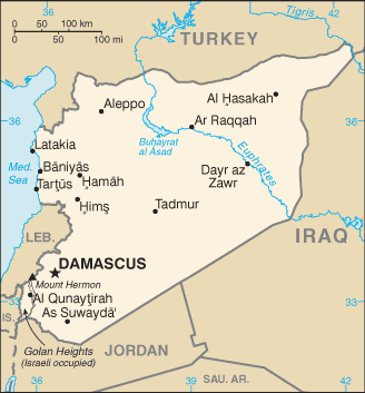
Lebanon border disputes?[edit]
I have figured out where exactly in Lebanon the claims of Syria are. —SPESH531Other 00:09, 20 May 2014 (UTC)
- Can you give a link to your sources? NNW 06:42, 20 May 2014 (UTC)
- Btw: This file uses a screenshot of Google Earth and has to be deleted as a copyvio. Try to use OpenStreetMap instead. NNW 06:45, 20 May 2014 (UTC)
- Yeah the file wasn't meant to last.—SPESH531Other 10:14, 20 May 2014 (UTC)
- [http://www.dailystar.com.lb/News/Lebanon-News/2005/May-04/5263-whose-map-is-right-syrian-colonel-insists-his-base-is-not-in-lebanon.ashx While it may be an old link, there has yet to be an agreement between the two countries.—SPESH531Other 10:15, 20 May 2014 (UTC)
- Also, OpenStreetMap is pretty inaccurate in some of theses areas; I am updating them myself so I can draw the disputed areas on a picture that I can upload to Commons.—SPESH531Other 20:17, 20 May 2014 (UTC)
- Yeah the file wasn't meant to last.—SPESH531Other 10:14, 20 May 2014 (UTC)
The changes I want to implement can be seen in the image to the right:

- You linked to a news article but what is the source for the exact form of the disputed areas? You need to have a map for this. Or did you draw these lines just according to the news text? NNW 07:39, 22 May 2014 (UTC)
- According to news text, so these aren't perfect. I cannot find a map showing the actual disputed territories, on any website on the world wide web, so I was reduced down to basing it off of town names that are disputed. —SPESH531Other 05:07, 23 May 2014 (UTC)
- According to news text is OR. This isn't allowed. NNW 08:25, 23 May 2014 (UTC)