File:Yugoslavia 1997 UN map.png

Original file (2,613 × 3,349 pixels, file size: 2.68 MB, MIME type: image/png)
Captions
Captions
| Description |
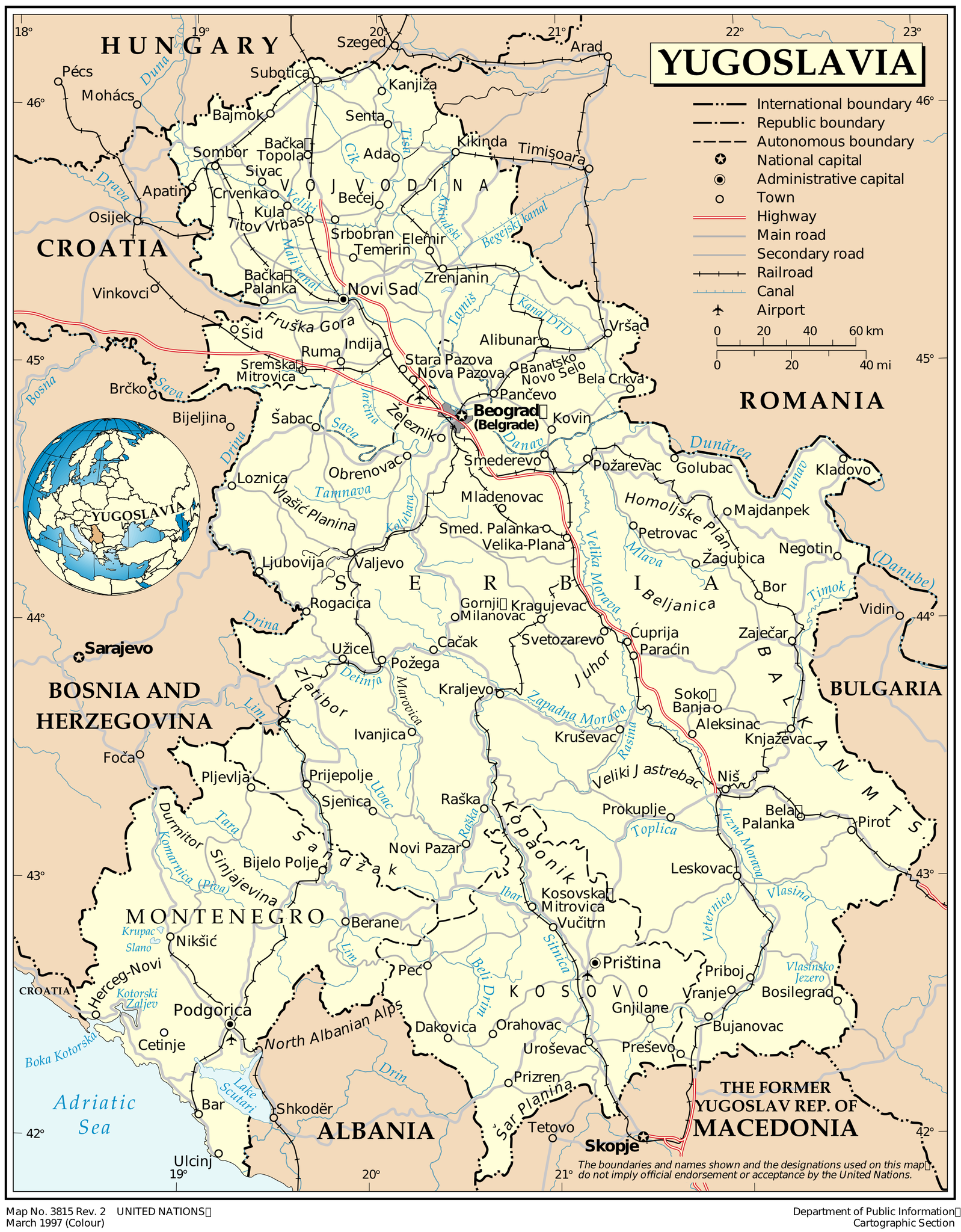
English: Map of Yugoslavia as of March 1997. Produced by the United Nations Cartographic Section.
Español: Mapa de Yugoslavia a fecha marzo de 1997. Realizado por el Servicio Cartográfico de las Naciones Unidas. |
|||
| Date | ||||
| Source | United Nations Cartographic Section | |||
| Author | United Nations Cartographic Section | |||
| Permission (Reusing this file) |
|

File history
Click on a date/time to view the file as it appeared at that time.
| Date/Time | Thumbnail | Dimensions | User | Comment | |
|---|---|---|---|---|---|
| current | 17:10, 30 November 2011 | | 2,613 × 3,349 (2.68 MB) | Montgomery (talk | contribs) | {{Information |Description ={{en|1=Map of Yugoslavia as of March 1997. Produced by the United Nations Cartographic Section.}} {{es|1=Mapa de Yugoslavia a fecha marzo de 1997. Realizado por el Servicio Cartográfico de las Naciones Unidas.}} |Source |
You cannot overwrite this file.
File usage on Commons
There are no pages that use this file.
File usage on other wikis
The following other wikis use this file:
- Usage on en.wikipedia.org
- Usage on sh.wikipedia.org