File:Wyspy Normandzkie.png
Jump to navigation
Jump to search
Size of this preview: 430 × 600 pixels. Other resolutions: 172 × 240 pixels | 344 × 480 pixels | 550 × 768 pixels | 734 × 1,024 pixels | 1,419 × 1,980 pixels.
Original file (1,419 × 1,980 pixels, file size: 293 KB, MIME type: image/png)
Captions
Captions
Add a one-line explanation of what this file represents
Summary[edit]
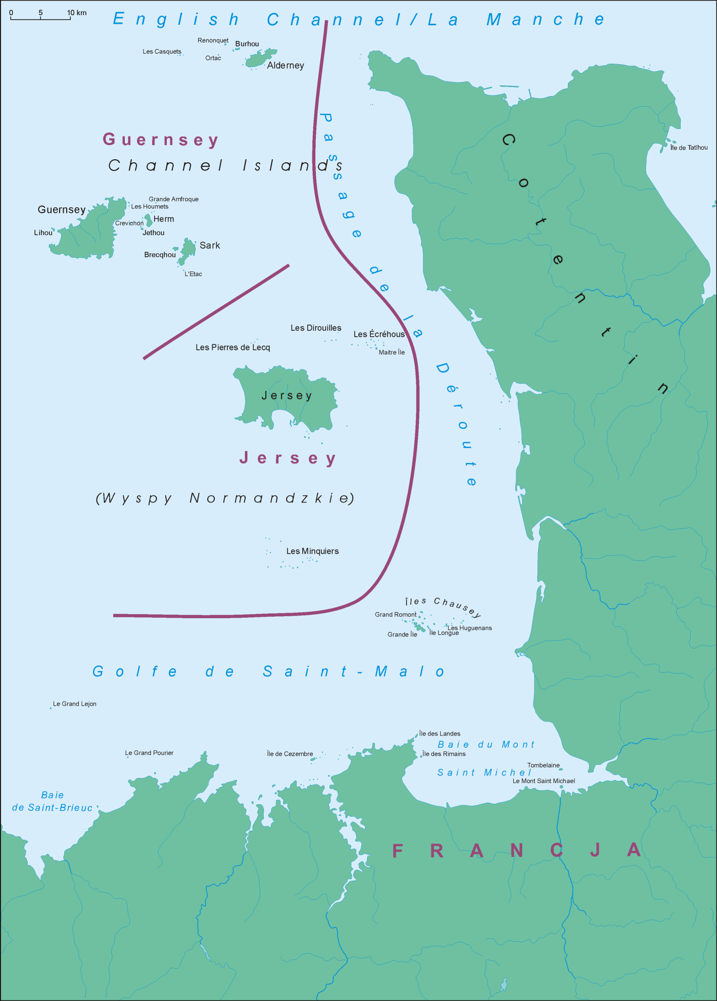
| Description |
Polski: Mapa Wysp Normandzkich English: Map of Channel Islands |
||||||||
| Date | |||||||||
| Source | Own work | ||||||||
| Author | Aotearoa | ||||||||
| Permission (Reusing this file) |
I, the copyright holder of this work, hereby publish it under the following license:
|

File history
Click on a date/time to view the file as it appeared at that time.
| Date/Time | Thumbnail | Dimensions | User | Comment | |
|---|---|---|---|---|---|
| current | 07:00, 15 April 2008 | | 1,419 × 1,980 (293 KB) | Aotearoa (talk | contribs) | == Summary == {{Information |Description=Location map of Sark |Source=własna praca |Date=14.04.2008 |Author= Aotearoa |Permission={{self|GFDL}} |other_versions= }} Category:Maps of the Channel Islands |
You cannot overwrite this file.
File usage on Commons
There are no pages that use this file.
File usage on other wikis
The following other wikis use this file:
- Usage on am.wikipedia.org
- Usage on be.wikipedia.org
- Usage on cs.wikipedia.org
- Usage on el.wikipedia.org
- Usage on en.wikipedia.org
- Usage on en.wikiversity.org
- Usage on es.wikipedia.org
- Usage on fr.wikipedia.org
- Usage on gv.wikipedia.org
- Usage on he.wikipedia.org
- Usage on hr.wikipedia.org
- Usage on hy.wikipedia.org
- Usage on it.wikipedia.org
- Usage on ja.wikipedia.org
- Usage on lt.wikipedia.org
- Usage on pl.wikipedia.org
- Usage on pl.wiktionary.org
- Usage on ru.wikipedia.org
- Usage on sh.wikipedia.org
- Usage on sr.wikipedia.org
- Usage on uk.wikipedia.org
- Usage on vi.wikipedia.org
- Usage on wuu.wikipedia.org
- Usage on yi.wikipedia.org
- Usage on zh.wikipedia.org