File:Wielkopolskie mapa fizyczna.png
Jump to navigation
Jump to search
Size of this preview: 473 × 599 pixels. Other resolutions: 189 × 240 pixels | 379 × 480 pixels | 607 × 768 pixels | 809 × 1,024 pixels | 1,618 × 2,048 pixels | 2,665 × 3,374 pixels.
Original file (2,665 × 3,374 pixels, file size: 918 KB, MIME type: image/png)
Captions
Captions
Add a one-line explanation of what this file represents
| Description |
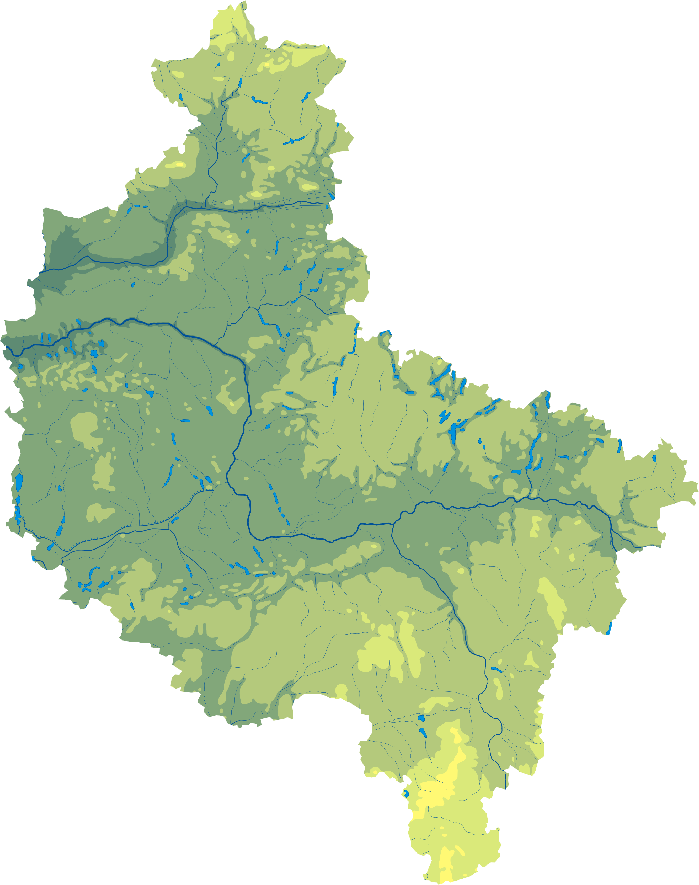
Polski: Mapa wód i ukształtowania powierzchni województwa wielkopolskiego.
Współrzędne graniczne mapy:
English: Relief map of Greater Poland Voivodeship. |
||
| Date | |||
| Source | Wielkopolskie mapa fizyczna, which was created and published under GFDL-self by Aotearoa. | ||
| Author | Aotearoa | ||
| Permission (Reusing this file) |
|

Legend[edit]

File history
Click on a date/time to view the file as it appeared at that time.
| Date/Time | Thumbnail | Dimensions | User | Comment | |
|---|---|---|---|---|---|
| current | 11:05, 29 October 2012 | | 2,665 × 3,374 (918 KB) | Aotearoa (talk | contribs) | drobne techniczne |
| 06:14, 8 February 2007 |  | 548 × 691 (118 KB) | Bonas (talk | contribs) | {{Information |Description= Relief map of Greater Poland Voivodeship. |Source= Wielkopolskie mapa fizyczna, which was created and published under GFDL-self by [[:pl:Wikipe |
You cannot overwrite this file.
File usage on Commons
There are no pages that use this file.
File usage on other wikis
The following other wikis use this file:
- Usage on be.wikipedia.org
- Usage on bg.wikipedia.org
- Познан
- Жележница (Великополско войводство)
- Волщин
- Калиш
- Конин
- Лешно
- Гнезно
- Остров Велкополски
- Пила (град)
- Сважендз
- Шрем
- Кротошин
- Вжешня
- Любон
- Турек
- Ярочин
- Вонгровец
- Кошчян
- Коло (Великополско войводство)
- Шрода Велкополска
- Равич
- Гостин
- Плешев
- Лобженица
- Гроджиск Велкополски
- Злотов
- Кемпно
- Мендзиход
- Нови Томишъл
- Оборники
- Остшешов
- Слупца
- Ходжеж
- Чарнков
- Шамотули
- Тшчянка
- Шаблон:ПК Полша Великополско войводство
- Костшинек
- Променко
- Нежихово
- Винна Гора (Великополско войводство)
- Качори (Пилски окръг)
- Мошчиска
- Хутка
- Жулч
- Остророг
- Usage on ce.wikipedia.org
- Usage on de.wikipedia.org
- Usage on hu.wikipedia.org
View more global usage of this file.