File:Western Empire as divided at Verdun 843.jpg
Jump to navigation
Jump to search
Size of this preview: 762 × 599 pixels. Other resolutions: 305 × 240 pixels | 610 × 480 pixels | 976 × 768 pixels | 1,280 × 1,007 pixels | 1,552 × 1,221 pixels.
Original file (1,552 × 1,221 pixels, file size: 776 KB, MIME type: image/jpeg)
Captions
Captions
Add a one-line explanation of what this file represents
Summary[edit]
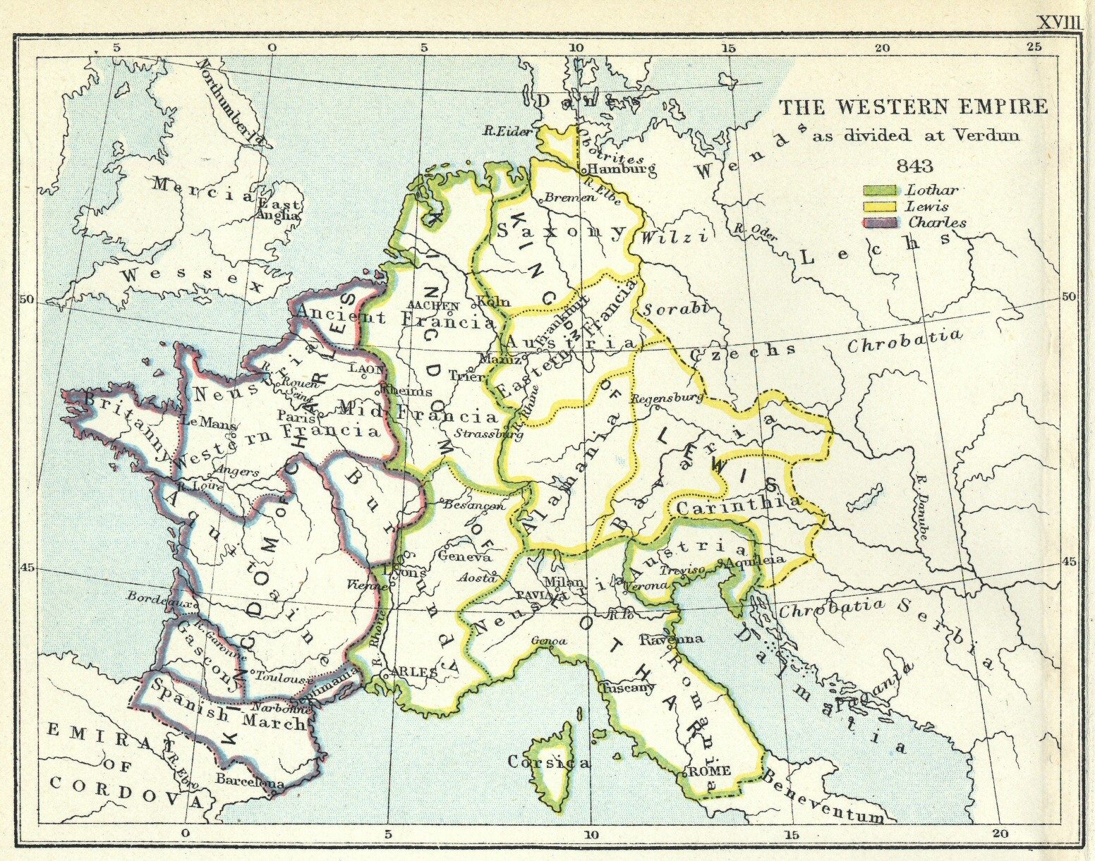
| Description | Map of the Empire of Charlemagne as divided among his three sons at the Treaty of Verdun, 843. |
| Date |
|
| Source | scanned from Freeman's Atlas to the Historical Geography of Europe, 3rd edition |
| Author | Nick Wedd |
| Permission (Reusing this file) |
The book, published in 1903, is out of copyright. I created the image myself. See below. |
Licensing[edit]
I, the copyright holder of this work, hereby publish it under the following licenses:

|
Permission is granted to copy, distribute and/or modify this document under the terms of the GNU Free Documentation License, Version 1.2 or any later version published by the Free Software Foundation; with no Invariant Sections, no Front-Cover Texts, and no Back-Cover Texts. A copy of the license is included in the section entitled GNU Free Documentation License. |
This file is licensed under the Creative Commons Attribution-Share Alike Attribution-Share Alike 4.0 International, 3.0 Unported, 2.5 Generic, 2.0 Generic and 1.0 Generic license.
- You are free:
- to share – to copy, distribute and transmit the work
- to remix – to adapt the work
- Under the following conditions:
- attribution – You must give appropriate credit, provide a link to the license, and indicate if changes were made. You may do so in any reasonable manner, but not in any way that suggests the licensor endorses you or your use.
- share alike – If you remix, transform, or build upon the material, you must distribute your contributions under the same or compatible license as the original.
You may select the license of your choice.
File history
Click on a date/time to view the file as it appeared at that time.
| Date/Time | Thumbnail | Dimensions | User | Comment | |
|---|---|---|---|---|---|
| current | 13:41, 20 November 2007 | | 1,552 × 1,221 (776 KB) | Maproom (talk | contribs) | {{Information |Description=Map of the Empire of Charlemagne as divided among his three sons at the Treaty of Verdun, 843. |Source=scanned from Freeman's Atlas to the Historical Geography of Europe, 3rd edition |Date= * map as at: 843 * work published: 190 |
You cannot overwrite this file.
File usage on Commons
There are no pages that use this file.
File usage on other wikis
The following other wikis use this file:
- Usage on csb.wikipedia.org
- Usage on pl.wikipedia.org