File:Weitsee-Reit im Winkl.jpg
Jump to navigation
Jump to search
Size of this preview: 800 × 374 pixels. Other resolutions: 320 × 150 pixels | 640 × 299 pixels | 1,024 × 478 pixels | 1,280 × 598 pixels | 2,560 × 1,196 pixels | 5,000 × 2,336 pixels.
Original file (5,000 × 2,336 pixels, file size: 7.52 MB, MIME type: image/jpeg)
Captions
Captions
Add a one-line explanation of what this file represents
Summary[edit]
| Description |
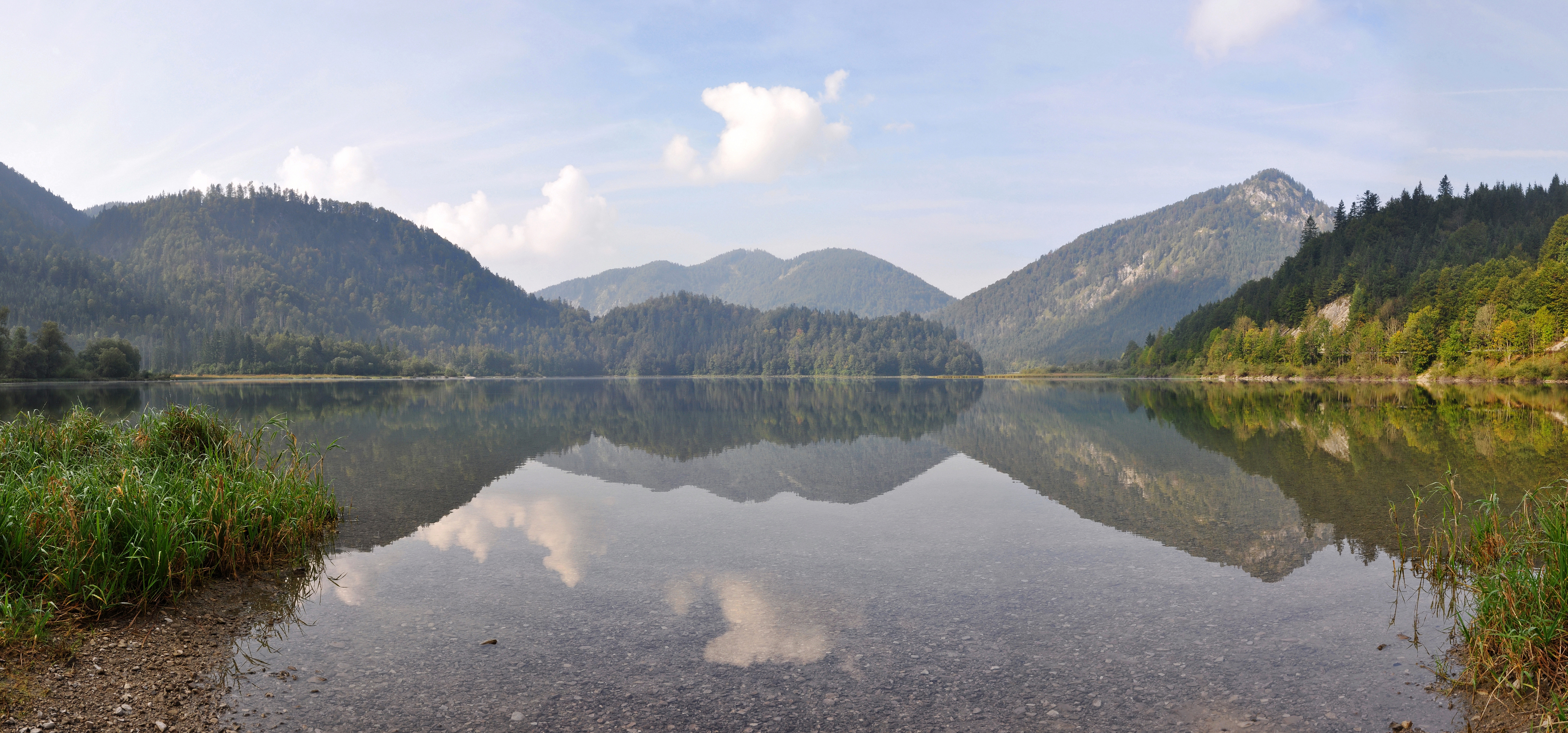
English: Weitsee (seen from the eastern bank) is a small lake on between Reit im Winkl and Ruhpolding with an area of 63.60 ha and a maximum depth of 9.30 m. The lake itself is separated in a shallow western and a deeper eastern part by a mountain halfisland. It is the first lake in the Dreiseengebiet (Three Lake Area) followed by the Mittersee and Lödensee.
Deutsch: Der Weitsee (hier vom östlichen Ufer aus gesehen) ist ein See im Gemeindegebiet von Reit im Winkl zwischen Ruhpolding und Reit im Winkl mit 63,60 ha Fläche und 9,3 m maximaler Tiefe. Er liegt im Dreiseengebiet (die weiteren Seen sind Mittersee und Lödensee) und erstreckt sich mit den anderen beiden Seen im Tal zwischen Gurnwandkopf und Dürrnbachhorn unmittelbar an der Deutschen Alpenstraße (B305).
Français : Weitsee (vu du bord de l'est) est un petit lac, situé entre Reit im Winkl et Ruhpolding, avec une surface de 63.60 ha et une profondeur maximale de 9,30 m. Il est le premier lac du Dreiseengebiet (région des trois lacs), suivi par le Mittelsee et le Lödensee. |
| Date | |
| Source | Own work |
| Author | Tobi 87 |
| Camera location | | View this and other nearby images on: OpenStreetMap |
|---|
Licensing[edit]
I, the copyright holder of this work, hereby publish it under the following licenses:

|
Permission is granted to copy, distribute and/or modify this document under the terms of the GNU Free Documentation License, Version 1.2 or any later version published by the Free Software Foundation; with no Invariant Sections, no Front-Cover Texts, and no Back-Cover Texts. A copy of the license is included in the section entitled GNU Free Documentation License. |
This file is licensed under the Creative Commons Attribution-Share Alike 3.0 Unported, 2.5 Generic, 2.0 Generic and 1.0 Generic license.
- You are free:
- to share – to copy, distribute and transmit the work
- to remix – to adapt the work
- Under the following conditions:
- attribution – You must give appropriate credit, provide a link to the license, and indicate if changes were made. You may do so in any reasonable manner, but not in any way that suggests the licensor endorses you or your use.
- share alike – If you remix, transform, or build upon the material, you must distribute your contributions under the same or compatible license as the original.
You may select the license of your choice.
This image has been assessed using the Quality image guidelines and is considered a Quality image.
|
File history
Click on a date/time to view the file as it appeared at that time.
| Date/Time | Thumbnail | Dimensions | User | Comment | |
|---|---|---|---|---|---|
| current | 17:42, 14 September 2010 | | 5,000 × 2,336 (7.52 MB) | Tobi 87 (talk | contribs) | downsampling |
| 15:22, 14 September 2010 |  | 8,490 × 3,967 (22.48 MB) | Tobi 87 (talk | contribs) | {{Information |Description={{en|1=Weitsee (seen from the eastern bank) is a small lake on between Reit im Winkl and Ruhpolding with an area of 63.60 ha and a maximum depth of 9.30 m. The lake itself is separated in a shallow western and a deeper eastern p |
You cannot overwrite this file.
File usage on Commons
The following 4 pages use this file:
File usage on other wikis
The following other wikis use this file:
- Usage on fr.wikipedia.org