File:University Park Airport Diagram.pdf
Jump to navigation
Jump to search

Size of this JPG preview of this PDF file: 390 × 599 pixels. Other resolutions: 156 × 240 pixels | 313 × 480 pixels | 806 × 1,237 pixels.
Original file (806 × 1,237 pixels, file size: 122 KB, MIME type: application/pdf)
Captions
Captions
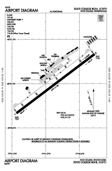
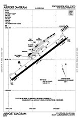
University Park Airport Diagram
Summary[edit]
| Description |
English: Overhead Diagram of University Park Airport |
| Date | |
| Source | https://adip.faa.gov/agis/public/#/airportCharts/UNV |
| Author | Federal Aviation Administration |
Licensing[edit]
This image or file is a work of a Federal Aviation Administration employee, taken or made as part of that person's official duties. As a work of the U.S. federal government, the image is in the public domain in the United States.
|
 |
File history
Click on a date/time to view the file as it appeared at that time.
| Date/Time | Thumbnail | Dimensions | User | Comment | |
|---|---|---|---|---|---|
| current | 17:34, 2 November 2023 |  | 806 × 1,237 (122 KB) | Alpacaaviator (talk | contribs) | November 2023 - Airport Renamed to State College Regional Airport |
| 03:49, 19 November 2022 |  | 806 × 1,237 (118 KB) | Alpacaaviator (talk | contribs) | DATE | |
| 13:50, 25 April 2022 |  | 806 × 1,237 (118 KB) | Alpacaaviator (talk | contribs) | Updated April 2022 - old runway removed | |
| 01:53, 16 September 2021 |  | 806 × 1,237 (122 KB) | Alpacaaviator (talk | contribs) | Date | |
| 15:37, 23 April 2021 |  | 806 × 1,237 (133 KB) | Alpacaaviator (talk | contribs) | Date | |
| 23:44, 2 April 2021 |  | 806 × 1,237 (133 KB) | Alpacaaviator (talk | contribs) | April 2021 | |
| 04:33, 8 March 2021 |  | 806 × 1,237 (133 KB) | Alpacaaviator (talk | contribs) | Date | |
| 12:57, 11 January 2021 |  | 806 × 1,237 (122 KB) | Alpacaaviator (talk | contribs) | Uploaded a work by Federal Aviation Administration from https://adip.faa.gov/agis/public/#/airportCharts/UNV with UploadWizard |
You cannot overwrite this file.
File usage on Commons
The following 8 pages use this file:
- User:Chumwa/OgreBot/Transport Maps/2021 April 1-10
- User:Chumwa/OgreBot/Transport Maps/2021 April 21-30
- User:Chumwa/OgreBot/Transport Maps/2021 January 11-20
- User:Chumwa/OgreBot/Transport Maps/2021 March 1-10
- User:Chumwa/OgreBot/Transport Maps/2021 September 11-20
- User:Chumwa/OgreBot/Transport Maps/2022 April 21-30
- User:Chumwa/OgreBot/Transport Maps/2022 November 11-20
- User:Chumwa/OgreBot/Transport Maps/2023 November 1-10
File usage on other wikis
The following other wikis use this file:
- Usage on en.wikipedia.org
- Usage on ru.wikipedia.org