File:Topographical Map of Oregon Showing the Umpqua River and Cultivated Land, Indian Creek, Timber, and Ranches - DPLA - be80eaacacc8c3110c176654068cac49.jpg
Jump to navigation
Jump to search

Size of this preview: 581 × 599 pixels. Other resolutions: 233 × 240 pixels | 465 × 480 pixels | 744 × 768 pixels | 993 × 1,024 pixels | 1,985 × 2,048 pixels | 10,116 × 10,436 pixels.
Original file (10,116 × 10,436 pixels, file size: 3.86 MB, MIME type: image/jpeg)
Captions
Captions
Add a one-line explanation of what this file represents
Summary[edit]
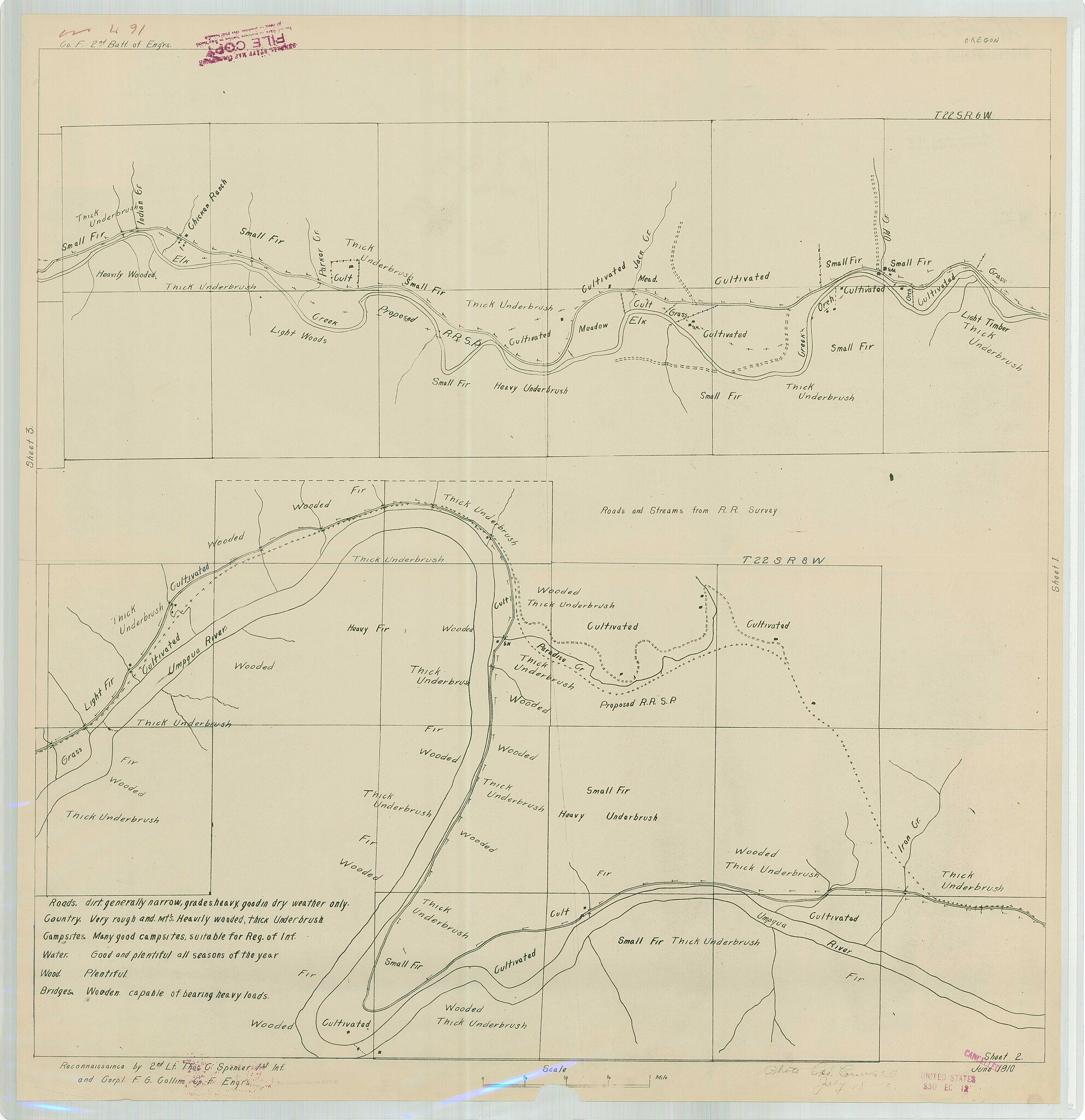
| Topographical Map of Oregon Showing the Umpqua River and Cultivated Land, Indian Creek, Timber, and Ranches
( |
||||||||||||||
|---|---|---|---|---|---|---|---|---|---|---|---|---|---|---|
| Creator | War Department. Office of the Chief of Engineers. War Department Map Collection. 1939-1942 | |||||||||||||
| Title |
Topographical Map of Oregon Showing the Umpqua River and Cultivated Land, Indian Creek, Timber, and Ranches |
|||||||||||||
| Description |
TS - 22 S and Range - 6 W. |
|||||||||||||
| Date | 1910 | |||||||||||||
| Collection |
|
|||||||||||||
| Source/Photographer |
|
|||||||||||||
| Permission (Reusing this file) |
|
|||||||||||||
| Standardized rights statement |
|
|||||||||||||


File history
Click on a date/time to view the file as it appeared at that time.
| Date/Time | Thumbnail | Dimensions | User | Comment | |
|---|---|---|---|---|---|
| current | 18:24, 10 November 2022 | | 10,116 × 10,436 (3.86 MB) | DPLA bot (talk | contribs) | Uploading DPLA ID be80eaacacc8c3110c176654068cac49 |
You cannot overwrite this file.
File usage on Commons
The following page uses this file: