Category:US National Archives series: War Department Map Collection, 1939 - 1942
The series includes manuscript and annotated maps compiled by Army units or accompanying reports of military intelligence attaches and observers. Among the maps are maps and plans depicting the boundaries of U.S. military reservations; Latin American railroads and air routes; areas of labor unrest and communist activity in the 1920s in the United States and Eastern Europe; and troop movements in the Spanish-American War in Cuba and the Philippines, the Philippines Pacification, the Russo-Japanese War in China, World War I in France, the Mexican Civil War, the Russian Civil War, and other military events. Also included are maps of the United States showing Army installations and territorial commands.
Media in category "US National Archives series: War Department Map Collection, 1939 - 1942"
The following 200 files are in this category, out of 1,175 total.
(previous page) (next page)-
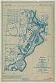
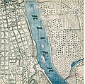
 1927 Map of Fort Snelling and Vicinity - NARA - 117090495.jpg 6,048 × 9,020; 6.12 MB
-
 1927 Map of Fort Snelling and vicinity - NARA - 137929343.jpg 6,036 × 8,941; 3.76 MB
-

-

-

-

-

-

-

-

-

-
-
 Battle at Wounded Knee, December 29, 1890 - NARA - 137930169.jpg 3,777 × 2,721; 2.17 MB
-
 Battle Commander's Battle Chart "Wright" - NARA - 137929680.jpg 5,100 × 5,545; 1.55 MB
-
 Battle Ground at Bladensburg - NARA - 137929254 (page 1).jpg 4,843 × 4,276; 2.59 MB
-
 Battle Ground at Bladensburg - NARA - 137929254 (page 2).jpg 4,288 × 4,823; 4.58 MB
-

-

-

-

-

-
 Battle of Germantown, Pennsylvania - NARA - 137930018.jpg 5,648 × 6,763; 1.42 MB
-
 Battle of White Plains, 1776 - NARA - 137929778.jpg 3,574 × 3,032; 1.74 MB
-
 Battles of Trenton and Princeton - NARA - 137929546.jpg 3,528 × 5,228; 779 KB
-

-

-

-
 Camp Shelby, Mississippi - DPLA - 25126e89681ca91e28beb4b51a5bc0bf.jpg 3,460 × 7,740; 1.25 MB
-
 Camp Taylor Cantonment near Louisville - DPLA - 7974faf8ab92894ab2f8c3854942a07a.jpg 3,228 × 7,714; 3.17 MB
-
 Camp Wheeler near Macon - DPLA - 45069ce03f2878d0514606ffbdba4427.jpg 3,416 × 7,766; 3.15 MB
-

-
 Coal Producing Districts and Fields - State of Alabama - DPLA - 4d0a41e26fbb0a68cd4c5f7a5a69c42d.jpg 9,164 × 13,944; 20.51 MB
-

-

-

-

-
 Coal Producing Districts and Fields- State of Illinois - DPLA - 738076d0715103df2c40ef14b9f8bc11.jpg 9,128 × 15,353; 10.68 MB
-
 Command Chronology Report of 3rd Marine Division - DPLA - 21625d5bdabbd0a935b001e118bcfe24.pdf 1,295 × 1,647, 174 pages; 4.8 MB
-

-
 Compilation to Create a Map of the Mexican Border - DPLA - 303c68b525d0d7ca4c1bd2b70dfdf45b (page 1).jpg 12,148 × 10,800; 10.34 MB
-

-
-

-
-

-

-

-

-
 Compilation to Create a Map of the Mexican Border - DPLA - 303c68b525d0d7ca4c1bd2b70dfdf45b (page 6).jpg 12,435 × 10,772; 21.32 MB
-
 Compilation to Create a Map of the Mexican Border - DPLA - 303c68b525d0d7ca4c1bd2b70dfdf45b (page 7).jpg 12,378 × 10,788; 21.39 MB
-

-

-

-

-
-

-
-

-
 Division Districts of the Organized Militia - DPLA - 0a7a38ce439519bca0a719a971c5fa55.jpg 9,222 × 6,088; 4.83 MB
-

-

-
 Fermentation Map of the United States - DPLA - 7af1cac60b08efd069c457662a8edb3c.jpg 10,857 × 7,536; 3.51 MB
-
 Fort Kamehameha, Oahu, Territory of Hawaii - NARA - 103396812.jpg 9,328 × 8,062; 3.57 MB
-
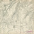
 Fort Leavenworth Topographic Map - DPLA - 69e86a32f108832e0b9b9bf5ba29c2d7 (page 1).jpg 2,830 × 2,552; 933 KB
-
 Fort Leavenworth Topographic Map - DPLA - 69e86a32f108832e0b9b9bf5ba29c2d7 (page 10).jpg 5,248 × 4,948; 1.36 MB
-
 Fort Leavenworth Topographic Map - DPLA - 69e86a32f108832e0b9b9bf5ba29c2d7 (page 100).jpg 5,340 × 5,370; 2.26 MB
-
 Fort Leavenworth Topographic Map - DPLA - 69e86a32f108832e0b9b9bf5ba29c2d7 (page 101).jpg 5,400 × 5,353; 2.88 MB
-
 Fort Leavenworth Topographic Map - DPLA - 69e86a32f108832e0b9b9bf5ba29c2d7 (page 102).jpg 5,400 × 5,356; 2.84 MB
-
 Fort Leavenworth Topographic Map - DPLA - 69e86a32f108832e0b9b9bf5ba29c2d7 (page 103).jpg 5,332 × 5,359; 2.27 MB
-
 Fort Leavenworth Topographic Map - DPLA - 69e86a32f108832e0b9b9bf5ba29c2d7 (page 104).jpg 5,332 × 5,358; 2.29 MB
-
 Fort Leavenworth Topographic Map - DPLA - 69e86a32f108832e0b9b9bf5ba29c2d7 (page 105).jpg 5,320 × 5,391; 2.21 MB
-
 Fort Leavenworth Topographic Map - DPLA - 69e86a32f108832e0b9b9bf5ba29c2d7 (page 106).jpg 5,308 × 5,385; 2.28 MB
-
 Fort Leavenworth Topographic Map - DPLA - 69e86a32f108832e0b9b9bf5ba29c2d7 (page 107).jpg 5,340 × 5,332; 2.17 MB
-
 Fort Leavenworth Topographic Map - DPLA - 69e86a32f108832e0b9b9bf5ba29c2d7 (page 108).jpg 5,336 × 5,326; 2.16 MB
-
 Fort Leavenworth Topographic Map - DPLA - 69e86a32f108832e0b9b9bf5ba29c2d7 (page 109).jpg 5,400 × 5,336; 2.16 MB
-
 Fort Leavenworth Topographic Map - DPLA - 69e86a32f108832e0b9b9bf5ba29c2d7 (page 11).jpg 5,248 × 4,955; 1.77 MB
-
 Fort Leavenworth Topographic Map - DPLA - 69e86a32f108832e0b9b9bf5ba29c2d7 (page 110).jpg 5,400 × 5,341; 2.14 MB
-
 Fort Leavenworth Topographic Map - DPLA - 69e86a32f108832e0b9b9bf5ba29c2d7 (page 111).jpg 5,400 × 5,333; 2.19 MB
-
 Fort Leavenworth Topographic Map - DPLA - 69e86a32f108832e0b9b9bf5ba29c2d7 (page 112).jpg 5,400 × 5,330; 2.08 MB
-
 Fort Leavenworth Topographic Map - DPLA - 69e86a32f108832e0b9b9bf5ba29c2d7 (page 113).jpg 5,400 × 5,336; 2.54 MB
-
 Fort Leavenworth Topographic Map - DPLA - 69e86a32f108832e0b9b9bf5ba29c2d7 (page 114).jpg 5,400 × 5,341; 2.52 MB
-
 Fort Leavenworth Topographic Map - DPLA - 69e86a32f108832e0b9b9bf5ba29c2d7 (page 115).jpg 5,400 × 5,365; 2.61 MB
-
 Fort Leavenworth Topographic Map - DPLA - 69e86a32f108832e0b9b9bf5ba29c2d7 (page 116).jpg 5,400 × 5,371; 2.49 MB
-
 Fort Leavenworth Topographic Map - DPLA - 69e86a32f108832e0b9b9bf5ba29c2d7 (page 117).jpg 5,328 × 5,325; 2.28 MB
-
 Fort Leavenworth Topographic Map - DPLA - 69e86a32f108832e0b9b9bf5ba29c2d7 (page 118).jpg 5,328 × 5,327; 2.14 MB
-
 Fort Leavenworth Topographic Map - DPLA - 69e86a32f108832e0b9b9bf5ba29c2d7 (page 119).jpg 5,400 × 5,263; 2.77 MB
-
 Fort Leavenworth Topographic Map - DPLA - 69e86a32f108832e0b9b9bf5ba29c2d7 (page 12).jpg 5,244 × 4,953; 1.81 MB
-

-
 Fort Leavenworth Topographic Map - DPLA - 69e86a32f108832e0b9b9bf5ba29c2d7 (page 121).jpg 5,400 × 5,066; 2.53 MB
-
 Fort Leavenworth Topographic Map - DPLA - 69e86a32f108832e0b9b9bf5ba29c2d7 (page 122).jpg 5,400 × 5,073; 2.55 MB
-
 Fort Leavenworth Topographic Map - DPLA - 69e86a32f108832e0b9b9bf5ba29c2d7 (page 123).jpg 5,400 × 5,358; 2.49 MB
-
 Fort Leavenworth Topographic Map - DPLA - 69e86a32f108832e0b9b9bf5ba29c2d7 (page 124).jpg 5,400 × 5,351; 2.52 MB
-
 Fort Leavenworth Topographic Map - DPLA - 69e86a32f108832e0b9b9bf5ba29c2d7 (page 125).jpg 5,316 × 5,301; 2.26 MB
-
 Fort Leavenworth Topographic Map - DPLA - 69e86a32f108832e0b9b9bf5ba29c2d7 (page 126).jpg 5,260 × 5,320; 4.08 MB
-
 Fort Leavenworth Topographic Map - DPLA - 69e86a32f108832e0b9b9bf5ba29c2d7 (page 127).jpg 5,400 × 5,374; 2.55 MB
-
 Fort Leavenworth Topographic Map - DPLA - 69e86a32f108832e0b9b9bf5ba29c2d7 (page 128).jpg 5,400 × 5,365; 2.61 MB
-
 Fort Leavenworth Topographic Map - DPLA - 69e86a32f108832e0b9b9bf5ba29c2d7 (page 129).jpg 5,400 × 5,328; 1.61 MB
-
 Fort Leavenworth Topographic Map - DPLA - 69e86a32f108832e0b9b9bf5ba29c2d7 (page 13).jpg 5,316 × 5,327; 2.88 MB
-
 Fort Leavenworth Topographic Map - DPLA - 69e86a32f108832e0b9b9bf5ba29c2d7 (page 130).jpg 5,400 × 5,329; 1.88 MB
-
 Fort Leavenworth Topographic Map - DPLA - 69e86a32f108832e0b9b9bf5ba29c2d7 (page 131).jpg 5,400 × 5,358; 2.52 MB
-
 Fort Leavenworth Topographic Map - DPLA - 69e86a32f108832e0b9b9bf5ba29c2d7 (page 132).jpg 5,400 × 5,359; 2.53 MB
-
 Fort Leavenworth Topographic Map - DPLA - 69e86a32f108832e0b9b9bf5ba29c2d7 (page 133).jpg 5,328 × 5,362; 2.35 MB
-
 Fort Leavenworth Topographic Map - DPLA - 69e86a32f108832e0b9b9bf5ba29c2d7 (page 134).jpg 5,328 × 5,355; 2.51 MB
-
 Fort Leavenworth Topographic Map - DPLA - 69e86a32f108832e0b9b9bf5ba29c2d7 (page 135).jpg 5,400 × 5,338; 2.02 MB
-
 Fort Leavenworth Topographic Map - DPLA - 69e86a32f108832e0b9b9bf5ba29c2d7 (page 136).jpg 5,400 × 5,336; 1.93 MB
-
 Fort Leavenworth Topographic Map - DPLA - 69e86a32f108832e0b9b9bf5ba29c2d7 (page 137).jpg 5,400 × 5,336; 1.81 MB
-
 Fort Leavenworth Topographic Map - DPLA - 69e86a32f108832e0b9b9bf5ba29c2d7 (page 138).jpg 5,400 × 5,335; 1.73 MB
-
-
 Fort Leavenworth Topographic Map - DPLA - 69e86a32f108832e0b9b9bf5ba29c2d7 (page 14).jpg 5,320 × 5,330; 2.93 MB
-
 Fort Leavenworth Topographic Map - DPLA - 69e86a32f108832e0b9b9bf5ba29c2d7 (page 140).jpg 5,400 × 5,357; 1.71 MB
-

-
 Fort Leavenworth Topographic Map - DPLA - 69e86a32f108832e0b9b9bf5ba29c2d7 (page 142).jpg 5,400 × 5,353; 2.22 MB
-
 Fort Leavenworth Topographic Map - DPLA - 69e86a32f108832e0b9b9bf5ba29c2d7 (page 143).jpg 9,212 × 10,325; 5.03 MB
-

-

-
 Fort Leavenworth Topographic Map - DPLA - 69e86a32f108832e0b9b9bf5ba29c2d7 (page 146).jpg 5,236 × 4,963; 1.39 MB
-
 Fort Leavenworth Topographic Map - DPLA - 69e86a32f108832e0b9b9bf5ba29c2d7 (page 147).jpg 5,236 × 4,954; 1.53 MB
-
 Fort Leavenworth Topographic Map - DPLA - 69e86a32f108832e0b9b9bf5ba29c2d7 (page 148).jpg 5,400 × 5,335; 2.66 MB
-
 Fort Leavenworth Topographic Map - DPLA - 69e86a32f108832e0b9b9bf5ba29c2d7 (page 149).jpg 5,400 × 5,339; 2.76 MB
-
 Fort Leavenworth Topographic Map - DPLA - 69e86a32f108832e0b9b9bf5ba29c2d7 (page 15).jpg 5,400 × 5,322; 2.87 MB
-
 Fort Leavenworth Topographic Map - DPLA - 69e86a32f108832e0b9b9bf5ba29c2d7 (page 150).jpg 5,400 × 5,318; 2.46 MB
-
 Fort Leavenworth Topographic Map - DPLA - 69e86a32f108832e0b9b9bf5ba29c2d7 (page 151).jpg 5,400 × 5,312; 2.53 MB
-
 Fort Leavenworth Topographic Map - DPLA - 69e86a32f108832e0b9b9bf5ba29c2d7 (page 152).jpg 5,400 × 5,344; 2.71 MB
-
 Fort Leavenworth Topographic Map - DPLA - 69e86a32f108832e0b9b9bf5ba29c2d7 (page 153).jpg 5,400 × 5,357; 2.77 MB
-
 Fort Leavenworth Topographic Map - DPLA - 69e86a32f108832e0b9b9bf5ba29c2d7 (page 154).jpg 5,400 × 5,349; 2.51 MB
-
 Fort Leavenworth Topographic Map - DPLA - 69e86a32f108832e0b9b9bf5ba29c2d7 (page 155).jpg 5,400 × 5,352; 2.64 MB
-
 Fort Leavenworth Topographic Map - DPLA - 69e86a32f108832e0b9b9bf5ba29c2d7 (page 156).jpg 5,400 × 5,354; 2.25 MB
-
 Fort Leavenworth Topographic Map - DPLA - 69e86a32f108832e0b9b9bf5ba29c2d7 (page 157).jpg 5,400 × 5,339; 2.74 MB
-
 Fort Leavenworth Topographic Map - DPLA - 69e86a32f108832e0b9b9bf5ba29c2d7 (page 158).jpg 5,400 × 5,339; 2.72 MB
-

-
 Fort Leavenworth Topographic Map - DPLA - 69e86a32f108832e0b9b9bf5ba29c2d7 (page 16).jpg 5,400 × 5,319; 2.99 MB
-
 Fort Leavenworth Topographic Map - DPLA - 69e86a32f108832e0b9b9bf5ba29c2d7 (page 160).jpg 5,400 × 5,339; 2.81 MB
-
 Fort Leavenworth Topographic Map - DPLA - 69e86a32f108832e0b9b9bf5ba29c2d7 (page 161).jpg 5,400 × 5,339; 2.74 MB
-
 Fort Leavenworth Topographic Map - DPLA - 69e86a32f108832e0b9b9bf5ba29c2d7 (page 162).jpg 5,400 × 5,322; 2.53 MB
-
 Fort Leavenworth Topographic Map - DPLA - 69e86a32f108832e0b9b9bf5ba29c2d7 (page 163).jpg 5,400 × 5,325; 2.47 MB
-
 Fort Leavenworth Topographic Map - DPLA - 69e86a32f108832e0b9b9bf5ba29c2d7 (page 164).jpg 5,400 × 5,337; 2.88 MB
-
 Fort Leavenworth Topographic Map - DPLA - 69e86a32f108832e0b9b9bf5ba29c2d7 (page 165).jpg 5,400 × 5,333; 2.72 MB
-
 Fort Leavenworth Topographic Map - DPLA - 69e86a32f108832e0b9b9bf5ba29c2d7 (page 166).jpg 5,400 × 5,324; 2.52 MB
-
 Fort Leavenworth Topographic Map - DPLA - 69e86a32f108832e0b9b9bf5ba29c2d7 (page 167).jpg 5,400 × 5,321; 2.42 MB
-
 Fort Leavenworth Topographic Map - DPLA - 69e86a32f108832e0b9b9bf5ba29c2d7 (page 168).jpg 5,400 × 5,332; 3.14 MB
-
 Fort Leavenworth Topographic Map - DPLA - 69e86a32f108832e0b9b9bf5ba29c2d7 (page 169).jpg 5,400 × 5,330; 3.06 MB
-
 Fort Leavenworth Topographic Map - DPLA - 69e86a32f108832e0b9b9bf5ba29c2d7 (page 17).jpg 5,400 × 5,322; 2.44 MB
-
 Fort Leavenworth Topographic Map - DPLA - 69e86a32f108832e0b9b9bf5ba29c2d7 (page 170).jpg 5,400 × 5,346; 2.67 MB
-
 Fort Leavenworth Topographic Map - DPLA - 69e86a32f108832e0b9b9bf5ba29c2d7 (page 171).jpg 5,400 × 5,348; 2.79 MB
-
 Fort Leavenworth Topographic Map - DPLA - 69e86a32f108832e0b9b9bf5ba29c2d7 (page 172).jpg 5,400 × 5,356; 2.43 MB
-
 Fort Leavenworth Topographic Map - DPLA - 69e86a32f108832e0b9b9bf5ba29c2d7 (page 173).jpg 5,400 × 5,364; 2.52 MB
-
 Fort Leavenworth Topographic Map - DPLA - 69e86a32f108832e0b9b9bf5ba29c2d7 (page 174).jpg 5,400 × 5,318; 2.71 MB
-
 Fort Leavenworth Topographic Map - DPLA - 69e86a32f108832e0b9b9bf5ba29c2d7 (page 175).jpg 5,400 × 5,312; 2.78 MB
-
 Fort Leavenworth Topographic Map - DPLA - 69e86a32f108832e0b9b9bf5ba29c2d7 (page 176).jpg 5,400 × 5,326; 2.53 MB
-
 Fort Leavenworth Topographic Map - DPLA - 69e86a32f108832e0b9b9bf5ba29c2d7 (page 177).jpg 5,400 × 5,325; 2.44 MB
-

-
 Fort Leavenworth Topographic Map - DPLA - 69e86a32f108832e0b9b9bf5ba29c2d7 (page 179).jpg 5,400 × 5,286; 2.58 MB
-
 Fort Leavenworth Topographic Map - DPLA - 69e86a32f108832e0b9b9bf5ba29c2d7 (page 18).jpg 5,400 × 5,322; 2.4 MB
-
 Fort Leavenworth Topographic Map - DPLA - 69e86a32f108832e0b9b9bf5ba29c2d7 (page 180).jpg 5,400 × 5,385; 2.68 MB
-
 Fort Leavenworth Topographic Map - DPLA - 69e86a32f108832e0b9b9bf5ba29c2d7 (page 181).jpg 5,400 × 5,384; 2.59 MB
-
 Fort Leavenworth Topographic Map - DPLA - 69e86a32f108832e0b9b9bf5ba29c2d7 (page 182).jpg 5,400 × 5,383; 2.54 MB
-
 Fort Leavenworth Topographic Map - DPLA - 69e86a32f108832e0b9b9bf5ba29c2d7 (page 183).jpg 5,400 × 5,382; 2.44 MB
-
 Fort Leavenworth Topographic Map - DPLA - 69e86a32f108832e0b9b9bf5ba29c2d7 (page 184).jpg 5,400 × 5,308; 2.65 MB
-
 Fort Leavenworth Topographic Map - DPLA - 69e86a32f108832e0b9b9bf5ba29c2d7 (page 185).jpg 5,400 × 5,309; 2.58 MB
-
 Fort Leavenworth Topographic Map - DPLA - 69e86a32f108832e0b9b9bf5ba29c2d7 (page 186).jpg 5,400 × 5,276; 2.57 MB
-
 Fort Leavenworth Topographic Map - DPLA - 69e86a32f108832e0b9b9bf5ba29c2d7 (page 187).jpg 5,400 × 5,275; 2.49 MB
-
 Fort Leavenworth Topographic Map - DPLA - 69e86a32f108832e0b9b9bf5ba29c2d7 (page 188).jpg 5,400 × 5,350; 2.98 MB
-
 Fort Leavenworth Topographic Map - DPLA - 69e86a32f108832e0b9b9bf5ba29c2d7 (page 189).jpg 5,400 × 5,342; 2.94 MB
-
 Fort Leavenworth Topographic Map - DPLA - 69e86a32f108832e0b9b9bf5ba29c2d7 (page 19).jpg 5,400 × 5,319; 2.26 MB
-
 Fort Leavenworth Topographic Map - DPLA - 69e86a32f108832e0b9b9bf5ba29c2d7 (page 190).jpg 5,400 × 5,306; 2.61 MB
-
 Fort Leavenworth Topographic Map - DPLA - 69e86a32f108832e0b9b9bf5ba29c2d7 (page 191).jpg 5,400 × 5,308; 2.64 MB
-
 Fort Leavenworth Topographic Map - DPLA - 69e86a32f108832e0b9b9bf5ba29c2d7 (page 192).jpg 5,400 × 5,321; 2.62 MB
-
 Fort Leavenworth Topographic Map - DPLA - 69e86a32f108832e0b9b9bf5ba29c2d7 (page 193).jpg 5,400 × 5,339; 2.69 MB
-
 Fort Leavenworth Topographic Map - DPLA - 69e86a32f108832e0b9b9bf5ba29c2d7 (page 194).jpg 5,400 × 5,331; 2.91 MB
-
 Fort Leavenworth Topographic Map - DPLA - 69e86a32f108832e0b9b9bf5ba29c2d7 (page 195).jpg 5,347 × 5,340; 6.66 MB
-
 Fort Leavenworth Topographic Map - DPLA - 69e86a32f108832e0b9b9bf5ba29c2d7 (page 196).jpg 5,342 × 5,400; 5.86 MB
-
 Fort Leavenworth Topographic Map - DPLA - 69e86a32f108832e0b9b9bf5ba29c2d7 (page 197).jpg 5,336 × 5,400; 4.63 MB
-
 Fort Leavenworth Topographic Map - DPLA - 69e86a32f108832e0b9b9bf5ba29c2d7 (page 2).jpg 2,845 × 2,552; 943 KB
-
 Fort Leavenworth Topographic Map - DPLA - 69e86a32f108832e0b9b9bf5ba29c2d7 (page 20).jpg 5,400 × 5,322; 2.31 MB
-
 Fort Leavenworth Topographic Map - DPLA - 69e86a32f108832e0b9b9bf5ba29c2d7 (page 21).jpg 5,400 × 5,352; 3.36 MB
-
 Fort Leavenworth Topographic Map - DPLA - 69e86a32f108832e0b9b9bf5ba29c2d7 (page 22).jpg 5,400 × 5,356; 3.45 MB
-
 Fort Leavenworth Topographic Map - DPLA - 69e86a32f108832e0b9b9bf5ba29c2d7 (page 23).jpg 5,340 × 5,404; 2.19 MB
-
 Fort Leavenworth Topographic Map - DPLA - 69e86a32f108832e0b9b9bf5ba29c2d7 (page 24).jpg 5,400 × 5,404; 2.22 MB
-
 Fort Leavenworth Topographic Map - DPLA - 69e86a32f108832e0b9b9bf5ba29c2d7 (page 25).jpg 5,400 × 5,396; 2.58 MB
-
 Fort Leavenworth Topographic Map - DPLA - 69e86a32f108832e0b9b9bf5ba29c2d7 (page 26).jpg 5,400 × 5,417; 2.6 MB
-
 Fort Leavenworth Topographic Map - DPLA - 69e86a32f108832e0b9b9bf5ba29c2d7 (page 27).jpg 5,400 × 5,322; 2.84 MB
-
 Fort Leavenworth Topographic Map - DPLA - 69e86a32f108832e0b9b9bf5ba29c2d7 (page 28).jpg 5,400 × 5,328; 2.89 MB
-
 Fort Leavenworth Topographic Map - DPLA - 69e86a32f108832e0b9b9bf5ba29c2d7 (page 29).jpg 5,400 × 5,360; 2.69 MB
-
 Fort Leavenworth Topographic Map - DPLA - 69e86a32f108832e0b9b9bf5ba29c2d7 (page 3).jpg 2,844 × 2,530; 1.07 MB
-
 Fort Leavenworth Topographic Map - DPLA - 69e86a32f108832e0b9b9bf5ba29c2d7 (page 30).jpg 5,340 × 5,359; 2.7 MB
-
 Fort Leavenworth Topographic Map - DPLA - 69e86a32f108832e0b9b9bf5ba29c2d7 (page 31).jpg 5,354 × 5,400; 6.03 MB
-
 Fort Leavenworth Topographic Map - DPLA - 69e86a32f108832e0b9b9bf5ba29c2d7 (page 32).jpg 5,400 × 5,344; 2.6 MB
-
 Fort Leavenworth Topographic Map - DPLA - 69e86a32f108832e0b9b9bf5ba29c2d7 (page 33).jpg 5,332 × 5,332; 2.81 MB
-
 Fort Leavenworth Topographic Map - DPLA - 69e86a32f108832e0b9b9bf5ba29c2d7 (page 34).jpg 5,328 × 5,331; 2.83 MB
-
 Fort Leavenworth Topographic Map - DPLA - 69e86a32f108832e0b9b9bf5ba29c2d7 (page 35).jpg 5,400 × 5,332; 6.69 MB
-
 Fort Leavenworth Topographic Map - DPLA - 69e86a32f108832e0b9b9bf5ba29c2d7 (page 36).jpg 5,400 × 5,342; 2.8 MB
-
 Fort Leavenworth Topographic Map - DPLA - 69e86a32f108832e0b9b9bf5ba29c2d7 (page 37).jpg 5,400 × 5,358; 2.71 MB
-
 Fort Leavenworth Topographic Map - DPLA - 69e86a32f108832e0b9b9bf5ba29c2d7 (page 38).jpg 5,400 × 5,359; 6.38 MB
-
 Fort Leavenworth Topographic Map - DPLA - 69e86a32f108832e0b9b9bf5ba29c2d7 (page 39).jpg 5,400 × 5,359; 2.94 MB
-
 Fort Leavenworth Topographic Map - DPLA - 69e86a32f108832e0b9b9bf5ba29c2d7 (page 4).jpg 2,840 × 2,514; 945 KB
-
 Fort Leavenworth Topographic Map - DPLA - 69e86a32f108832e0b9b9bf5ba29c2d7 (page 40).jpg 5,400 × 5,361; 2.89 MB
-
 Fort Leavenworth Topographic Map - DPLA - 69e86a32f108832e0b9b9bf5ba29c2d7 (page 41).jpg 5,400 × 5,352; 3.03 MB
-
 Fort Leavenworth Topographic Map - DPLA - 69e86a32f108832e0b9b9bf5ba29c2d7 (page 42).jpg 5,400 × 5,360; 3.04 MB
-
 Fort Leavenworth Topographic Map - DPLA - 69e86a32f108832e0b9b9bf5ba29c2d7 (page 43).jpg 5,400 × 5,337; 2.58 MB
-
 Fort Leavenworth Topographic Map - DPLA - 69e86a32f108832e0b9b9bf5ba29c2d7 (page 44).jpg 5,400 × 5,345; 2.54 MB


.jpg)


.jpg)
.jpg)


.jpg)
.jpg)
.jpg)
.jpg)
.jpg)


_Map_of_Army_and_Corps_Areas_in_the_United_States_Army_-_DPLA_-_0c58028803c1fce26aefb2f24030d9e3.jpg)
.jpg)
.jpg)
.jpg)
.jpg)
.jpg)
.jpg)
.jpg)
.jpg)
.jpg)
.jpg)
.jpg)
.jpg)
.jpg)


_-_DPLA_-_a7245adb55b23add66e3f3fff60d61f3.jpg)

.jpg)
.jpg)


.jpg)
.jpg)
.jpg)
.jpg)
.jpg)
.jpg)
.jpg)
.jpg)
.jpg)
.jpg)
.jpg)
.jpg)
.jpg)
.jpg)
.jpg)
.jpg)
.jpg)
.jpg)
.jpg)
.jpg)
.jpg)
.jpg)
.jpg)
.jpg)
.jpg)
.jpg)
.jpg)
.jpg)
.jpg)
.jpg)
.jpg)
.jpg)
.jpg)
.jpg)
.jpg)
.jpg)
.jpg)
.jpg)
.jpg)
.jpg)
.jpg)
.jpg)
.jpg)
.jpg)
.jpg)
.jpg)
.jpg)
.jpg)
.jpg)
.jpg)
.jpg)
.jpg)
.jpg)
.jpg)
.jpg)
.jpg)
.jpg)
.jpg)
.jpg)
.jpg)
.jpg)
.jpg)
.jpg)
.jpg)
.jpg)
.jpg)
.jpg)
.jpg)
.jpg)
.jpg)
.jpg)
.jpg)
.jpg)
.jpg)
.jpg)
.jpg)
.jpg)
.jpg)
.jpg)
.jpg)
.jpg)
.jpg)
.jpg)
.jpg)
.jpg)
.jpg)
.jpg)
.jpg)
.jpg)
.jpg)
.jpg)
.jpg)
.jpg)
.jpg)
.jpg)
.jpg)
.jpg)
.jpg)
.jpg)
.jpg)
.jpg)
.jpg)
.jpg)
.jpg)
.jpg)
.jpg)
.jpg)
.jpg)
.jpg)
.jpg)
.jpg)
.jpg)
.jpg)
.jpg)
.jpg)
.jpg)
.jpg)
.jpg)
.jpg)
.jpg)
.jpg)
.jpg)
.jpg)
.jpg)
.jpg)
.jpg)
.jpg)
.jpg)
.jpg)
.jpg)
.jpg)
.jpg)
.jpg)
.jpg)
.jpg)
.jpg)
.jpg)