File:Tierra Nova" (South America) southeast.jpg
Tierra_Nova"_(South_America)_southeast.jpg (800 × 600 pixels, file size: 120 KB, MIME type: image/jpeg)
Captions
Captions
Summary[edit]
_southeast.jpg&action=edit§ion=1)
| Description |
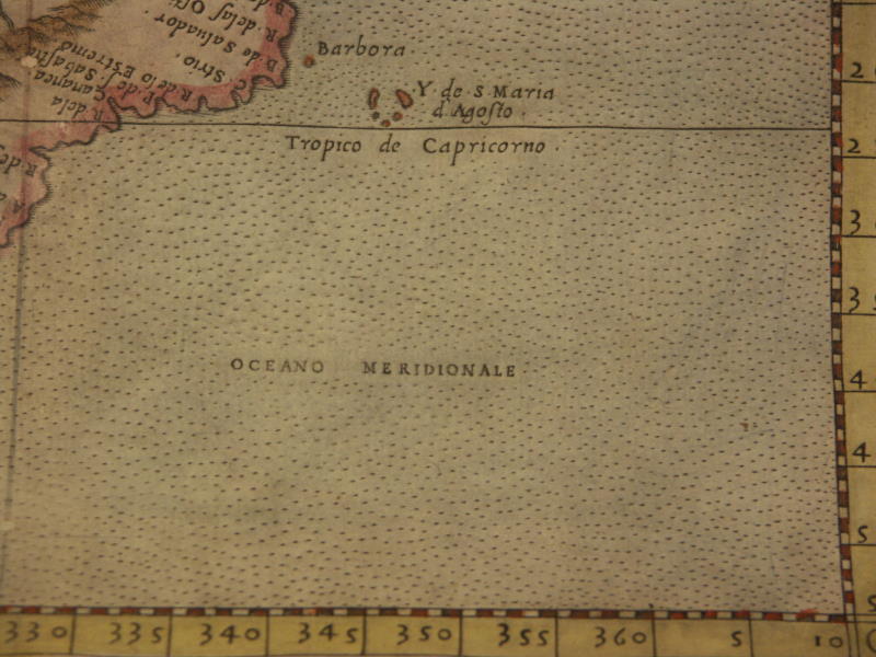
English: *"Calecut Nuova Tavola" (the Deccan and the South), a map by Girolamo Ruscelli, published by Girodano Ziletti, Venice, 1561 and later editions: *a closeup of the South*
More maps from the same set, both Ptolemaic and updated, 1574 ed. unless otherwise marked, some with modern hand coloring:
==*"Carta Marina Nuova Tavola" (a sea map)*: *northwest*; *northeast*; *southwest*; *southeast* ==*Tabula Asiae I (Turkey and Asia Minor)*: *northwest*; *northeast*; *southwest*; *southeast* ==*Tabula Asiae II (Caucasus, Ukraine)*: *northwest*; *northeast*; *southwest*; *southeast* ==*Tabula Asiae III (Caucasus)*: *northwest*; *northeast*; *southwest*; *southeast* ==*"Natolia Nuova Tavola"*: *northwest*; *northeast*; *southwest*; *southeast* ==*"Moschovia Nuova Tavola"*: *northwest*; *northeast*; *southwest*; *southeast* ==*Tabula Asiae IV (the Holy Land)* ==*"Soria et Terra Santa Nuova Tavola" (the Holy Land)*: *northwest*; *northeast*; *southwest*; *southeast* ==*Tabula Asiae V (Persia)*: *northwest*; *northeast*; *southwest*; *southeast* ==*"Persia Nuova Tavola"*: *northwest*; *northeast*; *southwest*; *southeast* ==*Tabula Asiae VI (Arabia)*: *northwest*; *northeast*; *southwest*; *southeast* ==*"Arabia Felice Nuova Tavola" (Arabia)*: *northwest*; *northeast*; *southwest*; *southeast* ==*Tabula Asiae VII (Western Asia)*: *northwest*; *southwest*; *southeast* ==*Tabula Asiae VIII (Central Asia)*: *northwest*; *northeast*; *southwest*; *southeast* ==*Tabula Asiae IX (the Afghanistan region)*: *northwest*; *northeast*; *southwest*; *southeast* . ==*Tabula Asiae X, 1561 ed. (India)* ==*Tabula Asiae X (India)*: *northwest*; *northeast*; *southwest*; *southeast* ==*"Calecut Nuova Tavola"*; closer views from a colored version of the map: *northwest*; *northeast*; *southwest*; *southeast*; *a closeup of the Deccan* ==*Tabula Asiae XI, 1561 ed. (Southeast Asia)* ==*"India Tercera Nuova Tavola" (Southeast Asia)*: *northwest*; *northeast*; *southwest*; *southeast* ==*Tabula Asiae XII (Sri Lanka)*: *north*; *south* . ==*Tabula Aphricae I, 1561 ed. (Northwest Africa)*;
==*Tabula Aphricae II, 1561 ed. (North Africa)*
==*Tabula Aphricae III (North Africa)*: *northwest*; *northeast*; *southwest*; *southeast* ==*Tabula Aphricae IV (Northeast Africa)*: *northwest*; *northeast*; *southwest*; *southeast* ==*"Africa Minor Nuova Tavola," 1561 ed. (North Central Africa)*
==*"Egitto Nuova Tavola" (Egypt)*: *northwest*; *northeast*; *southwest*; *southeast* ==*"Marmarica Nuova Tavola" (Northeast Africa)* ==*"Mauritania Nuova Tavola"*: *northwest*; *northeast*; *southwest*; *southeast* ==*"Africa Nuova Tavola" (South Africa)*: *northwest*; *northeast*; *southwest*; *southeast* ==*Tabula Europae I (Britain)*: *northwest*; *northeast*; *southwest*; *southeast* ==*"Anglia et Hibernia Nova" (Britain)*: *northwest*; *northeast*; *southwest*; *southeast* ==*Tabula Europae II (Spain, Portugal)* ==*"Hispania Nuova Tavola" (Spain)*: *northwest*; *northeast*; *southwest*; *southeast* ==*Tabula Europae III (France)*: *northwest*; *northeast*; *southwest*; *southeast* ==*"Gallia Nuova Tavola" (France)* ==*Tabula Europae IV (Germany)* ==*"Tavola Nuova di Germania" (Germany)*: *northwest*; *northeast*; *southwest*; *southeast* ==*Tabula Europae V (Italy)* ==*"Tavola Nuova della Marca Trivigiana" (northern Italy)*: *northwest*; *northeast*; *southwest*; *southeast* ==*"Territorio de Roma"*: *northwest*; *northeast*; *southwest*; *southeast* ==*Tabula Europae VIII (Sarmatia)* . ==*Tabula Europae X (Greece)* ==*"Graetia Nuova Tavola" (Greece)*: *northwest*; *northeast*; *southwest*; *southeast* . ==*"Tierra Nova" (South America)*: *northwest*; *northeast*; *southwest*; *southeast* ==*"Brasil Nuova Tavola"*: *upper left*; *upper right*; *lower left*; *lower right* "These maps were published in the 1574 edition of Girolamo Ruscelli`s 'La Geografia di Claudio Tolomeo'. Girolamo Ruscelli's Italian translation of Ptolemy's 'Geographia', revised by Giovanni Malombra, contained 27 maps based on the text of Ptolemy and 38 maps of the modern world by Ruscelli." |
| Date | 15611-1574 |
| Source | http://www.columbia.edu/itc/mealac/pritchett/00maplinks/mughal/ruscelli1574/ruscelli1574.html |
| Author | Girolamo Ruscelli |
Licensing[edit]
_southeast.jpg&action=edit§ion=2)
|
This work is in the public domain in its country of origin and other countries and areas where the copyright term is the author's life plus 70 years or fewer.
| |
| This file has been identified as being free of known restrictions under copyright law, including all related and neighboring rights. | |
File history
Click on a date/time to view the file as it appeared at that time.
| Date/Time | Thumbnail | Dimensions | User | Comment | |
|---|---|---|---|---|---|
| current | 13:09, 25 June 2017 | | 800 × 600 (120 KB) | Baddu676 (talk | contribs) | User created page with UploadWizard |
You cannot overwrite this file.
File usage on Commons
There are no pages that use this file.
_southeast.jpg&oldid=846174726)