Category:Calecut Nuova Tavola (Ruscelli)
Jump to navigation
Jump to search
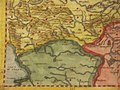
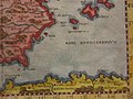
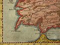
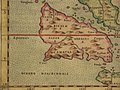
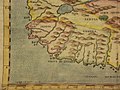
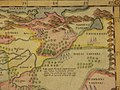
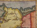
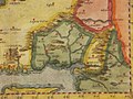
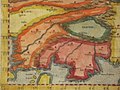
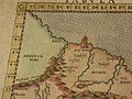
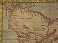
Calecut Nuova Tavola (the Deccan and the South), a map by Girolamo Ruscelli, published by Girodano Ziletti, Venice, 1561 and later editions: *a closeup of the South*
- frontispiece to the 1574 edition*; *the whole map, 1574 ed.*: *northwest*; *northeast*; *southwest*; *southeast*; *a closeup of the Deccan*.
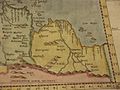
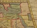
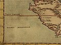
More maps from the same set, both Ptolemaic and updated, 1574 ed. unless otherwise marked, some with modern hand coloring
Italiano: La geografia di Claudio Tolomeo Alessandrino, nuouamente tradotta di Greco in Italiano, da Girolamo Ruscelli ; con Espositioni del medesimo, particolari di luogo in luogo, & uniuersali sopra tutto il libro, et sopra tutta la Geografia, o modo di far la descrittione di tutto il mondo ; et con nuoue & bellisime figure in istampe di rame, oue, oltre alle XXVI antiche di Tolomeo, se ne son'aggiunte XXXVI altre delle moderne ; con la carta da nauicare, & col modo d'intenderla, & d'adoperarla ; aggiuntoui un pieno discorso di M. Gioseppe Moleto matematico ; nel quale si dichiarano tutti i termini & le regole appartenenti alla Geografia ; et con una nuoua & copiosa tauola di nomi antichi, dichiarati coi nomi moderni, & con molte altre cose utillissime & necessarie, che ciascuno leggendo potra conoscere. Al Sacratissimo et Sempre Felicissimo Imperator Ferdinando Primo. Con privilegio dell'Illustrissimo Senato Veneto, & d'altri Principi per anni XV. In Venetia, Appresso Vincenzo Valgrisi, M.D.LXI. (1561).
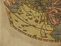
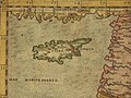
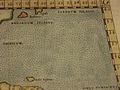
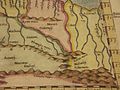
English: The first edition of Girolamo Ruscelli's translation of Claudius Ptolemy's Geographia, published in Italian. It was printed by Vincenzo Valgrisi in Venice, with the text translated from Greek by Ruscelli. The 64 double page copperplate maps were partly based on those of Jacopo Gastaldo in the edition of 1548, with descriptive text on recto of first leaf and verso of last leaf. 27 Ptolemy maps and 37 'modern' map, including 3 world maps, 6 maps of America (South America, Mexico with Florida, Brazil, east coast of North America, Haiti, Cuba), 27 European maps (including the North-Atlantic map with parts of Labrador), 9 maps of Africa and 19 maps of Asia. Maps showing settlements, landmarks, rivers, mountains, ports, forests, illustrations of wildlife,etc. Includes index. Relief shown pictorially. Bound in half leather marbled paper covered boards, with title "Geografia di Tolomeo" on spine. Claudius Ptolemy (90-168 CE) was a Roman geographer and mathematician living in Egypt, who compiled his knowledge and theories about the world's geography into one seminal work. Although his maps did not survive, his mathematical projections and location coordinates did. Girolamo Ruscelli (c. 1504-1566) was a Venetian editor, whose maps are primarily based on those by Jacopo Gastaldi (1548) but with many of his own additions and reproduced on a larger scale. Ruscelli introduces several important innovations in this volume through his 37 "modern" maps, which cover Europe, Africa, Asia and the New World. Ruscelli includes a double hemisphere world map, which was the first of its kind to be used in an atlas, and "Carta Marina Nuova Tavola", a rare sea chart of the world.
- Pub Date: 1561
- Authors: Ptolemy, Claudius; Ruscelli, Girolamo; Giuseppe Moletti, M.
- Publisher: Vincenzo Valgrisi, Venice
Subcategories
This category has the following 2 subcategories, out of 2 total.
I
- India Tercera Nuova Tavola (7 F)
Media in category "Calecut Nuova Tavola (Ruscelli)"
The following 149 files are in this category, out of 149 total.
-

-
 "Orbis Descriptio" (two hemispheres) eastern.jpg 800 × 600; 130 KB
-
 "Orbis Descriptio" (two hemispheres) North America.jpg 800 × 600; 147 KB
-
 "Orbis Descriptio" (two hemispheres) South America.jpg 800 × 600; 144 KB
-
 "Orbis Descriptio" (two hemispheres) western.jpg 800 × 600; 135 KB
-
 "Tavola Nuova della Marca Trivigiana (northern Italy) northeast.jpg 800 × 600; 132 KB
-
 "Tavola Nuova della Marca Trivigiana (northern Italy) northwest.jpg 800 × 600; 144 KB
-
 "Tavola Nuova della Marca Trivigiana (northern Italy) southeast.jpg 800 × 600; 124 KB
-
 "Tavola Nuova della Marca Trivigiana (northern Italy) southwest.jpg 800 × 600; 119 KB
-
 *"Arabia Felice Nuova Tavola" (Arabia) southeast.jpg 800 × 600; 115 KB
-
 *Tabula Aphricae II (North Africa) northwest.jpg 800 × 600; 129 KB
-
 *Tabula Aphricae II (North Africa) southeast.jpg 800 × 600; 129 KB
-
 *Tabula Aphricae II (North Africa) southwest.jpg 800 × 600; 124 KB
-
 *Tabula Aphricae IV (Northeast Africa northwest.jpg 800 × 600; 123 KB
-
 *Tabula Aphricae IV (Northeast Africa) northeast.jpg 800 × 600; 120 KB
-
 *Tabula Aphricae IV (Northeast Africa) southeast.jpg 800 × 600; 118 KB
-
 *Tabula Aphricae IV (Northeast Africa) southwest.jpg 800 × 600; 107 KB
-
 *Tabula Asiae VIII (Central Asia) northeast.jpg 800 × 600; 110 KB
-
 *Tabula Asiae VIII (Central Asia) northwest.jpg 800 × 600; 108 KB
-
 *Tabula Asiae VIII (Central Asia) southwest.jpg 800 × 600; 114 KB
-
 *Tabula Asiae XII (Sri Lanka) north.jpg 800 × 600; 129 KB
-
 *Tabula Asiae XII (Sri Lanka) south.jpg 800 × 600; 116 KB
-
 Africa Minor Nuova Tavola" (North Central Africa) northeast.jpg 800 × 600; 132 KB
-
 Africa Minor Nuova Tavola" (North Central Africa) northwest.jpg 800 × 600; 124 KB
-
 Africa Minor Nuova Tavola" (North Central Africa) southeast.jpg 800 × 600; 110 KB
-
 Africa Minor Nuova Tavola" (North Central Africa) southwest.jpg 800 × 600; 126 KB
-
 Africa Nuova Tavola (South Africa) northeast.jpg 800 × 600; 137 KB
-
 Africa Nuova Tavola (South Africa) southeast.jpg 800 × 600; 120 KB
-
 Africa Nuova Tavola (South Africa) southwest.jpg 800 × 600; 118 KB
-
 Africa Nuova Tavola" (South Africa) northwest.jpg 800 × 600; 136 KB
-
 Anglia et Hibernia Nova (Britain) northwest.jpg 800 × 600; 136 KB
-
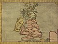 Anglia et Hibernia Nova (Britain).jpg 800 × 600; 152 KB
-
 Anglia et Hibernia Nova southeast.jpg 800 × 600; 143 KB
-
 Anglia et Hibernia Nova" (Britain) northeast.jpg 800 × 600; 140 KB
-
 Anglia et Hibernia Nova" (Britain) southwest.jpg 800 × 600; 144 KB
-
 Arabia Felice Nuova Tavola (Arabia), northeast.jpg 800 × 600; 123 KB
-
 Arabia Felice Nuova Tavola (Arabia), northwest.jpg 800 × 600; 136 KB
-
 Arabia Felice Nuova Tavola (Arabia), southwest.jpg 800 × 600; 126 KB
-
 Brasil Nuova Tavola lower left.jpg 800 × 600; 116 KB
-
 Brasil Nuova Tavola lower right.jpg 800 × 600; 112 KB
-
 Brasil Nuova Tavola upper left.jpg 800 × 600; 119 KB
-
 Brasil Nuova Tavola upper right.jpg 800 × 600; 106 KB
-

-
 Carta Marina Nuova Tavola (a sea map) north east.jpg 800 × 600; 156 KB
-
 Carta Marina Nuova Tavola (a sea map) northwest.jpg 800 × 600; 151 KB
-
 Carta Marina Nuova Tavola (a sea map) southeast.jpg 800 × 600; 164 KB
-
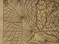 Carta Marina Nuova Tavola (a sea map) southwest.jpg 800 × 600; 159 KB
-
 Egitto Nuova Tavola (Egypt) northeast.jpg 800 × 600; 127 KB
-
 Egitto Nuova Tavola (Egypt) northwest.jpg 800 × 600; 125 KB
-
 Egitto Nuova Tavola (Egypt) southeast.jpg 800 × 600; 121 KB
-
 Egitto Nuova Tavola (Egypt) southwest.jpg 800 × 600; 108 KB
-
 Graetia Nuova Tavola (Greece) *southwest.jpg 800 × 600; 125 KB
-
 Graetia Nuova Tavola (Greece) northeast.jpg 800 × 600; 148 KB
-
 Graetia Nuova Tavola (Greece) northwest.jpg 800 × 600; 147 KB
-
 Graetia Nuova Tavola (Greece) southeast.jpg 800 × 600; 150 KB
-
 Hispania Nuova Tavola (Spain) northeast.jpg 800 × 600; 135 KB
-
 Hispania Nuova Tavola (Spain) northwest.jpg 800 × 600; 129 KB
-
 Hispania Nuova Tavola (Spain) southeast.jpg 800 × 600; 126 KB
-
 Hispania Nuova Tavola (Spain) southwest.jpg 800 × 600; 136 KB
-
 India Tercera Nuova Tavola (Southeast Asia) southeast.jpg 800 × 600; 141 KB
-
 India Tercera Nuova Tavola (Southeast Asia) southwest.jpg 800 × 600; 135 KB
-
 India Tercera Nuova Tavola 1.jpg 800 × 600; 151 KB
-
 India Tercera Nuova Tavola northeast.jpg 800 × 600; 131 KB
-
 India Tercera Nuova Tavola" (Southeast Asia) northwest.jpg 800 × 600; 135 KB
-
 Mauritania Nuova Tavola northeast.jpg 800 × 600; 126 KB
-
 Mauritania Nuova Tavola northwest.jpg 800 × 600; 133 KB
-
 Mauritania Nuova Tavola southeast.jpg 800 × 600; 116 KB
-
 Mauritania Nuova Tavola southwest.jpg 800 × 600; 122 KB
-
 Moschovia Nuova Tavola northeast.jpg 800 × 600; 116 KB
-
 Moschovia Nuova Tavola northwest.jpg 800 × 600; 123 KB
-
 Moschovia Nuova Tavola southeast.jpg 800 × 600; 113 KB
-
 Moschovia Nuova Tavola southwest.jpg 800 × 600; 122 KB
-
 Natolia Nuova Tavola northeast.jpg 800 × 600; 117 KB
-
 Natolia Nuova Tavola northwest.jpg 800 × 600; 129 KB
-
 Natolia Nuova Tavola southeast.jpg 800 × 600; 121 KB
-
 Natolia Nuova Tavola southwest.jpg 800 × 600; 130 KB
-
 Persia Nuova Tavola *southwest.jpg 800 × 600; 133 KB
-
 Persia Nuova Tavola northeast.jpg 800 × 600; 129 KB
-
 Persia Nuova Tavola northwest.jpg 800 × 600; 131 KB
-
 Persia Nuova Tavola southeast.jpg 800 × 600; 117 KB
-
 Ptolemaei Cognita (world) northeast.jpg 800 × 600; 114 KB
-
 Ptolemaei Cognita (world) northwest.jpg 800 × 600; 119 KB
-
 Ptolemaei Cognita (world) southeast.jpg 800 × 600; 126 KB
-
 Ptolemaei Cognita (world) southern Asia.jpg 800 × 600; 146 KB
-
 Ptolemaei Cognita (world) southwest.jpg 800 × 600; 128 KB
-
 Ptolemaei Cognita (world) west Asia*.jpg 800 × 600; 154 KB
-
 Soria et Terra Santa Nuova Tavola (the Holy Land) northeast.jpg 800 × 600; 134 KB
-
 Soria et Terra Santa Nuova Tavola (the Holy Land) northwest.jpg 800 × 600; 139 KB
-
 Soria et Terra Santa Nuova Tavola (the Holy Land) southeast.jpg 800 × 600; 115 KB
-
 Soria et Terra Santa Nuova Tavola (the Holy Land) southwest.jpg 800 × 600; 126 KB
-
 Tabula Aphricae I (Northwest Africa) northeast.jpg 800 × 600; 108 KB
-
 Tabula Aphricae I (Northwest Africa) northwest.jpg 800 × 600; 123 KB
-
 Tabula Aphricae I (Northwest Africa) southeast.jpg 800 × 600; 118 KB
-
 Tabula Aphricae I (Northwest Africa) southwest.jpg 800 × 600; 126 KB
-
 Tabula Aphricae III (North Africa) northeast.jpg 800 × 600; 131 KB
-
 Tabula Aphricae III (North Africa) northwest.jpg 800 × 600; 127 KB
-
 Tabula Aphricae III (North Africa) southeast.jpg 800 × 600; 103 KB
-
 Tabula Aphricae III (North Africa) southwest.jpg 800 × 600; 107 KB
-
 Tabula Asiae I (Turkey and Asia Minor) North East.jpg 800 × 600; 131 KB
-
 Tabula Asiae I (Turkey and Asia Minor) North West.jpg 800 × 600; 134 KB
-
 Tabula Asiae I (Turkey and Asia Minor) South east.jpg 800 × 600; 124 KB
-
 Tabula Asiae I (Turkey and Asia Minor) South West.jpg 800 × 600; 143 KB
-
 Tabula Asiae II (Caucasus, Ukraine) northeast.jpg 800 × 600; 107 KB
-
 Tabula Asiae II (Caucasus, Ukraine) northwest.jpg 800 × 600; 111 KB
-
 Tabula Asiae II (Caucasus, Ukraine) southeast.jpg 800 × 600; 124 KB
-
 Tabula Asiae III (Caucasus) northeas.jpg 800 × 600; 116 KB
-
 Tabula Asiae III (Caucasus) northwest.jpg 800 × 600; 120 KB
-
 Tabula Asiae III (Caucasus) southeast.jpg 800 × 600; 103 KB
-
 Tabula Asiae III (Caucasus) southwest.jpg 800 × 600; 122 KB
-
 Tabula Asiae IX (the Afghanistan region) northeast.jpg 800 × 600; 131 KB
-
 Tabula Asiae IX (the Afghanistan region) northwest.jpg 800 × 600; 124 KB
-
 Tabula Asiae IX (the Afghanistan region) southeast.jpg 800 × 600; 104 KB
-
 Tabula Asiae IX (the Afghanistan region) southwest.jpg 800 × 600; 117 KB
-
 Tabula Asiae V (Persia) northeast.jpg 800 × 600; 128 KB
-
 Tabula Asiae V (Persia) northwest.jpg 800 × 600; 123 KB
-
 Tabula Asiae V (Persia) southeast.jpg 800 × 600; 120 KB
-
 Tabula Asiae V (Persia) southwest.jpg 800 × 600; 129 KB
-
 Tabula Asiae VI (Arabia) northeast.jpg 800 × 600; 147 KB
-
 Tabula Asiae VI (Arabia) northwest.jpg 800 × 600; 126 KB
-
 Tabula Asiae VI (Arabia) southeast.jpg 800 × 600; 133 KB
-
 Tabula Asiae VI (Arabia) southwest.jpg 800 × 600; 132 KB
-
 Tabula Asiae VII (Western Asia) northwest.jpg 800 × 600; 141 KB
-
 Tabula Asiae VII (Western Asia) south west.jpg 800 × 600; 128 KB
-
 Tabula Asiae VII (Western Asia) southeast.jpg 800 × 600; 125 KB
-
 Tabula Asiae X (India) northeast.jpg 800 × 600; 126 KB
-
 Tabula Asiae X (India) northwest.jpg 800 × 600; 128 KB
-
 Tabula Asiae X (India) southeast.jpg 800 × 600; 119 KB
-
 Tabula Asiae X (India) southwest.jpg 800 × 600; 113 KB
-
 Tabula Europae I (Britain) northeast.jpg 800 × 600; 131 KB
-
 Tabula Europae I (Britain) northwest.jpg 800 × 600; 125 KB
-
 Tabula Europae I (Britain) southeast.jpg 800 × 600; 114 KB
-
 Tabula Europae I (Britain) southwest.jpg 800 × 600; 130 KB
-
 Tabula Europae III (France) northeast.jpg 800 × 600; 125 KB
-
 Tabula Europae III (France) northwest.jpg 800 × 600; 123 KB
-
 Tabula Europae III (France) southeast.jpg 800 × 600; 135 KB
-
 Tabula Europae III (France) southwest.jpg 800 × 600; 125 KB
-
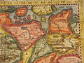 Tavola Nuova di Germania (Germany) northeast.jpg 800 × 600; 160 KB
-
 Tavola Nuova di Germania (Germany) northwest.jpg 800 × 600; 153 KB
-
 Tavola Nuova di Germania (Germany) southeast.jpg 800 × 600; 155 KB
-
 Tavola Nuova di Germania (Germany) southwest.jpg 800 × 600; 151 KB
-
 Territorio de Roma northeast.jpg 800 × 600; 126 KB
-
 Territorio de Roma northwest.jpg 800 × 600; 137 KB
-
 Territorio de Roma southeast.jpg 800 × 600; 135 KB
-
 Territorio de Roma southwest.jpg 800 × 600; 137 KB
-
 Territorio de Roma.jpg 800 × 600; 149 KB
-
 Tierra Nova" (South America) northeast.jpg 800 × 600; 136 KB
-
 Tierra Nova" (South America) northwest.jpg 800 × 600; 134 KB
-
 Tierra Nova" (South America) southeast.jpg 800 × 600; 120 KB
-
 Tierra Nova" (South America) southwest.jpg 800 × 600; 133 KB
_a_closer_view_of_the_eastern_hemisphere.jpg)
_eastern.jpg)
_North_America.jpg)
_South_America.jpg)
_western.jpg)
_northeast.jpg)
_northwest.jpg)
_southeast.jpg)
_southwest.jpg)
_southeast.jpg)
_northwest.jpg)
_southeast.jpg)
_southwest.jpg)

_northeast.jpg)
_southeast.jpg)
_southwest.jpg)
_northeast.jpg)
_northwest.jpg)
_southwest.jpg)
_north.jpg)
_south.jpg)
_northeast.jpg)
_northwest.jpg)
_southeast.jpg)
_southwest.jpg)
_northeast.jpg)
_southeast.jpg)
_southwest.jpg)
_northwest.jpg)
_northwest.jpg)
.jpg)

_northeast.jpg)
_southwest.jpg)
,_northeast.jpg)
,_northwest.jpg)
,_southwest.jpg)


,_a_map_by_Girolamo_Ruscelli,_published_by_Girodano_Ziletti,_Venice,_1561.jpg)
_north_east.jpg)
_northwest.jpg)
_southeast.jpg)
_southwest.jpg)
_northeast.jpg)
_northwest.jpg)
_southeast.jpg)
_southwest.jpg)
_*southwest.jpg)
_northeast.jpg)
_northwest.jpg)
_southeast.jpg)
_northeast.jpg)
_northwest.jpg)
_southeast.jpg)
_southwest.jpg)
_southeast.jpg)
_southwest.jpg)


_northwest.jpg)


_northeast.jpg)
_northwest.jpg)
_southeast.jpg)
_southern_Asia.jpg)
_southwest.jpg)
_west_Asia*.jpg)
_northeast.jpg)
_northwest.jpg)
_southeast.jpg)
_southwest.jpg)
_northeast.jpg)
_northwest.jpg)
_southeast.jpg)
_southwest.jpg)
_northeast.jpg)
_northwest.jpg)
_southeast.jpg)
_southwest.jpg)
_North_East.jpg)
_North_West.jpg)
_South_east.jpg)
_South_West.jpg)
_northeast.jpg)
_northwest.jpg)
_southeast.jpg)
_northeas.jpg)
_northwest.jpg)
_southeast.jpg)
_southwest.jpg)
_northeast.jpg)
_northwest.jpg)
_southeast.jpg)
_southwest.jpg)
_northeast.jpg)
_northwest.jpg)
_southeast.jpg)
_southwest.jpg)
_northeast.jpg)
_northwest.jpg)
_southeast.jpg)
_southwest.jpg)
_northwest.jpg)
_south_west.jpg)
_southeast.jpg)
_northeast.jpg)
_northwest.jpg)
_southeast.jpg)
_southwest.jpg)
_northeast.jpg)
_northwest.jpg)
_southeast.jpg)
_southwest.jpg)
_northeast.jpg)
_northwest.jpg)
_southeast.jpg)
_southwest.jpg)
_northeast.jpg)
_northwest.jpg)
_southeast.jpg)
_southwest.jpg)


_northeast.jpg)
_northwest.jpg)
_southeast.jpg)
_southwest.jpg)