File:Teczowa.zach.i.sciezka.jpg
Jump to navigation
Jump to search

Size of this preview: 800 × 600 pixels. Other resolutions: 320 × 240 pixels | 640 × 480 pixels | 1,024 × 768 pixels | 1,280 × 960 pixels | 2,048 × 1,536 pixels.
Original file (2,048 × 1,536 pixels, file size: 853 KB, MIME type: image/jpeg)
Captions
Captions
Add a one-line explanation of what this file represents
| Camera location | | View this and other nearby images on: OpenStreetMap |
|---|
| Description |
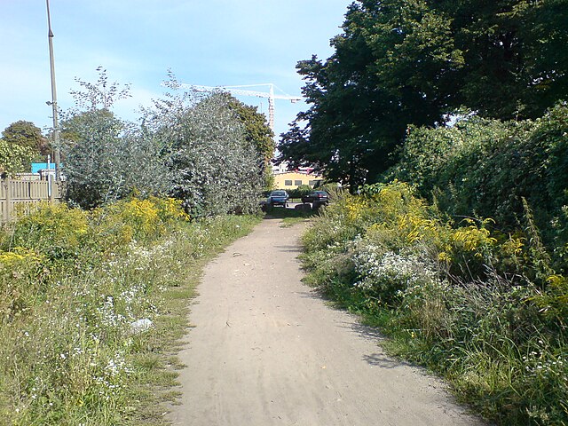
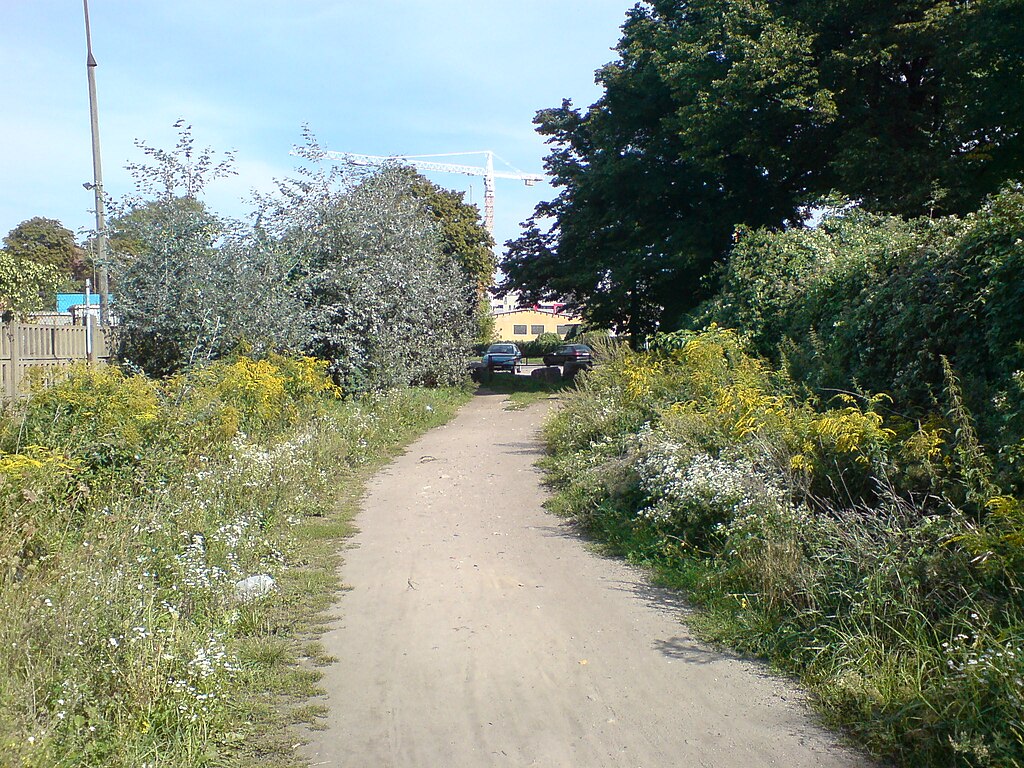
Polski: zachodni kraniec ul. Tęczowej we Wrocławiu; widok w kierunku wschodnim ze ścieżki stanowiącej przedłużenie ulicy. |
||
| Date | |||
| Source | Own work | ||
| Author | Julo | ||
| Permission (Reusing this file) |
|
File history
Click on a date/time to view the file as it appeared at that time.
| Date/Time | Thumbnail | Dimensions | User | Comment | |
|---|---|---|---|---|---|
| current | 14:13, 1 September 2008 | | 2,048 × 1,536 (853 KB) | Julo (talk | contribs) | {{Information |Description={{pl|1=zachodni kraniec ul. Tęczowej we Wrocławiu; widok w kierunku wschodnim<br>na pierwszym planie ścieżka stanowiąca przedłużenie ulicy}} |Source=Praca własna osoby przesyłającej (own work by uploader) |Author=[ |
You cannot overwrite this file.
File usage on Commons
There are no pages that use this file.
File usage on other wikis
The following other wikis use this file:
- Usage on pl.wikipedia.org