File:Strait of Hormuz-svg-en.svg
Jump to navigation
Jump to search

Size of this PNG preview of this SVG file: 754 × 600 pixels. Other resolutions: 302 × 240 pixels | 604 × 480 pixels | 966 × 768 pixels | 1,280 × 1,018 pixels | 2,560 × 2,035 pixels | 1,264 × 1,005 pixels.
Original file (SVG file, nominally 1,264 × 1,005 pixels, file size: 2.06 MB)
Captions
Captions
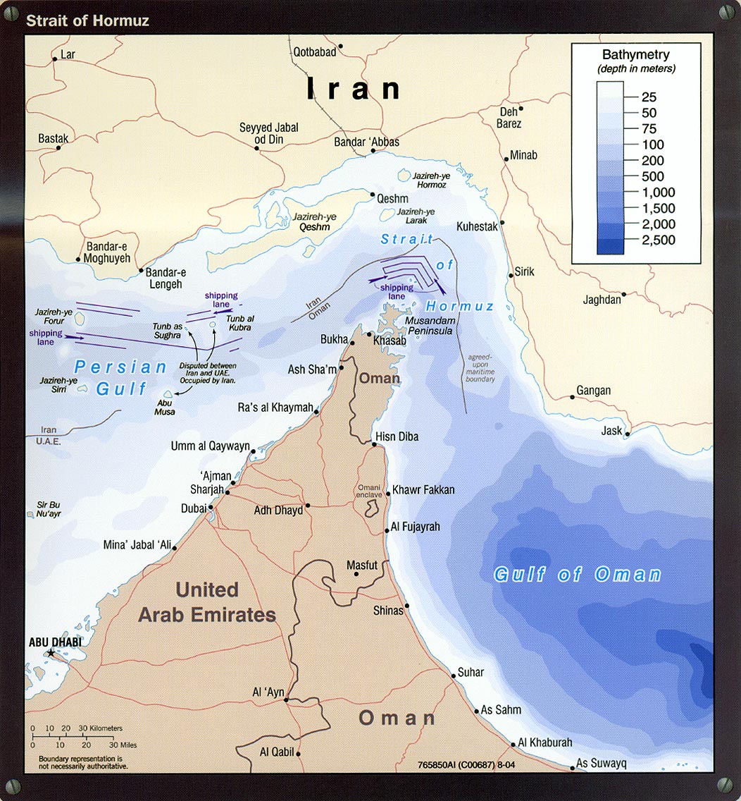
Strait of Hormuz
Summary[edit]
| Description |
English: Map of Strait of Hormuz (English)
Dansk: Kort over Hormuzstrædet (Engelsk)
Svenska: Karta över Hormuzsundet (Engelska)
Español: Mapa del Estrecho de Ormuz (Inglés)
Русский: Карта Ормузского пролива (англ.)
فارسی: نقشهٔ تنگهٔ هرمز (انگلیسی)
|
||||||||||||||||||||||||||||||||||||||||||||||||||||||||||||||||||||||||||||||||
| Date | |||||||||||||||||||||||||||||||||||||||||||||||||||||||||||||||||||||||||||||||||
| Source |
Own work based on: Information from: |
||||||||||||||||||||||||||||||||||||||||||||||||||||||||||||||||||||||||||||||||
| Author | Goran_tek-en | ||||||||||||||||||||||||||||||||||||||||||||||||||||||||||||||||||||||||||||||||
| Permission (Reusing this file) |
This file is licensed under the Creative Commons Attribution-Share Alike 4.0 International license. Attribution: Goran_tek-en
|
||||||||||||||||||||||||||||||||||||||||||||||||||||||||||||||||||||||||||||||||
| Other versions |
|
||||||||||||||||||||||||||||||||||||||||||||||||||||||||||||||||||||||||||||||||
| SVG development | This vector image was created with Inkscape. |
||||||||||||||||||||||||||||||||||||||||||||||||||||||||||||||||||||||||||||||||


| Object location | | View this and other nearby images on: OpenStreetMap |
|---|


File history
Click on a date/time to view the file as it appeared at that time.
| Date/Time | Thumbnail | Dimensions | User | Comment | |
|---|---|---|---|---|---|
| current | 14:54, 1 March 2022 | | 1,264 × 1,005 (2.06 MB) | Goran tek-en (talk | contribs) | {{Information |description = {{en|Map of Strait of Hormuz (English)}} {{da|Kort over Hormuzstrædet (Engelsk)}} {{es|Mapa del estrecho de Ormuz (Inglés)}} {{fa|نقشهٔ تنگهٔ هرمز (انگلیسی)}} {{ru|Карта Ормузского пролива (англ.)}} {{Institution |wikidata=Q794}} {{Institution |wikidata=Q842}} {{Institution |wikidata=Q878}} {{Institution |wikidata=Q79883}} |date =2022-03-01 |source ={{Own based|Strait_of_Hormuz.jpg|Maps templ... |
You cannot overwrite this file.
File usage on Commons
The following 3 pages use this file:
File usage on other wikis
The following other wikis use this file:
- Usage on ar.wikipedia.org
- Usage on en.wikipedia.org
- Usage on he.wikipedia.org