File:Spanish Florida Map 1803-es.svg
Jump to navigation
Jump to search

Size of this PNG preview of this SVG file: 619 × 448 pixels. Other resolutions: 320 × 232 pixels | 640 × 463 pixels | 1,024 × 741 pixels | 1,280 × 926 pixels | 2,560 × 1,853 pixels.
Original file (SVG file, nominally 619 × 448 pixels, file size: 837 KB)
Captions
Captions
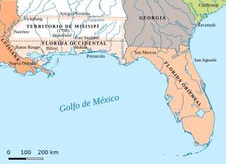
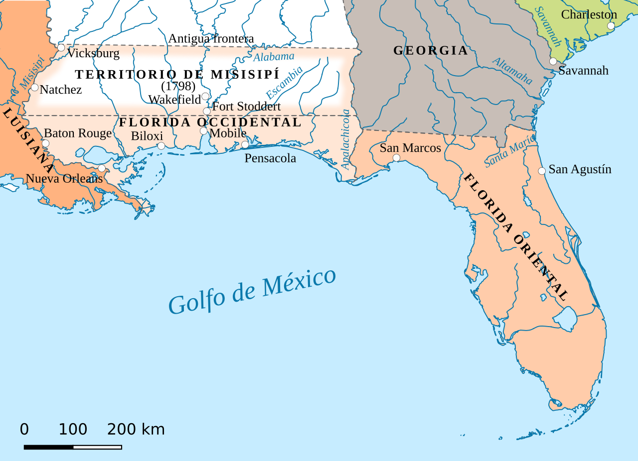
Map of the Spanish provinces of West Florida and East Florida in 1803
Summary[edit]
| Description |
English: Spanish Florida. Detail from map in Perry-Castañeda Library Map Collection. Español: Mapa de la Florida española en el periodo 1783-1810 |
| Source |
This file was derived from: Spanish Florida Map 1803.jpg “The United States, 1783-1803” Insets: The State of Franklin, 1784-1788. Early distribution of the Public Lands (Ohio). From The Historical Atlas by William R. Shepherd, 1923.
|
| Author | Jan Kronsell |
Licensing[edit]
This file is licensed under the Creative Commons Attribution-Share Alike 4.0 International license.
- You are free:
- to share – to copy, distribute and transmit the work
- to remix – to adapt the work
- Under the following conditions:
- attribution – You must give appropriate credit, provide a link to the license, and indicate if changes were made. You may do so in any reasonable manner, but not in any way that suggests the licensor endorses you or your use.
- share alike – If you remix, transform, or build upon the material, you must distribute your contributions under the same or compatible license as the original.
File history
Click on a date/time to view the file as it appeared at that time.
| Date/Time | Thumbnail | Dimensions | User | Comment | |
|---|---|---|---|---|---|
| current | 08:10, 8 August 2019 | | 619 × 448 (837 KB) | Rowanwindwhistler (talk | contribs) | frame removed |
| 08:04, 8 August 2019 |  | 619 × 448 (837 KB) | Rowanwindwhistler (talk | contribs) | Uploading a file from a free published source using File Upload Wizard |
You cannot overwrite this file.
File usage on Commons
There are no pages that use this file.
File usage on other wikis
The following other wikis use this file:
- Usage on es.wikipedia.org
- Usage on zh.wikipedia.org
Metadata
Categories:
- SVG maps of Florida
- Spanish-language SVG maps showing history of North America
- Maps of colonial North America
- Maps of former territories of the United States
- Maps of West Florida
- Maps of Spanish Florida
- 1803 maps of North America
- Pinckney's Treaty
- SVG maps of the Viceroyalty of New Spain
- Mississippi Territory