File:South Sudan location map.svg

Original file (SVG file, nominally 1,561 × 1,133 pixels, file size: 205 KB)
Captions
Captions
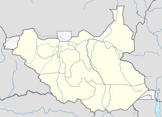
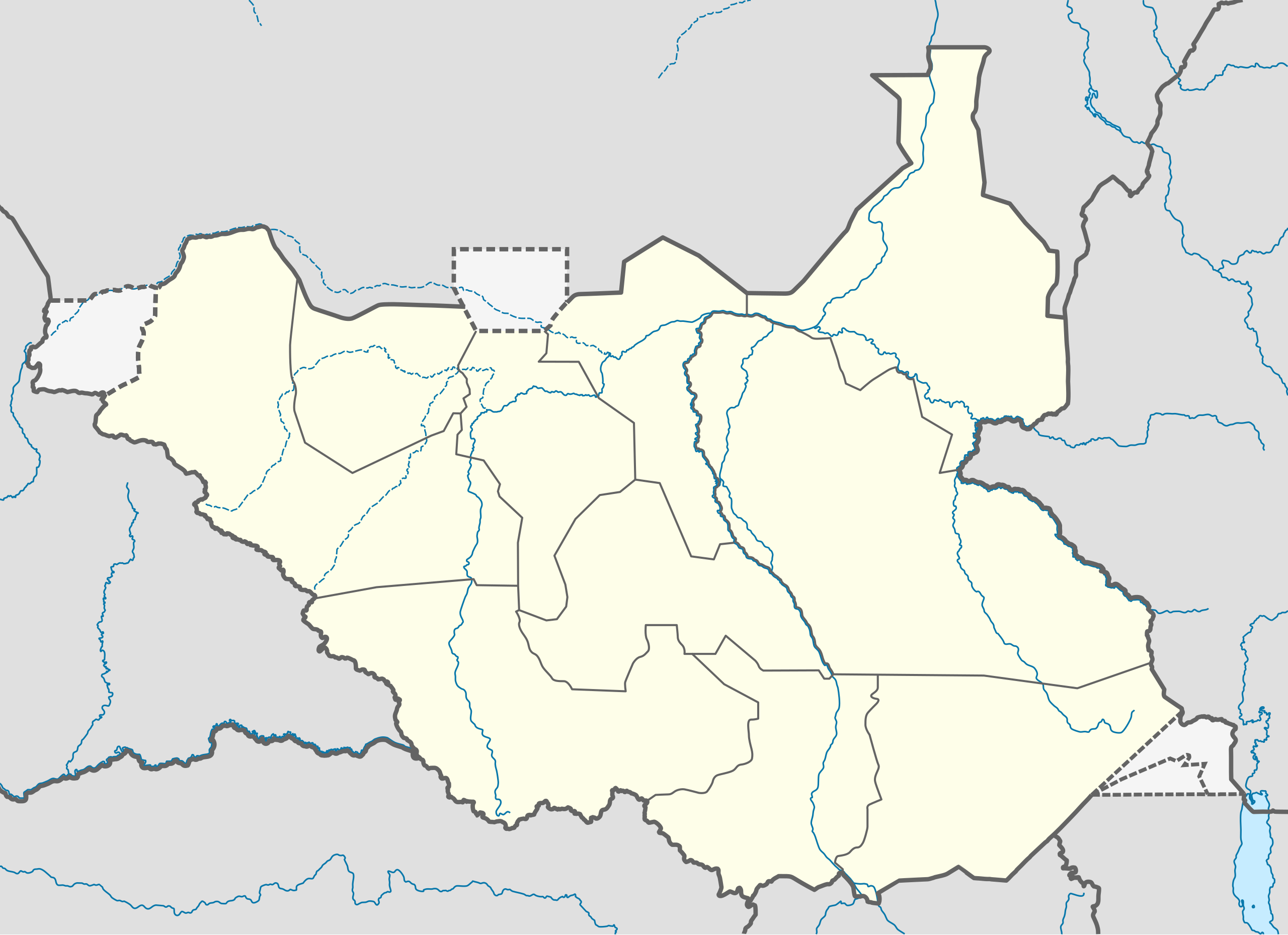
Summary[edit]
| Description |
Deutsch: Positionskarte vom Südsudan
Quadratische Plattkarte, N-S-Streckung 101 %. Geographische Begrenzung der Karte:
English: Location map of South Sudan
Equirectangular projection, N/S stretching 101 %. Geographic limits of the map:
|
|
| Date | ||
| Source |
Own work, using
|
|
| Author | NordNordWest | |
| Permission (Reusing this file) |
This file is licensed under the Creative Commons Attribution-Share Alike 3.0 Germany license.
 This file is licensed under the Creative Commons Attribution-Share Alike 3.0 Unported license.
|
|
| Other versions |
Derivative works of this file: File:South Sudan location green map.svg |


|
This map has been made or improved in the German Kartenwerkstatt (Map Lab). You can propose maps to improve as well.
|
File history
Click on a date/time to view the file as it appeared at that time.
| Date/Time | Thumbnail | Dimensions | User | Comment | |
|---|---|---|---|---|---|
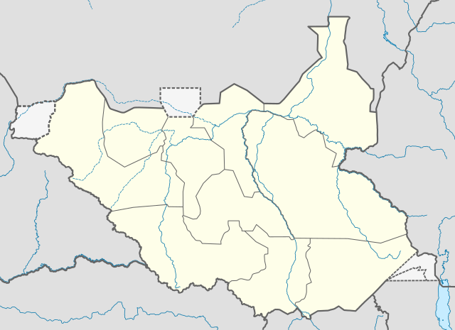
| current | 08:21, 18 August 2011 | | 1,561 × 1,133 (205 KB) | Spesh531 (talk | contribs) | I am reverting and fixing all of the templates ot the best of my ability, I can need some help |
| 07:53, 18 August 2011 |  | 1,500 × 1,133 (171 KB) | NordNordWest (talk | contribs) | you cannot change the area that is shown without adjusting all templates in which this map is used | |
| 23:20, 17 August 2011 |  | 1,561 × 1,133 (205 KB) | Spesh531 (talk | contribs) | adding a disputed territory | |
| 11:42, 18 July 2011 |  | 1,500 × 1,133 (171 KB) | NordNordWest (talk | contribs) | corr | |
| 12:04, 8 July 2011 |  | 1,500 × 1,133 (172 KB) | NordNordWest (talk | contribs) | upd | |
| 14:23, 18 February 2011 |  | 1,500 × 1,133 (178 KB) | NordNordWest (talk | contribs) | =={{int:filedesc}}== {{Information |Description= {{de|Positionskarte vom Südsudan}} Quadratische Plattkarte, N-S-Streckung 101 %. Geographische Begrenzung der Karte: * N: 12.7° N * S: 3.2° N * W: 23.7° O * O: 36.4° O {{en|Location m |
You cannot overwrite this file.
File usage on Commons
More than 100 pages use this file. The following list shows the first 100 pages that use this file only. A full list is available.
- User:NordNordWest/Gallery/Location maps
- File:Algeria in Africa.svg
- File:Algeria in Africa (-mini map -rivers).svg
- File:Angola in Africa.svg
- File:Angola in Africa (-mini map -rivers).svg
- File:BLANK in Africa.svg
- File:BLANK in Africa (-mini map -rivers).svg
- File:Benin in Africa.svg
- File:Benin in Africa (-mini map -rivers).svg
- File:Botswana in Africa.svg
- File:Botswana in Africa (-mini map -rivers).svg
- File:Burkina Faso in Africa.svg
- File:Burkina Faso in Africa (-mini map -rivers).svg
- File:Burundi in Africa.svg
- File:Burundi in Africa (-mini map -rivers).svg
- File:Cameroon in Africa.svg
- File:Cameroon in Africa (-mini map -rivers).svg
- File:Canary Islands in Africa.svg
- File:Canary Islands in Africa (-mini map -rivers).svg
- File:Canary Islands in Africa (special marker).svg
- File:Canary Islands in Africa (special marker) (-mini map -rivers).svg
- File:Cape Verde in Africa.svg
- File:Cape Verde in Africa (-mini map -rivers).svg
- File:Central African Republic in Africa.svg
- File:Central African Republic in Africa (-mini map -rivers).svg
- File:Ceuta in Africa.svg
- File:Chad in Africa.svg
- File:Comoros in Africa.svg
- File:Comoros in Africa (special marker).svg
- File:Cote d Ivoire in Africa.svg
- File:Democratic Republic of the Congo in Africa.svg
- File:Djibouti in Africa.svg
- File:Djibouti in Africa (special marker).svg
- File:Egypt in Africa (claimed).svg
- File:Egypt in Africa (controlled hatched).svg
- File:Egypt in Africa (de-facto).svg
- File:Egypt in Africa (undisputed only).svg
- File:Equatorial Guinea in Africa.svg
- File:Eritrea in Africa.svg
- File:Eswatini in Africa.svg
- File:Ethiopia in Africa.svg
- File:French Southern and Antarctic Lands in Africa (Scattered islands in the Indian Ocean only).svg
- File:Gabon in Africa.svg
- File:Gambia in Africa.svg
- File:Ghana in Africa.svg
- File:Guinea-Bissau in Africa.svg
- File:Guinea in Africa.svg
- File:Kenya in Africa (de-facto).svg
- File:Kenya in Africa (disputed hatched).svg
- File:Kenya in Africa (undisputed only).svg
- File:Lesotho in Africa.svg
- File:Lesotho in Africa (special marker).svg
- File:Liberia in Africa.svg
- File:Libya in Africa.svg
- File:Madagascar in Africa.svg
- File:Madeira in Africa.svg
- File:Malawi in Africa.svg
- File:Mali in Africa.svg
- File:Mauritania in Africa.svg
- File:Mauritius in Africa (+dependencies).svg
- File:Mauritius in Africa (Island of Mauritius only).svg
- File:Mauritius in Africa (most western islands only).svg
- File:Mayotte in Africa.svg
- File:Melilla in Africa.svg
- File:Morocco in Africa (claimed).svg
- File:Morocco in Africa (claims hatched).svg
- File:Morocco in Africa (de-facto).svg
- File:Morocco in Africa (only undisputed).svg
- File:Mozambique in Africa.svg
- File:Namibia in Africa.svg
- File:Niger in Africa.svg
- File:Nigeria in Africa.svg
- File:Plazas de soberania in Africa.svg
- File:Republic of the Congo in Africa.svg
- File:Reunion in Africa.svg
- File:Rwanda in Africa.svg
- File:Rwanda in Africa (special marker).svg
- File:Sahrawi Arab Democratic Republic in Africa (claimed).svg
- File:Sahrawi Arab Democratic Republic in Africa (claimed hatched).svg
- File:Sahrawi Arab Democratic Republic in Africa (de-facto).svg
- File:Saint Helena, Ascension, Tristan da Cunha in Africa.svg
- File:Saint Helena, Ascension in Africa (wo Tristan da Cunha).svg
- File:Sao Tome and Principe in Africa.svg
- File:Senegal in Africa.svg
- File:Seychelles in Africa.svg
- File:Sierra Leone in Africa.svg
- File:Somalia in Africa.svg
- File:Somalia in Africa (de-facto).svg
- File:Somaliland in Africa.svg
- File:South Africa in Africa.svg
- File:South Sudan in Africa (claimed).svg
- File:South Sudan in Africa (claimed hatched).svg
- File:South Sudan in Africa (de-facto).svg
- File:Southern Sudan location map.svg (file redirect)
- File:Sudan in Africa (claimed).svg
- File:Sudan in Africa (claimed hatched).svg
- File:Sudan in Africa (undisputed).svg
- File:Tanzania in Africa.svg
- File:Togo in Africa.svg
- File:Tunisia in Africa.svg
.svg)
.svg)
.svg)
.svg)
.svg)
.svg)
.svg)
.svg)
.svg)
.svg)
_(-mini_map_-rivers).svg)
.svg)
.svg)
.svg)
.svg)
.svg)
.svg)
.svg)
.svg)
.svg)
.svg)
.svg)
.svg)
.svg)
.svg)
.svg)
.svg)
.svg)
.svg)
.svg)
.svg)
.svg)
.svg)
.svg)
.svg)
.svg)
.svg)
.svg)
.svg)
.svg)
.svg)
.svg)
.svg)
View more links to this file.
File usage on other wikis
The following other wikis use this file:
- Usage on af.wikipedia.org
- Usage on ar.wikipedia.org
- Usage on bn.wikipedia.org
- Usage on ckb.wikipedia.org
- Usage on da.wikipedia.org
- Usage on de.wikipedia.org
- Usage on en.wikipedia.org
- Usage on eo.wikipedia.org
- Usage on es.wikipedia.org
- Usage on eu.wikipedia.org
- Usage on fa.wikipedia.org
- Usage on frr.wikipedia.org
- Usage on gl.wikipedia.org
- Usage on hy.wikipedia.org
- Usage on id.wikipedia.org
- Usage on incubator.wikimedia.org
- Usage on it.wikipedia.org
View more global usage of this file.