File:Second Seminole War map-es.svg
Jump to navigation
Jump to search

Size of this PNG preview of this SVG file: 430 × 599 pixels. Other resolutions: 172 × 240 pixels | 344 × 480 pixels | 551 × 768 pixels | 735 × 1,024 pixels | 1,469 × 2,048 pixels.
Original file (SVG file, nominally 800 × 1,115 pixels, file size: 247 KB)
Captions
Captions
Add a one-line explanation of what this file represents
Summary[edit]
| Description |
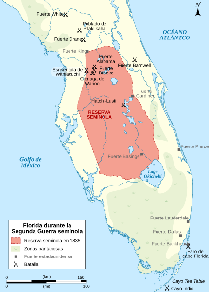
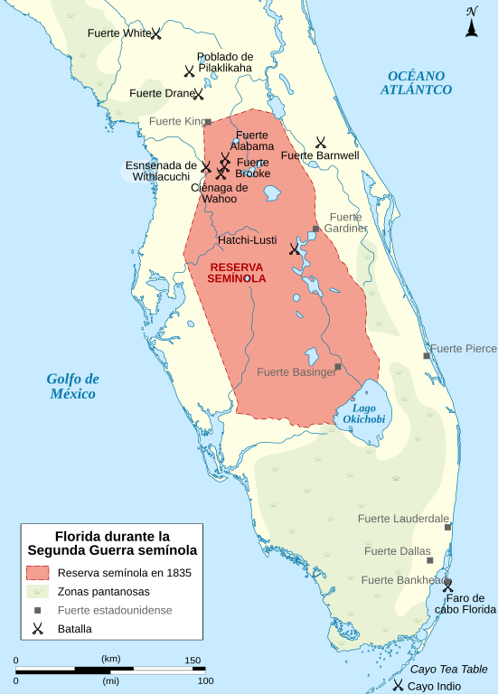
English: Map of the Florida peninsula during the Second Seminole War, between the Native Americans Seminole and the United States of America, between 1835 and 1842. Español: Mapa de la península de Florida durante la Segunda Guerra Seminola, entre los indios Seminola y los Estados Unidos de América, de 1835 a 1842. |
| Date | |
| Source |
This file was derived from: Second Seminole War map-fr.svg : Sémhur |
| Author |
|
Licensing[edit]
I, the copyright holder of this work, hereby publish it under the following license:
This file is licensed under the Creative Commons Attribution-Share Alike 4.0 International license.
- You are free:
- to share – to copy, distribute and transmit the work
- to remix – to adapt the work
- Under the following conditions:
- attribution – You must give appropriate credit, provide a link to the license, and indicate if changes were made. You may do so in any reasonable manner, but not in any way that suggests the licensor endorses you or your use.
- share alike – If you remix, transform, or build upon the material, you must distribute your contributions under the same or compatible license as the original.
File history
Click on a date/time to view the file as it appeared at that time.
| Date/Time | Thumbnail | Dimensions | User | Comment | |
|---|---|---|---|---|---|
| current | 20:17, 26 September 2014 | | 800 × 1,115 (247 KB) | Rowanwindwhistler (talk | contribs) | User created page with UploadWizard |
You cannot overwrite this file.
File usage on Commons
There are no pages that use this file.
File usage on other wikis
The following other wikis use this file:
- Usage on es.wikipedia.org
- Usage on it.wikipedia.org
- Usage on no.wikipedia.org
- Usage on sv.wikipedia.org