File:Sea-of-Okhotsk-Japanese-Map-オホーツク海の地図.png
Jump to navigation
Jump to search
Size of this preview: 800 × 547 pixels. Other resolutions: 320 × 219 pixels | 640 × 438 pixels | 1,024 × 700 pixels | 1,280 × 875 pixels | 2,560 × 1,751 pixels | 5,188 × 3,548 pixels.
Original file (5,188 × 3,548 pixels, file size: 14.76 MB, MIME type: image/png)
Captions
Captions
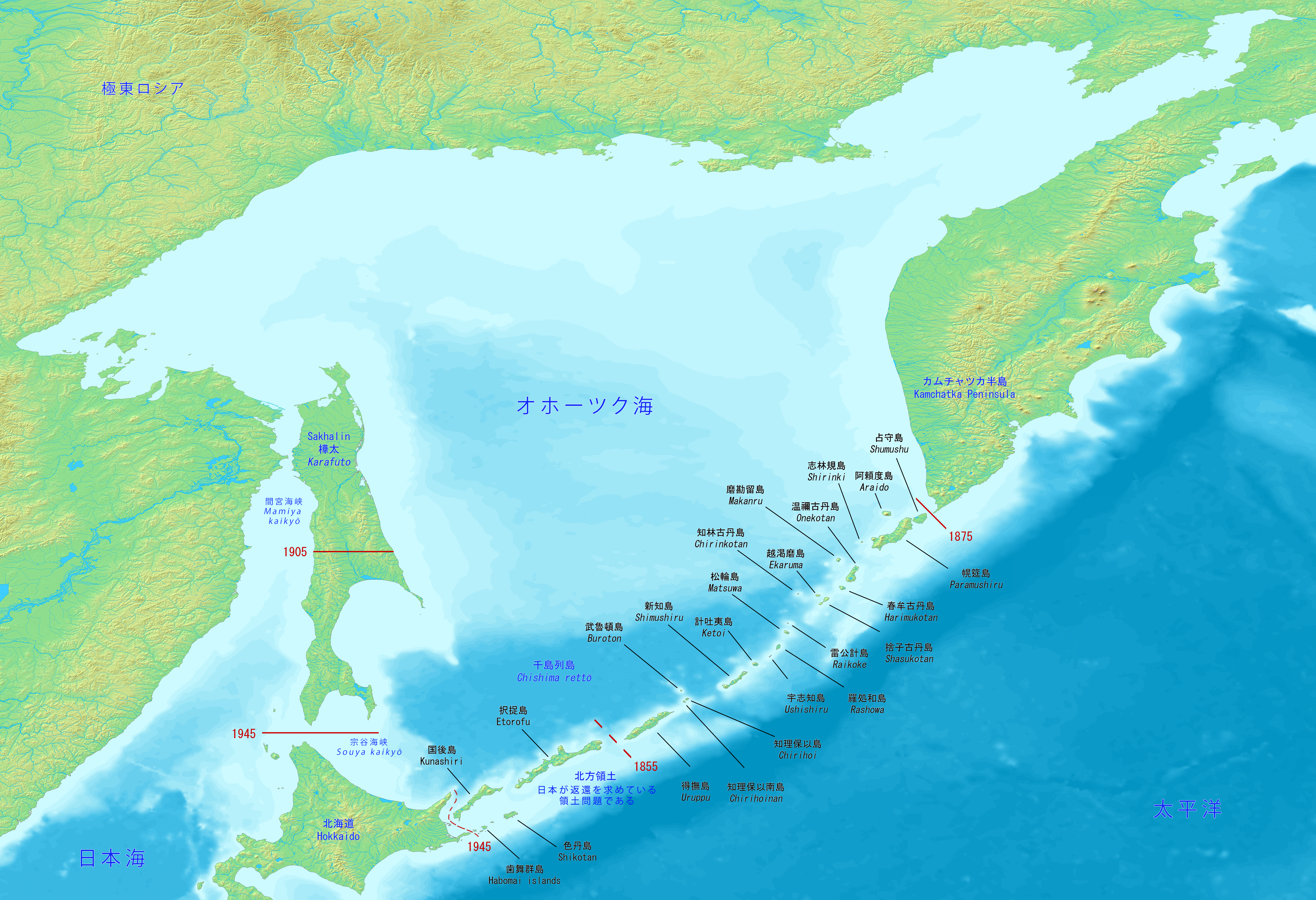
Sea of Okhotsk, Japanese Map
Summary[edit]
| Description |
English: Sea of Okhotsk, Japanese Map. It includes Sakhalin (Karafuto), the Kuril islands, Hokkaido and Kamchatka.
日本語: オホーツク海、日本の地図。 サハリン(樺太)、千島列島、北海道、カムチャツカが含まれます。 |
| Date | |
| Source | Own work |
| Author | Artanisen |
| Other versions |
|

Licensing[edit]
This image is in the public domain because it came from the site https://www.demis.nl/products/web-map-server/examples/ and was released by the copyright holder. Permission is granted to copy, distribute and/or modify this map since it is based on free of copyright images from: www.demis.nl. See also approval email on de.wp and its clarification.
|
| This work has been released into the public domain by its copyright holder, www.demis.nl. This applies worldwide. In some countries this may not be legally possible; if so: www.demis.nl grants anyone the right to use this work for any purpose, without any conditions, unless such conditions are required by law.
|
File history
Click on a date/time to view the file as it appeared at that time.
| Date/Time | Thumbnail | Dimensions | User | Comment | |
|---|---|---|---|---|---|
| current | 13:34, 14 May 2021 | | 5,188 × 3,548 (14.76 MB) | Artanisen (talk | contribs) | Uploaded own work with UploadWizard |
You cannot overwrite this file.
File usage on Commons
The following 3 pages use this file:
File usage on other wikis
The following other wikis use this file:
- Usage on fr.wikipedia.org
- Usage on ja.wikipedia.org