File:San Benito and Isla de Santa Barbara Guatemala 1923.tif
Jump to navigation
Jump to search
Size of this JPG preview of this TIF file: 800 × 484 pixels. Other resolutions: 320 × 194 pixels | 640 × 387 pixels | 1,024 × 620 pixels | 1,280 × 775 pixels | 2,560 × 1,550 pixels | 3,500 × 2,119 pixels.
Original file (3,500 × 2,119 pixels, file size: 14.15 MB, MIME type: image/tiff)
Captions
Captions
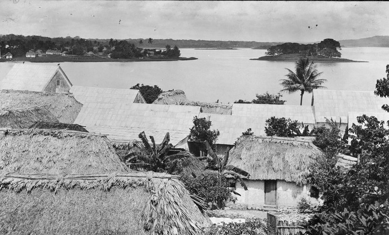
San Benito and Isla de Santa Barbara. Guatemala. 1923.
Summary[edit]
| Description |
English: San Benito is the village on the peninsula in the upper left. It consists mainly of Negroes who fled British Honduras. Isla de Santa Barbara is the island in the upper right. This photograpah was taken from the plaza in Flores. Guatemala. 1923. |
| Date | |
| Source | US Geological survey photo by Jerome O. Kilmartin via https://www.sciencebase.gov/catalog/item/5abd47bde4b081f61abfc143 |
| Author | Jerome O. Kilmartin |
Licensing[edit]
This image is in the public domain in the United States because it only contains materials that originally came from the United States Geological Survey, an agency of the United States Department of the Interior. For more information, see the official USGS copyright policy.
|
File history
Click on a date/time to view the file as it appeared at that time.
| Date/Time | Thumbnail | Dimensions | User | Comment | |
|---|---|---|---|---|---|
| current | 20:02, 18 January 2022 |  | 3,500 × 2,119 (14.15 MB) | Infrogmation (talk | contribs) | Uploaded a work by Jerome O. Kilmartin from US Geological survey photo by Jerome O. Kilmartin via https://www.sciencebase.gov/catalog/item/5abd47bde4b081f61abfc143 with UploadWizard |
You cannot overwrite this file.
File usage on Commons
There are no pages that use this file.