File:SWING SPAN TURNING MACHINERY HOUSE AND VARIOUS MEMBER COMPONENT DETAILS. - DeSiard Street Bridge, Spanning Ouachita River, Monroe, Ouachita Parish, LA HAER LA,37-MONR,4-8.tif
Jump to navigation
Jump to search

Size of this JPG preview of this TIF file: 735 × 600 pixels. Other resolutions: 294 × 240 pixels | 588 × 480 pixels | 941 × 768 pixels | 1,255 × 1,024 pixels | 2,510 × 2,048 pixels | 5,188 × 4,234 pixels.
Original file (5,188 × 4,234 pixels, file size: 20.95 MB, MIME type: image/tiff)
Captions
Captions
Add a one-line explanation of what this file represents
Summary[edit]
| SWING SPAN TURNING MACHINERY HOUSE AND VARIOUS MEMBER COMPONENT DETAILS. - DeSiard Street Bridge, Spanning Ouachita River, Monroe, Ouachita Parish, LA | ||||
|---|---|---|---|---|
| Photographer |
Lamkin, Marcus, creator |
|||
| Title |
SWING SPAN TURNING MACHINERY HOUSE AND VARIOUS MEMBER COMPONENT DETAILS. - DeSiard Street Bridge, Spanning Ouachita River, Monroe, Ouachita Parish, LA |
|||
| Depicted place | Louisiana; Ouachita Parish; Monroe | |||
| Date | Documentation compiled after 1968; 1997 | |||
| Dimensions | 4 x 5 in. | |||
| Current location |
Library of Congress Prints and Photographs Division Washington, D.C. 20540 USA http://hdl.loc.gov/loc.pnp/pp.print |
|||
| Accession number |
HAER LA,37-MONR,4-8 |
|||
| Credit line |
|
|||
| Notes |
|
|||
| Source | https://www.loc.gov/pictures/item/la0392.photos.205158p | |||
| Permission (Reusing this file) |
|
|||

File history
Click on a date/time to view the file as it appeared at that time.
| Date/Time | Thumbnail | Dimensions | User | Comment | |
|---|---|---|---|---|---|
| current | 22:55, 17 July 2014 | 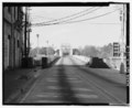 | 5,188 × 4,234 (20.95 MB) | Fæ (talk | contribs) | GWToolset: Creating mediafile for Fæ. HABS 17 July 2014 (1401:1600) |
You cannot overwrite this file.
File usage on Commons
The following page uses this file: