File:SWE-Map Valkretsar-kommuner.svg
Jump to navigation
Jump to search

Size of this PNG preview of this SVG file: 263 × 599 pixels. Other resolutions: 105 × 240 pixels | 211 × 480 pixels | 337 × 768 pixels | 450 × 1,024 pixels | 900 × 2,048 pixels | 290 × 660 pixels.
Original file (SVG file, nominally 290 × 660 pixels, file size: 187 KB)
Captions
Captions
Add a one-line explanation of what this file represents
| Description |
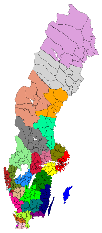
English: A coloured map of the Electoral districts and municipalities of Sweden. Coloured according to Riksdag-Valkrets.svg.
Svenska: En färglagd karta Sveriges valkretsar och kommuner. I samma färger som Riksdag-Valkrets.svg.
|
||
| Date | |||
| Source |
|
||
| Author | Lokal_Profil | ||
| Permission (Reusing this file) |
This file is licensed under the Creative Commons Attribution-Share Alike 2.5 Generic license. Attribution: Lokal_Profil
|
File history
Click on a date/time to view the file as it appeared at that time.
| Date/Time | Thumbnail | Dimensions | User | Comment | |
|---|---|---|---|---|---|
| current | 17:30, 9 October 2010 | | 290 × 660 (187 KB) | Lokal Profil (talk | contribs) | {{Information |Description={{en|A coloured map of the Electoral districts and municipalities of Sweden. Coloured according to Riksdag-Valkrets.svg. {{sv|En färglagd karta Sveriges valkretsar och kommuner. I samma färger so |
You cannot overwrite this file.
File usage on Commons
The following 4 pages use this file:
File usage on other wikis
The following other wikis use this file:
- Usage on ar.wikipedia.org
- Usage on fi.wikipedia.org
- Usage on pt.wikipedia.org
- Usage on sv.wikipedia.org
- Usage on www.wikidata.org