File:Rows of pine trees of Awaji National Route Aerial photograph.1974.jpg
Jump to navigation
Jump to search

Size of this preview: 800 × 571 pixels. Other resolutions: 320 × 228 pixels | 640 × 457 pixels | 1,024 × 731 pixels | 1,280 × 913 pixels | 1,763 × 1,258 pixels.
Original file (1,763 × 1,258 pixels, file size: 2.14 MB, MIME type: image/jpeg)
Captions
Captions
Add a one-line explanation of what this file represents
Summary[edit]
| Description |
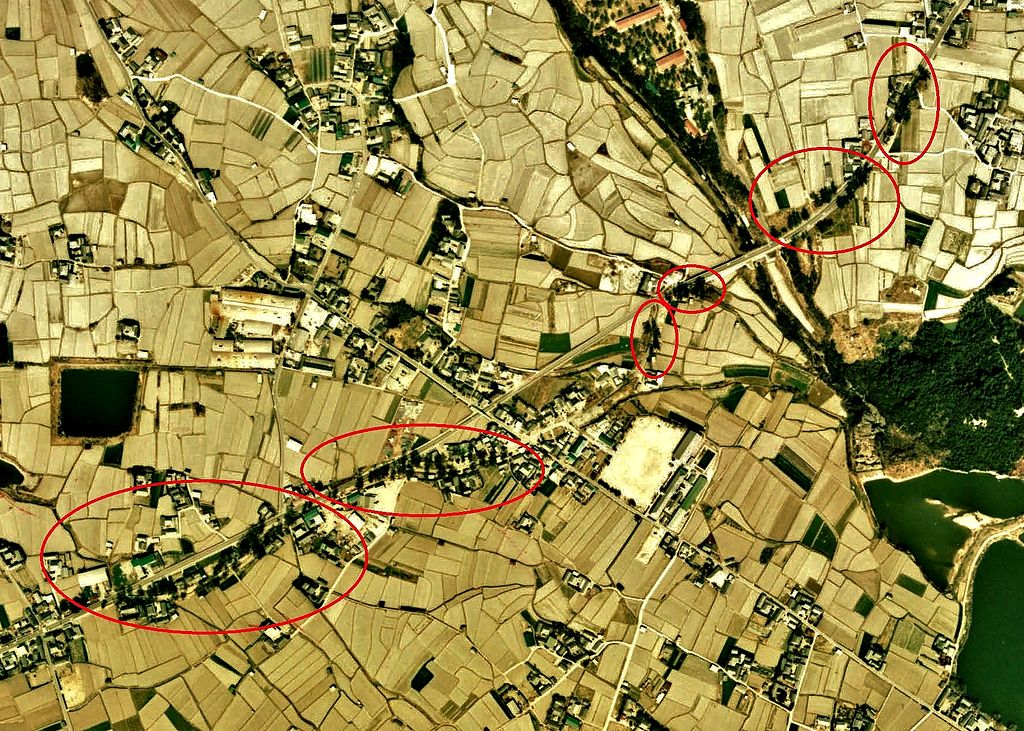
English: Rows of pine trees of Awaji National Route Aerial photograph.1974
日本語: かつての国指定天然記念物「淡路国道マツ並木」(現、南あわじ市)の空中写真。Ckk-74-10_c23_14を利用作成。 |
| Date | |
| Source | 国土情報ウェブマッピングシステム |
| Author | 国土交通省 |
Licensing[edit]

|
The copyright holder of this file, the Ministry of Land, Infrastructure, Transport and Tourism of Japan, allows anyone to use it for any purpose, provided that the copyright holder is properly attributed. Redistribution, derivative work, commercial use, and all other use is permitted. |
Attribution:
Copyright © National Land Image Information (Color Aerial Photographs), Ministry of Land, Infrastructure, Transport and Tourism
|
 |
This image is copyrighted by the Ministry of Land, Infrastructure, Transport and Tourism of Japan. For terms of use, see the stipulation to use of National Land Information (in Japanese) and message from MLIT (in Japanese and English). When you display this image on an article, include the following phrase in the description: "Made based on National Land Image Information (Color Aerial Photographs), Ministry of Land, Infrastructure, Transport and Tourism".
|
File history
Click on a date/time to view the file as it appeared at that time.
| Date/Time | Thumbnail | Dimensions | User | Comment | |
|---|---|---|---|---|---|
| current | 03:08, 4 January 2014 | | 1,763 × 1,258 (2.14 MB) | さかおり (talk | contribs) | {{Information |Description ={{en|1=Rows of pine trees of Awaji National Route Aerial photograph.1974}} {{ja|1=かつての国指定天然記念物「淡路国道マツ並木」(現、南あわじ市)の空中写真。Ckk-74-10_c23_14を利用作... |
You cannot overwrite this file.
File usage on Commons
There are no pages that use this file.
File usage on other wikis
The following other wikis use this file:
- Usage on ja.wikipedia.org