File:Paris department land cover location map.jpg
Jump to navigation
Jump to search
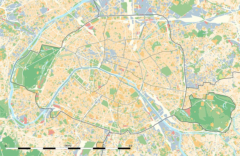
Size of this preview: 800 × 521 pixels. Other resolutions: 320 × 208 pixels | 640 × 417 pixels | 1,024 × 667 pixels | 1,371 × 893 pixels.
Original file (1,371 × 893 pixels, file size: 1.06 MB, MIME type: image/jpeg)
Captions
Captions
Add a one-line explanation of what this file represents
Summary[edit]
| Title |
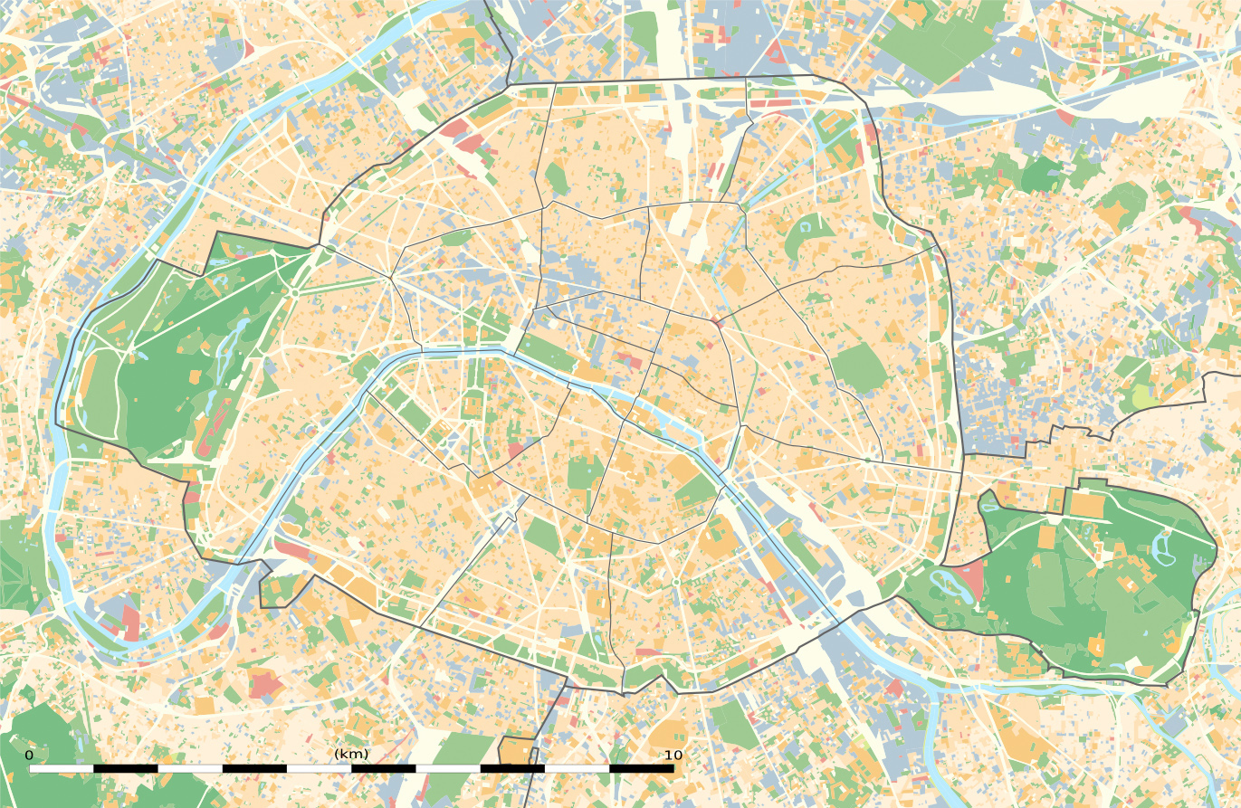
Blank land cover map of the city and department of Paris, France |
||||||||||||||||||||||||||||||||||||
| Description |
English: Blank land cover map of the city and department of Paris, France, as in January 2012, for geo-location purpose, with distinct boundaries for departments and arrondissements.
Français : Carte vierge de l'occupation du sol de la ville et département de Paris, France, tel qu'en janvier 2012, destinée à la géolocalisation, avec limite distincte des départements et arrondissements. |
||||||||||||||||||||||||||||||||||||
| Map legend |
|
||||||||||||||||||||||||||||||||||||
| Date | |||||||||||||||||||||||||||||||||||||
| Source |
Own work
|
||||||||||||||||||||||||||||||||||||
| Creator | |||||||||||||||||||||||||||||||||||||
| Permission (Reusing this file) |
|
||||||||||||||||||||||||||||||||||||
| Geotemporal data | |||||||||||||||||||||||||||||||||||||
| Date depicted | |||||||||||||||||||||||||||||||||||||
| Map location | Paris 48°51′24″N 2°21′03″E / 48.8567°N 2.3508°E | ||||||||||||||||||||||||||||||||||||
| Spatial reference system | WGS84 datum | ||||||||||||||||||||||||||||||||||||
| Scale | 1:124,000 (precision: 31 m) | ||||||||||||||||||||||||||||||||||||
| Heading |
 |
||||||||||||||||||||||||||||||||||||
| Bounding box |
|
||||||||||||||||||||||||||||||||||||
| Georeferencing | If inappropriate please set warp_status = skip to hide. | ||||||||||||||||||||||||||||||||||||
| Other versions |
|
||||||||||||||||||||||||||||||||||||


Licensing[edit]
Eric Gaba, Wikimedia Commons user Sting, the copyright holder of this work, hereby publishes it under the following license:
This file is licensed under the Creative Commons Attribution-Share Alike 3.0 Unported license.
Attribution: Eric Gaba, Wikimedia Commons user Sting
- You are free:
- to share – to copy, distribute and transmit the work
- to remix – to adapt the work
- Under the following conditions:
- attribution – You must give appropriate credit, provide a link to the license, and indicate if changes were made. You may do so in any reasonable manner, but not in any way that suggests the licensor endorses you or your use.
- share alike – If you remix, transform, or build upon the material, you must distribute your contributions under the same or compatible license as the original.
File history
Click on a date/time to view the file as it appeared at that time.
| Date/Time | Thumbnail | Dimensions | User | Comment | |
|---|---|---|---|---|---|
| current | 16:42, 22 February 2015 | | 1,371 × 893 (1.06 MB) | Spiridon Ion Cepleanu (talk | contribs) | Petit détail concernant le Muséum National d'Histoire Naturelle ("Clos Patouillet") |
| 11:10, 12 February 2015 |  | 1,371 × 893 (1.05 MB) | Sting (talk | contribs) | Metadata | |
| 02:14, 12 February 2015 |  | 1,371 × 893 (1.05 MB) | Sting (talk | contribs) | == {{int:filedesc}} == {{Location|48|51|22.5|N|02|20|37.5|E|scale:50000}} {{Information |Description={{en|Blank land cover map of the city and department of Paris, France, as in January 2012, for geo-location purpose, with distinct bounda... |
You cannot overwrite this file.
File usage on Commons
The following 12 pages use this file:
- Location maps of departments of France
- User:Sting/Gallery: Location and locator maps
- File:Blank map of Paris with Bois de Boulogne and Bois de Vincennes.svg
- File:Numbered map of Paris with Bois de Boulogne and Bois de Vincennes.svg
- File:Numbered map of Paris with Bois de Boulogne and Bois de Vincennes 2.svg
- File:Numbered map of Paris with Bois de Boulogne and Bois de Vincennes 3.svg
- File:Numbered map of Paris with Bois de Boulogne and Bois de Vincennes 4.svg
- File:Numbered map of Paris with arrondissements.svg
- File:Paris department land cover location map.svg
- File:Paris department location map.svg
- File:Paris department relief location map.jpg
- Category:Villa des Entrepreneurs (Paris)
File usage on other wikis
The following other wikis use this file:
- Usage on als.wikipedia.org
- Usage on ar.wikipedia.org
- Usage on de.wikipedia.org
- Usage on el.wikipedia.org
- Usage on eo.wikipedia.org
- Internacia Astronomia Unio
- Parizo
- Unesko
- Sorbono
- Panteono de Parizo
- Espéranto-France
- Nacia Biblioteko de Francio
- Franca Akademio
- Pariza Komunumo (1871)
- SAT-Amikaro
- TF1
- Avenuo de la Elizeaj Kampoj
- Luvro
- Metroo de Parizo
- Reĝa Palaco (Parizo)
- Hotelo de la Invalidoj
- Placo Vendôme
- Placo de la Venkoj (Parizo)
- INSEE (Francio)
- Eŭropa Kosma Agentejo
- Insulo Cité
- Insulo Saint-Louis
- Bosko de Boulogne
- Monteto Sainte-Geneviève
- Polica prefektejo (Parizo)
- Tuileries
- Triumfa Arko de Parizo
- Hotelo Crillon
- Hotelo Ritz (Parizo)
- Galeries Lafayette
- Internacia Komerca Ĉambro
- Bastille
- Placo de la Vogezoj
- Nacia Asembleo (Francio)
- Luksemburga Ĝardeno
- Organizaĵo pri Ekonomiaj Kunlaboro kaj Evoluigo
- Parko André Citroën
- Parko Montsouris
- Conciergerie
- Ĝardeno de la Plantoj (Parizo)
- Historia akso de Parizo
- Parko Buttes-Chaumont
- Parko de Belleville
View more global usage of this file.