File:Pallid Sturgeon range map-fr.svg
Jump to navigation
Jump to search

Size of this PNG preview of this SVG file: 770 × 600 pixels. Other resolutions: 308 × 240 pixels | 617 × 480 pixels | 986 × 768 pixels | 1,280 × 997 pixels | 2,560 × 1,994 pixels | 1,017 × 792 pixels.
Original file (SVG file, nominally 1,017 × 792 pixels, file size: 120 KB)
Captions
Captions
Add a one-line explanation of what this file represents
Summary[edit]
| Description |
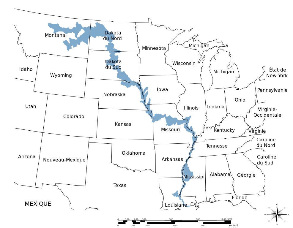
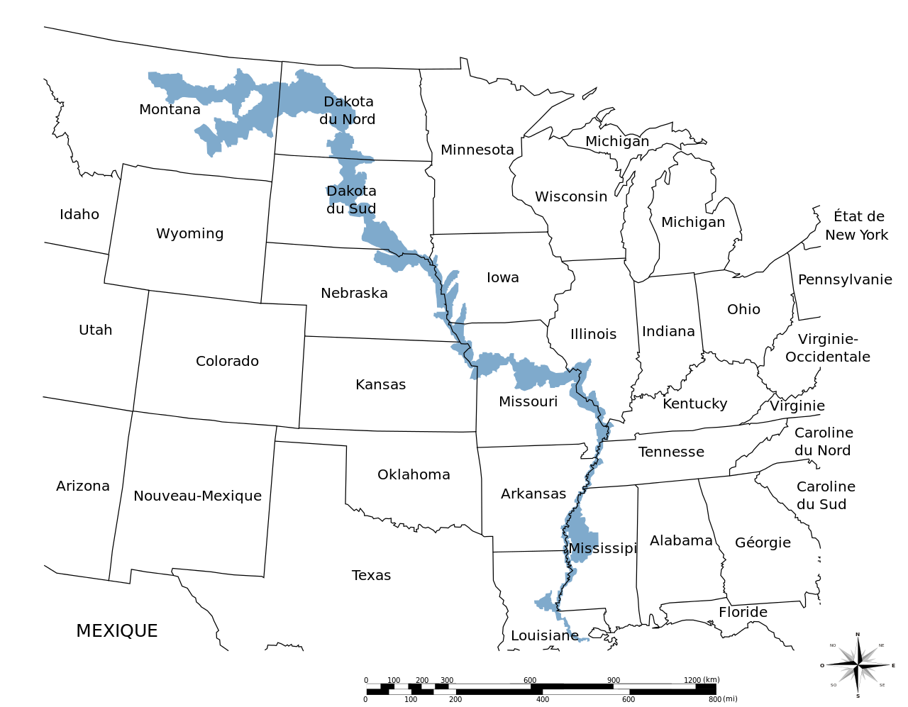
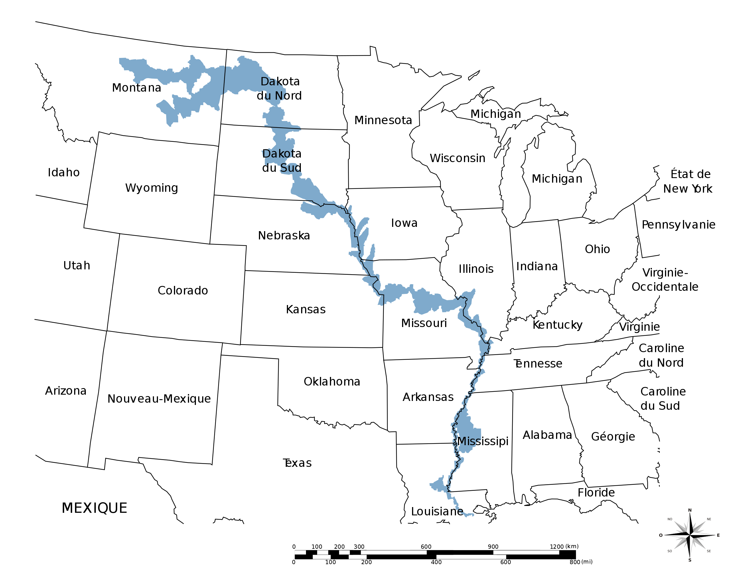
Français : Aire de distribution du Scaphirhynchus albus |
| Date | |
| Source | File:Pallid Sturgeon range map.JPG MONGO |
| Author | Augusta 89 |
| Other versions |
|

Licensing[edit]
I, the copyright holder of this work, hereby publish it under the following license:
This file is licensed under the Creative Commons Attribution-Share Alike 3.0 Unported license.
- You are free:
- to share – to copy, distribute and transmit the work
- to remix – to adapt the work
- Under the following conditions:
- attribution – You must give appropriate credit, provide a link to the license, and indicate if changes were made. You may do so in any reasonable manner, but not in any way that suggests the licensor endorses you or your use.
- share alike – If you remix, transform, or build upon the material, you must distribute your contributions under the same or compatible license as the original.
File history
Click on a date/time to view the file as it appeared at that time.
| Date/Time | Thumbnail | Dimensions | User | Comment | |
|---|---|---|---|---|---|
| current | 11:18, 9 August 2013 | | 1,017 × 792 (120 KB) | Augusta 89 (talk | contribs) | Suppression du titre. |
| 10:33, 8 August 2013 |  | 1,017 × 792 (121 KB) | Augusta 89 (talk | contribs) | Correction dans le nom du titre de la carte. | |
| 09:46, 7 August 2013 |  | 1,017 × 792 (121 KB) | Augusta 89 (talk | contribs) | User created page with UploadWizard |
You cannot overwrite this file.
File usage on Commons
The following page uses this file:
File usage on other wikis
The following other wikis use this file:
- Usage on bg.wikipedia.org
- Usage on de.wikipedia.org
- Usage on fr.wikipedia.org