File:North rhine we muensterland.png
Jump to navigation
Jump to search

Size of this preview: 800 × 563 pixels. Other resolutions: 320 × 225 pixels | 640 × 450 pixels | 901 × 634 pixels.
Original file (901 × 634 pixels, file size: 94 KB, MIME type: image/png)
Captions
Captions
Add a one-line explanation of what this file represents
| Description |
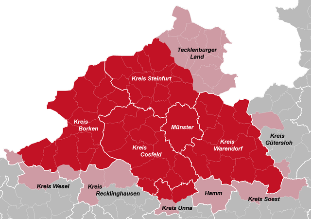
Deutsch: Karte von Nordrhein-Westfalen mit dem Münsterland. |
| Date | 15 September 2005 (original upload date) |
| Source | Transferred from de.wikipedia to Commons by ×× using CommonsHelper. |
| Author | The original uploader was Postm2001 at German Wikipedia. |
Licensing[edit]

|
Permission is granted to copy, distribute and/or modify this document under the terms of the GNU Free Documentation License, Version 1.2 or any later version published by the Free Software Foundation; with no Invariant Sections, no Front-Cover Texts, and no Back-Cover Texts. A copy of the license is included in the section entitled GNU Free Documentation License. |
| This file is licensed under the Creative Commons Attribution-Share Alike 3.0 Unported license. | ||
| ||
| This licensing tag was added to this file as part of the GFDL licensing update. |
Original upload log[edit]
The original description page was here. All following user names refer to de.wikipedia.
- 2005-09-15 17:59 Mimigernaford 265×246× (14369 bytes) Lizenz: dito. Nun aber das richtige Bild;-)
- 2005-09-15 17:53 Mimigernaford 265×246× (14406 bytes) Lizenz: dito. Tecklenburger Land als "Balkon des Münsterlandes" und Teil des Kreises Soest (Lippetal) eingefügt.
- 2005-09-14 19:55 Mimigernaford 265×246× (14406 bytes) bereits eingebundenes Bild bearbeitet - gleiche Lizenz (GNU-FDL)
- 2004-05-11 06:10 Postm2001 265×246× (14491 bytes) Karte von Nordrhein-Westfalen mit dem Münsterland
File history
Click on a date/time to view the file as it appeared at that time.
| Date/Time | Thumbnail | Dimensions | User | Comment | |
|---|---|---|---|---|---|
| current | 20:20, 18 July 2013 | | 901 × 634 (94 KB) | Postm2001 (talk | contribs) | Überarbeitete Version auf Kartenbasis von TUBS. Münsterlandkreise mit Randgebieten |
| 12:25, 11 June 2013 |  | 913 × 630 (134 KB) | Postm2001 (talk | contribs) | Neue Version auf Kartenbasis von TUBS. Münsterlandkreise mit Randgebieten. | |
| 17:03, 29 May 2013 |  | 265 × 246 (14 KB) | Postm2001 (talk | contribs) | Reverted to version as of 19:28, 3 May 2010 | |
| 06:31, 28 May 2013 |  | 2,000 × 2,000 (458 KB) | Postm2001 (talk | contribs) | Neue Karte mit der Lage des Münsterlandes in NRW | |
| 19:28, 3 May 2010 |  | 265 × 246 (14 KB) | NordNordWest (talk | contribs) | corr | |
| 07:34, 9 December 2008 |  | 265 × 246 (14 KB) | File Upload Bot (Magnus Manske) (talk | contribs) | {{BotMoveToCommons|de.wikipedia}} {{Information |Description={{de|Karte von Nordrhein-Westfalen mit dem Münsterland. GNU-FDL}} |Source=Transferred from [http://de.wikipedia.org de.wikipedia]; transferred to Commons by User:×× using [http://t |
You cannot overwrite this file.
File usage on Commons
The following page uses this file:
File usage on other wikis
The following other wikis use this file:
- Usage on ar.wikipedia.org
- Usage on de.wikipedia.org
- Usage on de.wikivoyage.org
- Usage on eo.wikipedia.org
- Usage on he.wikipedia.org
- Usage on it.wikipedia.org
- Usage on no.wikipedia.org
- Usage on ro.wikipedia.org
- Usage on sv.wikipedia.org