File:North America, east coast.jpg
Jump to navigation
Jump to search
Size of this preview: 780 × 600 pixels. Other resolutions: 312 × 240 pixels | 625 × 480 pixels | 999 × 768 pixels | 1,280 × 984 pixels | 2,560 × 1,968 pixels | 7,578 × 5,825 pixels.
Original file (7,578 × 5,825 pixels, file size: 13.73 MB, MIME type: image/jpeg)
Captions
Captions
Add a one-line explanation of what this file represents
Summary[edit]
| Description |
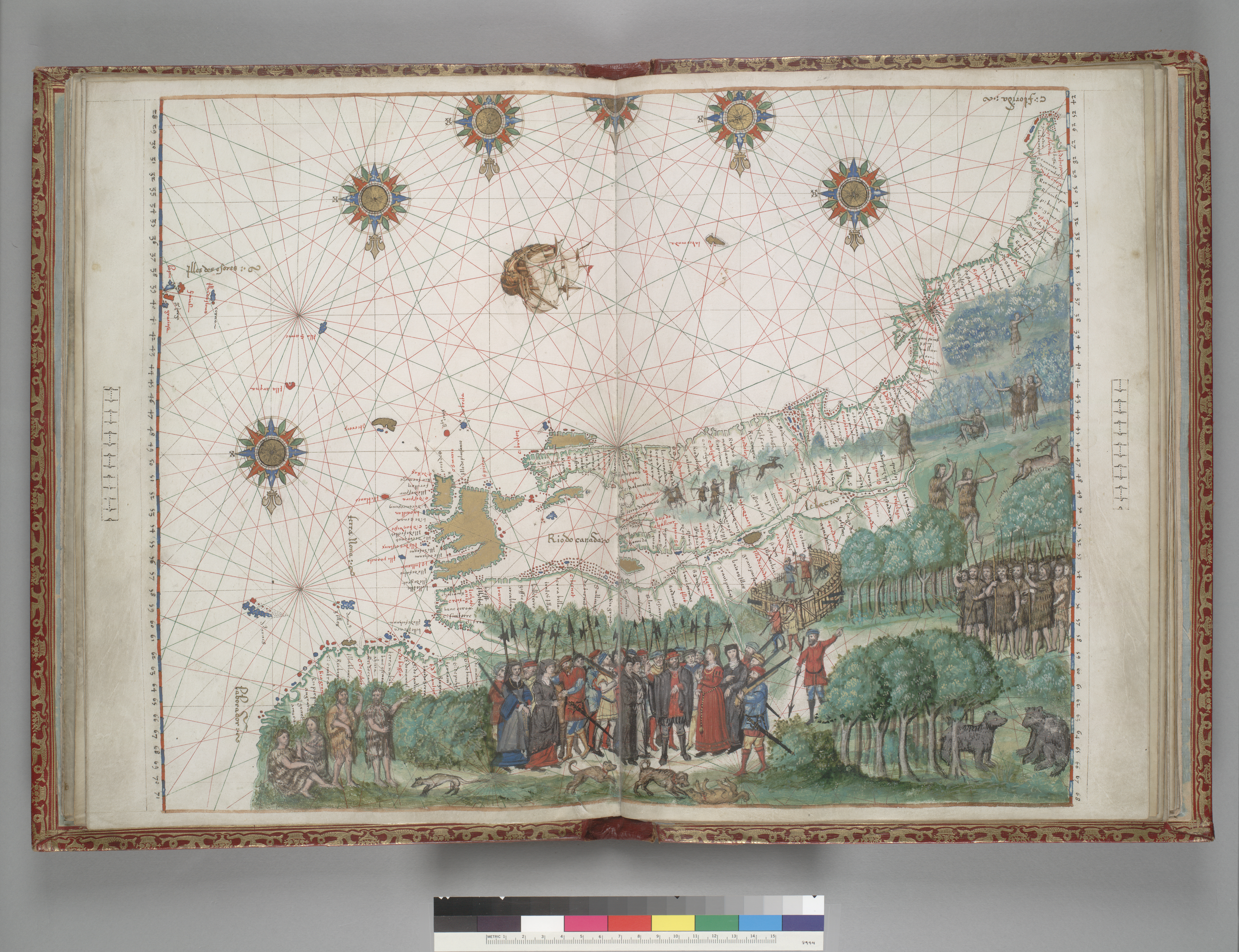
Français : [Carte de la côte est de l’Amérique du Nord], dans un atlas manuscrit attribué à Nicolas Vallard, Dieppe, 1547 (Huntington Library, HM 29, folio 9) « Il existe plusieurs cartes du territoire québécois à l’époque de la Nouvelle-France. L’une des premières à représenter la vallée du Saint-Laurent a été dessinée en 1547. Elle se trouve dans un atlas manuscrit attribué à un certain Nicolas Vallard et conservé à la Huntingdon Library (Californie). » – banq.qc.ca |
| Date | |
| Source | dpg.lib.berkeley.edu |
| Author | attribué à Nicolas Vallard |
Licensing[edit]
|
This work is in the public domain in its country of origin and other countries and areas where the copyright term is the author's life plus 70 years or fewer. This work is in the public domain in the United States because it was published (or registered with the U.S. Copyright Office) before January 1, 1929. | |
| This file has been identified as being free of known restrictions under copyright law, including all related and neighboring rights. | |
File history
Click on a date/time to view the file as it appeared at that time.
| Date/Time | Thumbnail | Dimensions | User | Comment | |
|---|---|---|---|---|---|
| current | 00:05, 20 January 2017 | | 7,578 × 5,825 (13.73 MB) | Jeangagnon (talk | contribs) | User created page with UploadWizard |
You cannot overwrite this file.
File usage on Commons
There are no pages that use this file.