Category:Old maps of New France
Jump to navigation
Jump to search
Subcategories
This category has the following 2 subcategories, out of 2 total.
*
N
- Novi Belgii, Atlas Maior (19 F)
Media in category "Old maps of New France"
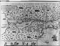
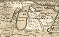
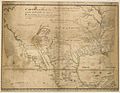
The following 153 files are in this category, out of 153 total.
-
-

-
 Il Desegno del Discoperto della Nova Franza.jpg 2,131 × 1,500; 888 KB
-
 Port de Tadoussac.png 2,000 × 2,004; 5.42 MB
-
 Amerique Septentrionale JBF 1688-detail.jpg 576 × 777; 140 KB
-

-
 Vincenzo Coronelli Partie occidentale du Canada 1688.PNG 1,906 × 1,418; 6.25 MB
-
 Western New France, 1688.jpg 953 × 709; 186 KB
-

-
 Hennepin Nouvelle découverte 1697.jpg 1,518 × 1,324; 623 KB
-
 1698 Louis Hennepin Map of North America - Geographicus - NorthAmerica-hennepin-1698.jpg 4,500 × 3,751; 4.79 MB
-
 Canada, New France, Florida, Virginia, Pennsylvania, Caroline.png 800 × 546; 982 KB
-

-
 1718 Carte de la Louisiane et du Cours du Mississipi by Guillaume Delisle.jpg 8,313 × 6,326; 11.27 MB
-
 Michigan 1718.jpg 1,006 × 625; 374 KB
-
 1718 Carte de la Louisiane - Ouabache detail.jpg 1,984 × 1,488; 399 KB
-
 1721 Map of the new part of French Louisiana.jpg 8,104 × 6,291; 14.19 MB
-
 1730 Canada de l'Isle.jpg 4,617 × 3,975; 1.81 MB
-
 1732 map of Louisiana.jpg 9,482 × 5,386; 11.85 MB
-
 Lac Champlain (Nouvelle-France) 1739.JPG 9,473 × 3,553; 3.28 MB
-

-
 22 of '(Montcalm and Wolfe. (With introductory chapters. 1710-1763.))' (11177470466).jpg 1,302 × 2,112; 402 KB
-
 28 of '(Montcalm and Wolfe. (With introductory chapters. 1710-1763.))' (11166200033).jpg 1,382 × 2,222; 429 KB
-
 1755 Bellin Map of the Great Lakes - Geographicus - GreatLakes-bellin-1755.jpg 4,000 × 3,215; 3.49 MB
-
 Map of Montreal (1758) by Thomas Jefferys.jpg 8,251 × 5,346; 9.94 MB
-
 Plan of the town and fortifications of Montreal or Ville Marie in Canada (4232068026).jpg 2,000 × 1,386; 3.26 MB
-
 Plan of the Town and Fortifications of Montreal or Ville Marie in Canada - 1758.jpg 1,945 × 1,306; 1.09 MB
-
 Plan of the town and fortifications of Montreal or Ville Marie in Canada.jpg 6,528 × 4,336; 15.45 MB
-
-
 A map of Louisiana and of the River Mississipi (4231931192).jpg 2,000 × 1,782; 3.83 MB
-
 A map of the British and French settlements in North America (4071880581).jpg 2,000 × 1,377; 2.87 MB
-

-
 Amcolonies17th-WSC.gif 6,532 × 10,200; 894 KB
-
 AMH-8632-NA Map of Nieuw Nederland featuring an inset showing Nieuw Amsterdam.jpg 2,400 × 2,028; 839 KB
-

-
 Archives nationales d’outre-mer - Louisiane - Jacques-Nicolas Bellin - 1744 - 001.jpg 5,262 × 3,921; 3.73 MB
-
 Atlas Maior - Novi Belgii - four colors.jpg 6,912 × 5,824; 11.21 MB
-
 Attaque française sur les colonie anglaise de Terre-Neuve.jpg 3,359 × 2,544; 1.61 MB
-
 B. port de Tadoussac, 1613.jpg 2,000 × 2,004; 2.95 MB
-
 Belgii Novi, Angliae Novae, et partis Virginiae (NYPL Hades-118550-54677).tif 4,747 × 4,141; 56.25 MB
-
 Belgii novi, angliae novae, et partis Virginiae - novissima delineatio. NYPL433965.tiff 4,975 × 4,262; 60.67 MB
-
 Canada ou Nouvelle France, Nouvelle Angleterre, Terres des Abenaquis.jpg 1,536 × 980; 376 KB
-
 Carte 1650 de la Nouvelle-France par Nicolas Sanson.jpg 4,344 × 2,889; 5.83 MB
-
 Carte de Guillaume Delisle tirée des relations des Hurons de 1639, 1640 et 1641.jpg 2,000 × 1,567; 435 KB
-
 Carte de l Amérique Septentrionale pour servir a l Histoire de la Nouvelle France.png 4,468 × 3,507; 23.92 MB
-
 Carte de la Nouuelle France... (2675698194).jpg 2,000 × 1,265; 2.2 MB
-

-

-
 Carte de la nouvelle France 1702-11 Franquelin Jean Baptiste.jpg 1,261 × 1,054; 599 KB
-
 Carte de la Nouvelle France et de la Louisiane nouvellement découverte.jpg 6,046 × 3,726; 12.27 MB
-

-
 Carte De La Nouvelle France, Nicolas de Fer, coloriée.jpg 1,872 × 1,690; 3.55 MB
-
 Carte de La Nouvelle-France du XVIIe siècle dédiée à Colbert.jpg 3,406 × 1,882; 1.02 MB
-
 Carte de la partie orientale de la Nouvelle France ou du Canada.png 4,436 × 3,213; 8.98 MB
-
 Carte de Nouvelle-France par Champlain (1612).tif 10,142 × 5,786; 56.01 MB
-

-
-
 Carte du cours du fleuve de Saint Laurent depuis Quebec jusqu a la mer - IIe Feuille.png 3,379 × 2,300; 16.06 MB
-
 Carte du cours du fleuve de Saint Laurent depuis Quebec jusqu a la mer - Ire Feuille bas.png 6,775 × 1,895; 28.53 MB
-
 Carte du cours du fleuve de Saint Laurent depuis Quebec jusqu a la mer - Ire Feuille haut.png 6,775 × 2,536; 35.41 MB
-

-
 Carte du Golphe de St-Laurent et Pays Voisins.png 1,375 × 870; 2.51 MB
-
 Carte Huronie en 1660.jpg 578 × 399; 85 KB
-
 Carte Louisiane Benard de la Harpe 1724.jpg 1,022 × 1,386; 498 KB
-
 Carte pour servir a l eclaircissement du papier terrier de la Nouvelle-France.png 2,516 × 1,444; 6.87 MB
-

-
-
 Cette carte montre le chemin que Louis Jolliet a fait depuis Tadoussac.jpg 1,412 × 952; 277 KB
-
 ChickasawWars.jpg 490 × 809; 155 KB
-
 Claude Bernou Carte de lAmerique septentrionale.jpg 3,841 × 3,641; 5.86 MB
-
 Darlinton map of lake huron 1680.png 683 × 540; 1,012 KB
-
 Delisle - Carte du Canada ou de la Nouvelle France.png 1,639 × 1,400; 4.63 MB
-
 Descripsion des costs, pts., rades, illes de la Nouuele France.jpg 2,221 × 1,517; 1.04 MB
-
 Description of the Coasts, Points, Harbours and Islands of New France WDL280.png 9,652 × 6,783; 94.71 MB
-
 Dirk Jansz van Santen - map finish comparison.jpg 640 × 815; 115 KB
-
 Early map of Lake Ontario.jpg 610 × 432; 138 KB
-
-
 Extrema Americae, versus boream, ubi Terra Nova, Nova Francia, adjcentiaque.png 4,520 × 3,609; 22.77 MB
-
 Figure du Port Royal en la Nouvelle France (Lescarbot).jpg 3,865 × 2,377; 8.12 MB
-

-
 Fort Louis de la Louisiane.png 687 × 465; 156 KB
-
 Historiae Canadensis, p. 46.jpg 1,287 × 990; 258 KB
-
 Illinois 1718.jpg 589 × 737; 232 KB
-

-
 Iowa 1718.jpg 1,560 × 1,039; 488 KB
-
 Jansson-Visscher map.jpg 1,728 × 1,456; 2.67 MB
-
 Jesuit map NF.jpg 2,035 × 1,348; 1.11 MB
-
 La baye françoise.png 3,409 × 2,121; 12.18 MB
-
 La Canada ou Nouvelle France, &c (légende).jpg 678 × 482; 267 KB
-
 La France Occidentale Dans l Amérique Septentrionale.jpg 1,591 × 1,469; 1.2 MB
-
 La Nouvelle-France, Nicolas de Fer.jpg 1,551 × 1,400; 1.34 MB
-
 La Nouvelle-France.jpg 676 × 573; 294 KB
-
 La Nuoua Francia (2674844435).jpg 2,000 × 1,469; 2.79 MB
-
 Lac Teiocha-Rontiong, dit communement Lac Érié.jpg 6,072 × 3,838; 4.29 MB
-
 Le Canada ou Nouvelle France.jpg 2,020 × 1,380; 1.29 MB
-
 Lescarbot Anticosti 1609.jpg 1,686 × 1,031; 1.81 MB
-
 Map of Iroquois Five Nations and Mission Sites 1656-1684 by John S. Clark 1879.png 5,711 × 4,926; 13.35 MB
-
 Mapa de la Nueva Francia (Cánada) 1594 - AHG.jpg 3,828 × 2,774; 9.7 MB
-
 Martin Waldseemuller Lorenz Fries 1541 Map of Florida and Mississippi Territories.png 2,592 × 1,944; 5.72 MB
-
 Montigny map with locations.jpg 863 × 1,036; 454 KB
-
 Natchez settlement map.jpg 701 × 651; 63 KB
-
 Nebraska 1718.jpg 634 × 497; 147 KB
-
 New France, 1729.jpg 980 × 752; 353 KB
-
 New France, New Englande, New Scotlande, and New Foundlande (2675734090).jpg 2,000 × 1,696; 2.69 MB
-
 North America, east coast.jpg 7,578 × 5,825; 13.73 MB
-
 Nouvelle France by Nicolas de Fer 1745.jpg 1,679 × 1,500; 645 KB
-
 Novae Franciae accurata delineatio Bressani Francesco (scene).jpg 2,835 × 1,818; 3.91 MB
-

-

-

-

-

-
-
 NoviBelgii.jpg 1,607 × 1,375; 915 KB
-
 Novi Belgii Novaeque Angliae nec non partis Virginiae tabula (NYPL b14946244-434503).jpg 5,259 × 4,736; 5.38 MB
-
 Novi Belgii Novaeque Angliae nec non partis Virginiae tabula (NYPL b14946244-434503).tiff 5,259 × 4,744; 71.39 MB
-

-
 Ohio archæological and historical quarterly (1887) (14578061279).jpg 1,972 × 1,428; 345 KB
-
 Old Mobile Map 1702.jpg 664 × 514; 59 KB
-
 Ontario Sessional Papers, 1897-98, No.1-3 (1905) (14589636968).jpg 3,024 × 1,694; 624 KB
-
 Pais des Illinois.jpg 780 × 570; 363 KB
-

-

-

-

-

-

-
 PaysEnHaut.jpg 2,609 × 2,252; 3.01 MB
-
 Plan de la baie de Pensacola (1744).png 663 × 497; 719 KB
-

-

-
 Plan du Fort Duquesne et de ses environs, Léry, 15 avril 1755.jpg 5,981 × 3,184; 3.83 MB
-

-
 Pointe-Saint-Mathieu.png 670 × 548; 697 KB
-
 PortRoyal par Champlain.tif 2,973 × 2,421; 20.8 MB
-
 Péninsule de Port-au-Port.png 680 × 600; 232 KB
-
 Rade de l Isle Percee.jpg 1,215 × 674; 341 KB
-
 Rade de l'Isle Percée.JPEG 1,420 × 874; 403 KB
-
 Rivière de Cataracoui ou des Iroquois.jpg 643 × 435; 99 KB
-

-
 Samuel de Champlain Carte geographique de la Nouvelle France.jpg 10,173 × 5,834; 16.05 MB
-
 Sanson, Nicolas, 1600-1667. Le Canada, ou Nouvelle France, etc (1656).jpg 4,320 × 3,354; 6.25 MB
-
 SegmentcarteHennepin.jpg 870 × 794; 243 KB
-
 Sept Isles 1760 1686.PNG 1,370 × 876; 2.35 MB
-
 The BL King’s Topographical Collection - NOVA FRANCIA et REGIONES ADIACENTES.jpg 4,000 × 3,064; 1.96 MB
-

-
 Tiré de la relation des Hurons de 1647 et 48, par Guillaume Delisle.jpg 2,000 × 1,585; 495 KB
-
 TroisRivieres1759.png 413 × 471; 427 KB
-
 Upper Canada and the Iroquois Confederacy.jpg 1,050 × 1,531; 303 KB
-
 Veue de Quebec a l est.jpg 1,455 × 1,459; 996 KB
-
 Vincenzo Coronelli Partie occidentale du Canada 1688.jpg 2,104 × 1,600; 3.59 MB
-
 WalkerExpeditionMarker.jpg 1,960 × 1,040; 598 KB
-
 Wisconsin in 1718.jpg 640 × 480; 184 KB

.jpg)


_-_Geographicus_-_NieuwVrankryk-hennepin-1688.jpg)


_-_Geographicus_-_LaLouisiana-coronelli-1695.jpg)


_-_Geographicus_-_AmeriqueSeptentrionale-covensmortier-1708.jpg)


)%27_(11177470466).jpg)
)%27_(11166200033).jpg)

_by_Thomas_Jefferys.jpg)
.jpg)


Hennepin_Louis_btv1b8619666f_19.jpg)
.jpg)
.jpg)
.jpg)


.jpg)


.jpg)


.jpg)
.jpg)


_(14760365214).jpg)
_(14576023458).jpg)


.jpg)

.jpg)


_(14771799954).jpg)


.jpg)


.jpg)


_1594_-_AHG.jpg)


.jpg)


.jpg)


.jpg)
_(14578061279).jpg)

_(14589636968).jpg)


.jpg)


.jpg)

.png)


.jpg)


.jpg)

.jpg)


_1739.JPG)