File:New Jersey Level IV ecoregions.pdf
Jump to navigation
Jump to search

Size of this JPG preview of this PDF file: 369 × 600 pixels. Other resolutions: 147 × 240 pixels | 295 × 480 pixels | 472 × 768 pixels | 630 × 1,024 pixels | 2,400 × 3,900 pixels.
Original file (2,400 × 3,900 pixels, file size: 664 KB, MIME type: application/pdf)
Captions
Captions
Add a one-line explanation of what this file represents
Summary[edit]
| Description |
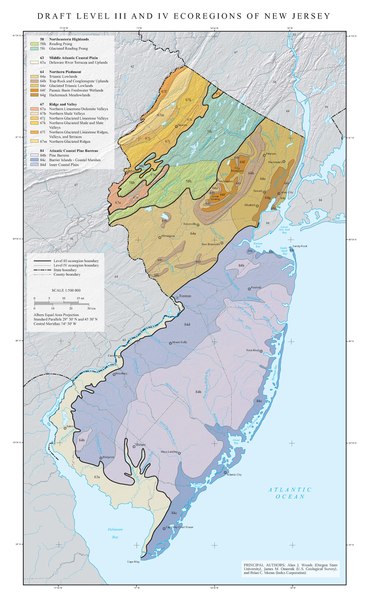
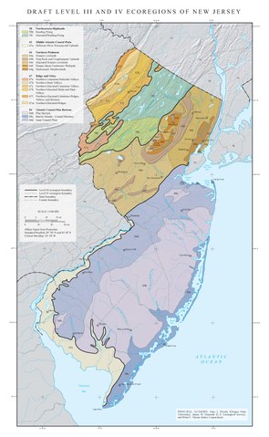
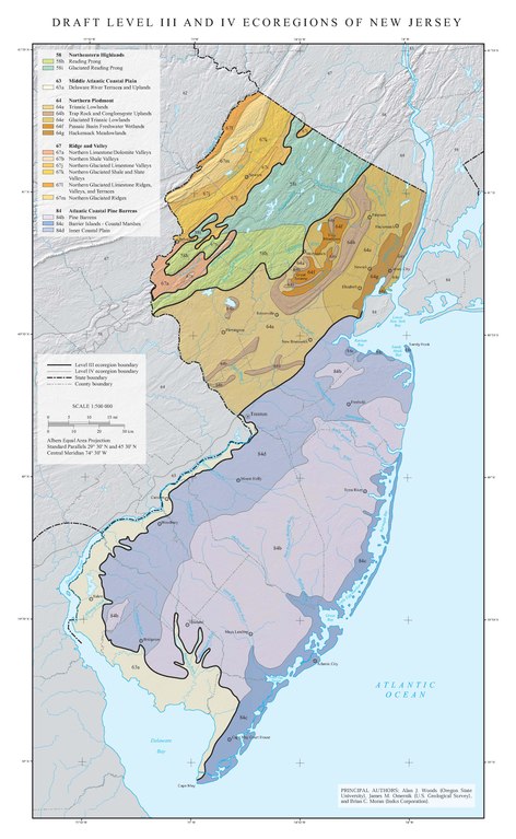
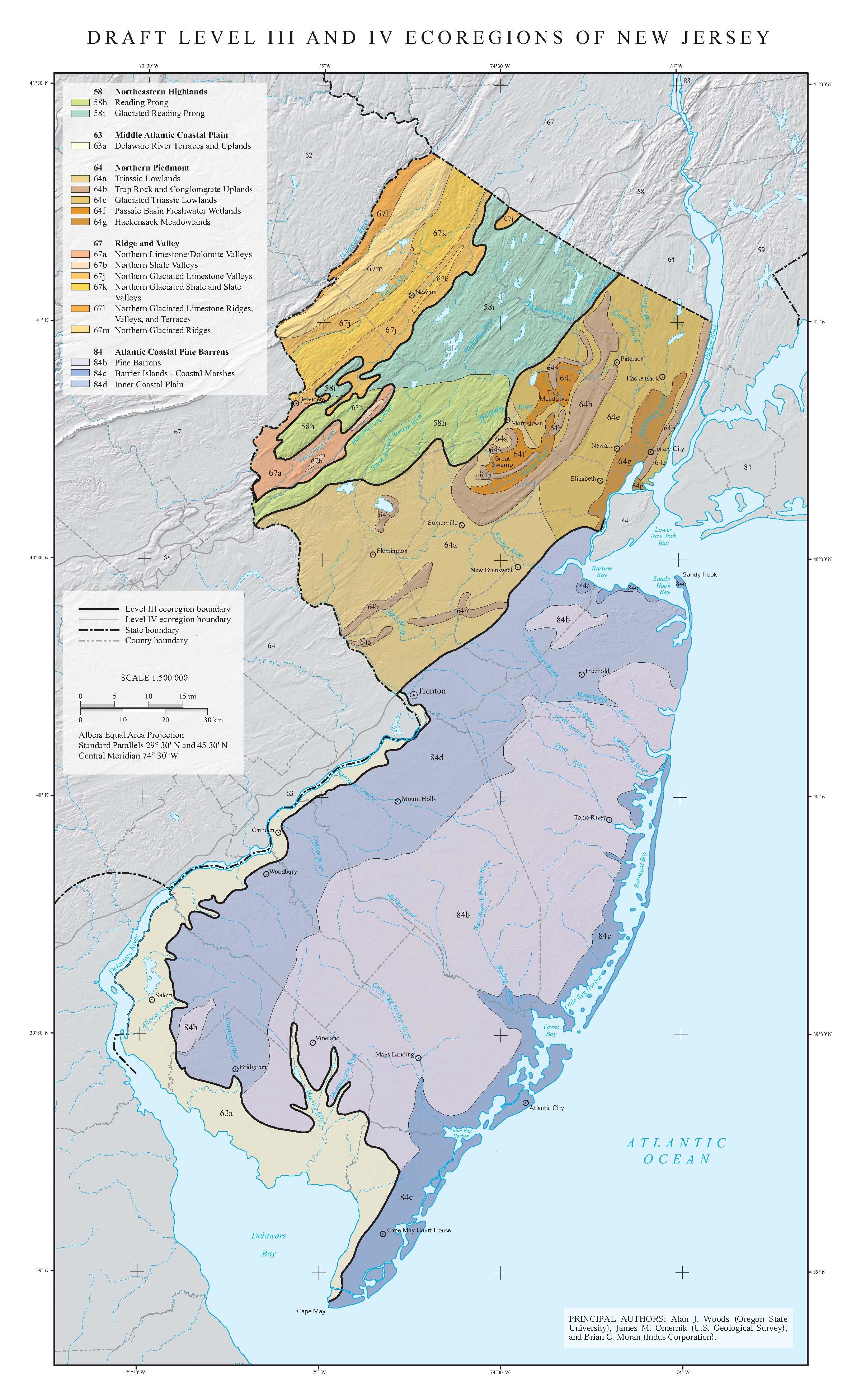
English: Map of Level III and Level IV ecoregions in New Jersey, as defined by the U.S. Environmental Protection Agency
|
|||||
| Source | ftp://newftp.epa.gov/EPADataCommons/ORD/Ecoregions/nj/nj_map.pdf via https://www.epa.gov/eco-research/ecoregion-download-files-state-region-2 | |||||
| Author | Alan J. Woods, James M. Omernik, and Brian C. Moran |
File history
Click on a date/time to view the file as it appeared at that time.
| Date/Time | Thumbnail | Dimensions | User | Comment | |
|---|---|---|---|---|---|
| current | 19:55, 19 April 2020 |  | 2,400 × 3,900 (664 KB) | TimK MSI (talk | contribs) | {{Information |description ={{en|1=Map of Level III and Level IV ecoregions in New Jersey, as defined by the U.S. Environmental Protection Agency {{PD-USGov-EPA}}}} |date = |source =ftp://newftp.epa.gov/EPADataCommons/ORD/Ecoregions/nj/nj_map.pdf via https://www.epa.gov/eco-research/ecoregion-download-files-state-region-2 |author =Alan J. Woods, James M. Omernik, and Brian C. Moran }} Category:Maps of EPA ecoregions Category:Maps of New Jersey |
You cannot overwrite this file.
File usage on Commons
There are no pages that use this file.