File:New-england-colonies-in-1677.jpg
Jump to navigation
Jump to search
Size of this preview: 553 × 600 pixels. Other resolutions: 221 × 240 pixels | 443 × 480 pixels | 708 × 768 pixels | 945 × 1,024 pixels | 1,522 × 1,650 pixels.
Original file (1,522 × 1,650 pixels, file size: 591 KB, MIME type: image/jpeg)
Captions
Captions
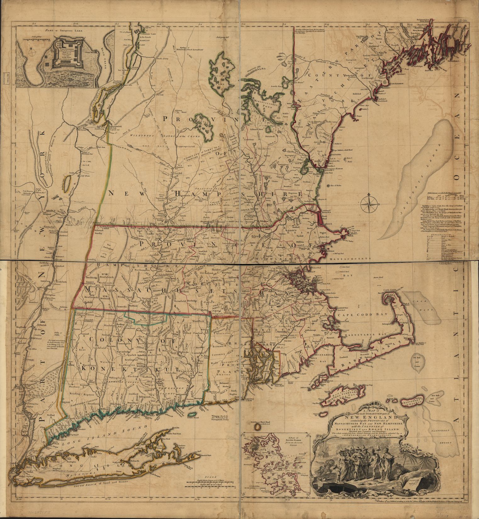
The New England colonies where Protestantism flourished.
Summary[edit]
| Description |
English: A map of the most inhabited part of New England : containing the provinces of Massachusets Bay and New Hampshire, with the colonies of KoneKtikut and Rhode Island, divided into counties and townships : the whole composed from actual surveys and its situation adjusted by astronomical observations. |
| Date | |
| Source | https://www.loc.gov/item/74692155/ |
| Author |
Jefferys, Thomas, -1771, cartographer. [London] : Thos. Jefferys, November 29, 1755. |
Licensing[edit]
|
This work is in the public domain in its country of origin and other countries and areas where the copyright term is the author's life plus 70 years or fewer. This work is in the public domain in the United States because it was published (or registered with the U.S. Copyright Office) before January 1, 1929. | |
| This file has been identified as being free of known restrictions under copyright law, including all related and neighboring rights. | |
File history
Click on a date/time to view the file as it appeared at that time.
| Date/Time | Thumbnail | Dimensions | User | Comment | |
|---|---|---|---|---|---|
| current | 11:55, 16 October 2022 | | 1,522 × 1,650 (591 KB) | Cyberquell (talk | contribs) | Uploaded a work by Jefferys, Thomas, -1771, cartographer. [London] : Thos. Jefferys, November 29, 1755. from https://www.loc.gov/item/74692155/ with UploadWizard |
You cannot overwrite this file.
File usage on Commons
There are no pages that use this file.
File usage on other wikis
The following other wikis use this file:
- Usage on en.wikipedia.org