File:NPS yellowstone-topo-map-north.jpg
Jump to navigation
Jump to search
Size of this preview: 800 × 506 pixels. Other resolutions: 320 × 202 pixels | 640 × 405 pixels | 1,024 × 648 pixels | 1,280 × 810 pixels | 2,560 × 1,620 pixels | 5,685 × 3,597 pixels.
Original file (5,685 × 3,597 pixels, file size: 5.96 MB, MIME type: image/jpeg)
Captions
Captions
Add a one-line explanation of what this file represents
Summary[edit]
| Description |
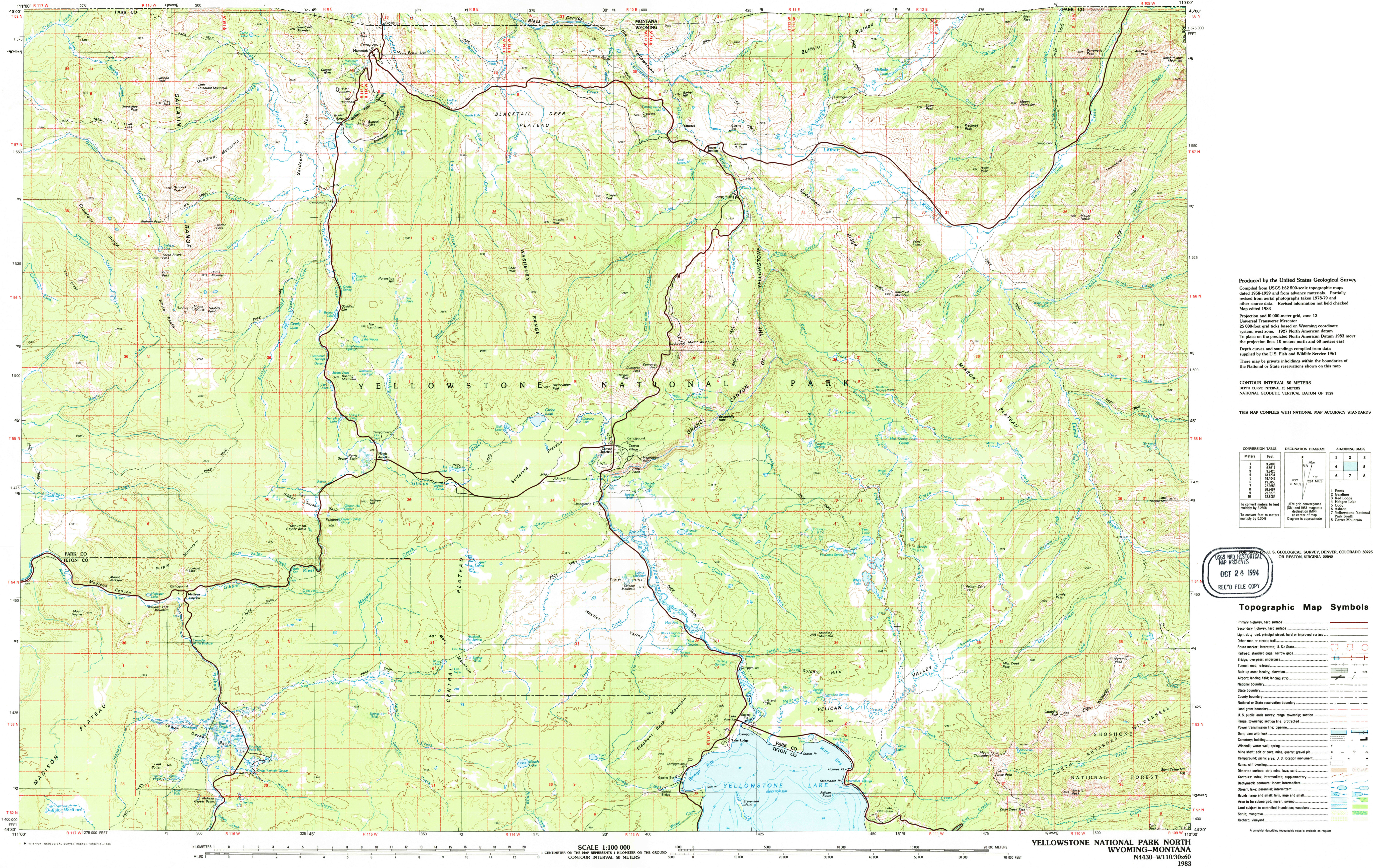
English: The north Yellowstone topo map focuses on the northern half of the park, extending from Mammoth Hot Springs south past Canyon Village toward Yellowstone Lake, including most popular visitor areas. |
| Date | |
| Source | U.S. National Park Service (http://npmaps.com/wp-content/uploads/yellowstone-topo-map-north.jpg) |
| Author | U.S. National Park Service, restoration/cleanup by Matt Holly |
Licensing[edit]
| This image or media file contains material based on a work of a National Park Service employee, created as part of that person's official duties. As a work of the U.S. federal government, such work is in the public domain in the United States. See the NPS website and NPS copyright policy for more information. |
File history
Click on a date/time to view the file as it appeared at that time.
| Date/Time | Thumbnail | Dimensions | User | Comment | |
|---|---|---|---|---|---|
| current | 10:12, 17 May 2017 | | 5,685 × 3,597 (5.96 MB) | RKBot (talk | contribs) | =={{int:filedesc}}== {{Information |description= {{en|1=The north Yellowstone topo map focuses on the northern half of the park, extending from Mammoth Hot Springs south past Canyon Village toward Yellowstone Lake, including most popular visitor areas.... |
You cannot overwrite this file.
File usage on Commons
The following page uses this file: