File:NPS wrangell-st-elias-alaska-campgrounds-map.pdf
Jump to navigation
Jump to search

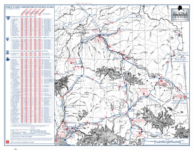
Size of this JPG preview of this PDF file: 776 × 600 pixels. Other resolutions: 311 × 240 pixels | 621 × 480 pixels | 994 × 768 pixels | 1,280 × 989 pixels | 2,560 × 1,978 pixels | 3,300 × 2,550 pixels.
Original file (3,300 × 2,550 pixels, file size: 2.02 MB, MIME type: application/pdf)
Captions
Captions
Add a one-line explanation of what this file represents
Summary[edit]
| Description |
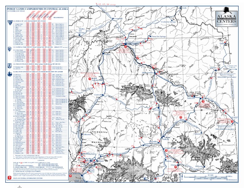
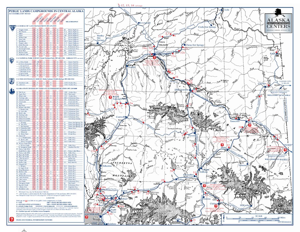
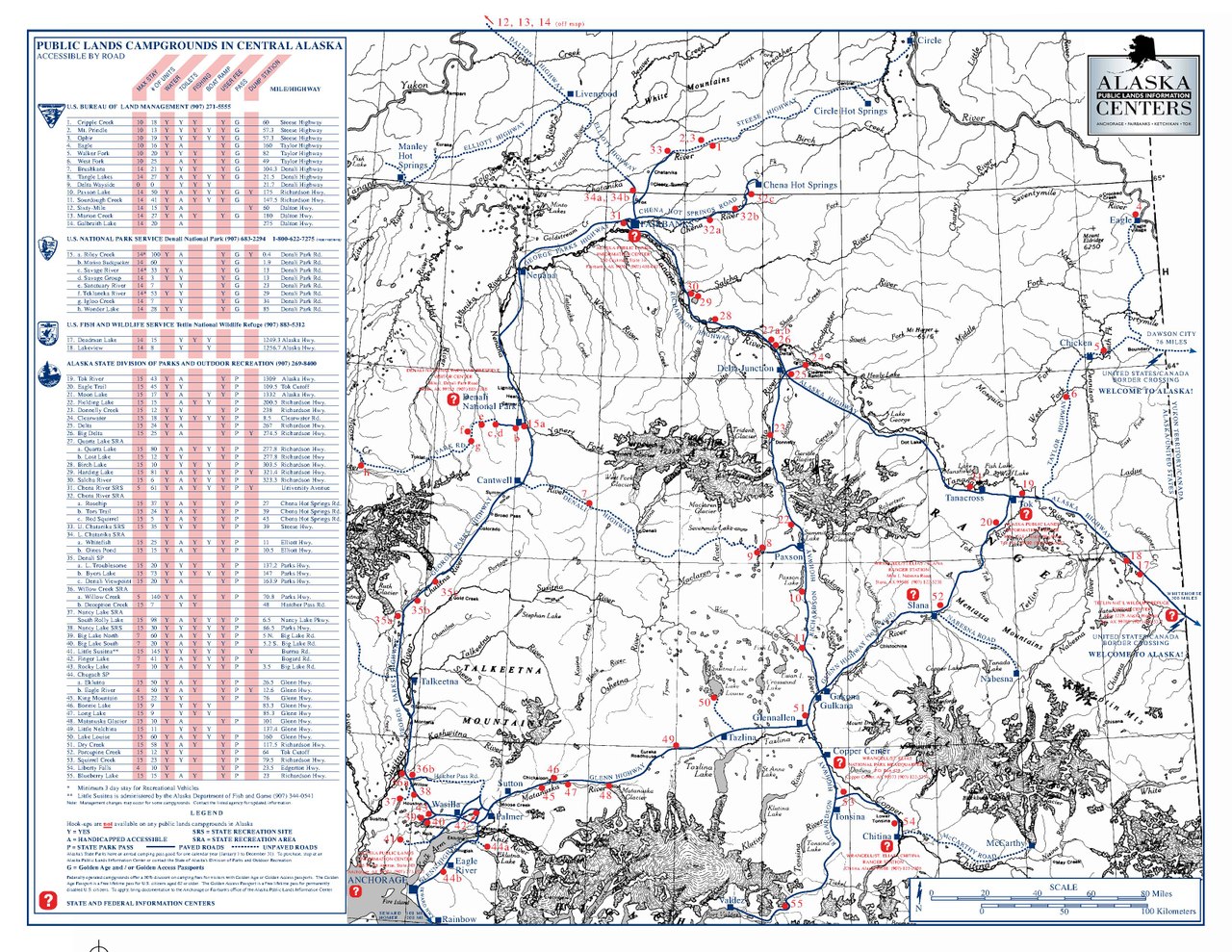
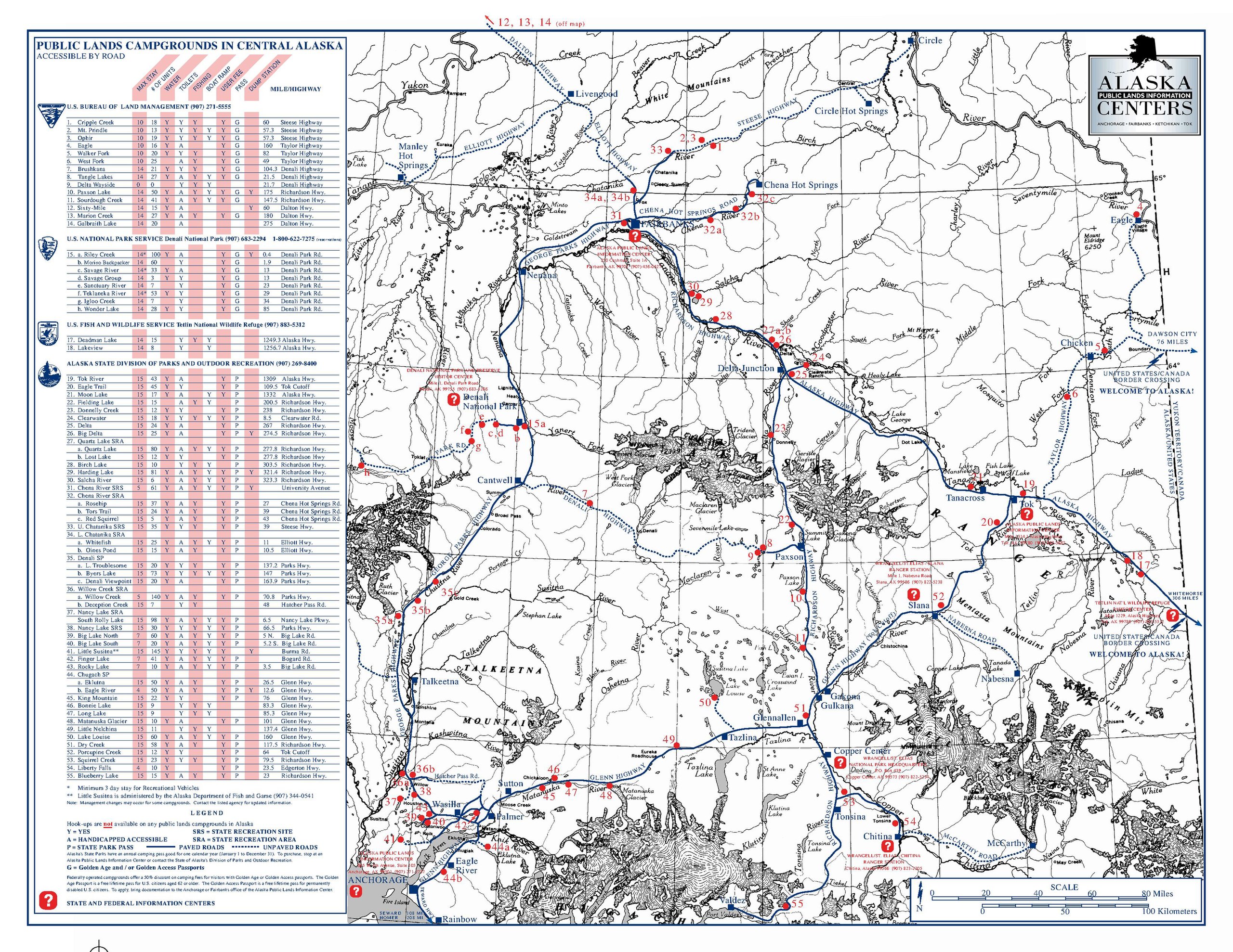
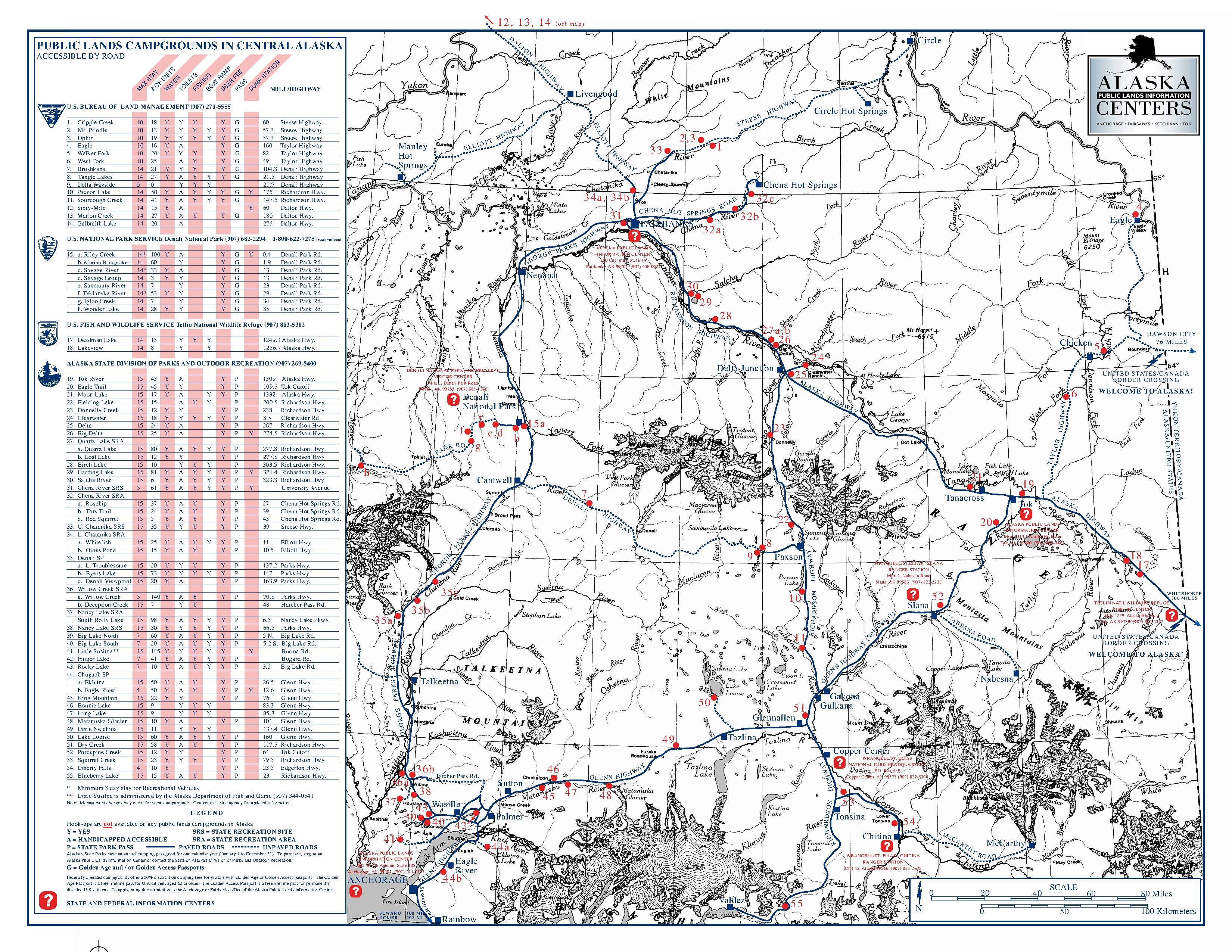
English: This Wrangell-St Elias campground map shows all the campgrounds in the entire central Alaska region, including Anchorage and Fairbanks. |
| Date | |
| Source | U.S. National Park Service (http://npmaps.com/wp-content/uploads/wrangell-st-elias-alaska-campgrounds-map.pdf) |
| Author | U.S. National Park Service, restoration/cleanup by Matt Holly |
| Other versions |
 |
Licensing[edit]
| This image or media file contains material based on a work of a National Park Service employee, created as part of that person's official duties. As a work of the U.S. federal government, such work is in the public domain in the United States. See the NPS website and NPS copyright policy for more information. |
File history
Click on a date/time to view the file as it appeared at that time.
| Date/Time | Thumbnail | Dimensions | User | Comment | |
|---|---|---|---|---|---|
| current | 10:02, 17 May 2017 |  | 3,300 × 2,550 (2.02 MB) | RKBot (talk | contribs) | =={{int:filedesc}}== {{Information |description= {{en|1=This Wrangell-St Elias campground map shows all the campgrounds in the entire central Alaska region, including Anchorage and Fairbanks.}} |date= 2016-04-10 |source= U.S. National Park Service (htt... |
You cannot overwrite this file.
File usage on Commons
The following 4 pages use this file: