File:Mount Rainier National Park map.pdf
Jump to navigation
Jump to search

Size of this JPG preview of this PDF file: 772 × 599 pixels. Other resolutions: 309 × 240 pixels | 618 × 480 pixels | 989 × 768 pixels | 1,280 × 994 pixels | 2,560 × 1,988 pixels | 3,260 × 2,531 pixels.
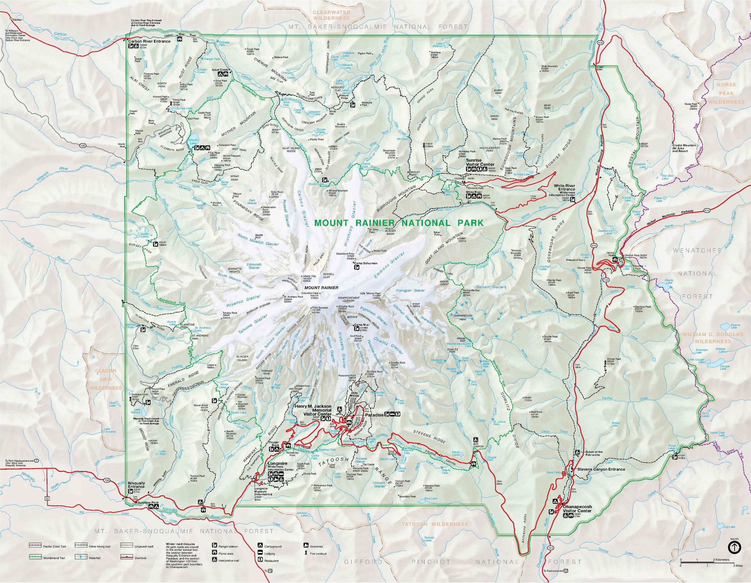
Original file (3,260 × 2,531 pixels, file size: 739 KB, MIME type: application/pdf)
Captions
Captions
Add a one-line explanation of what this file represents
| Description |
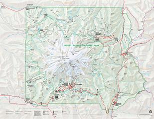
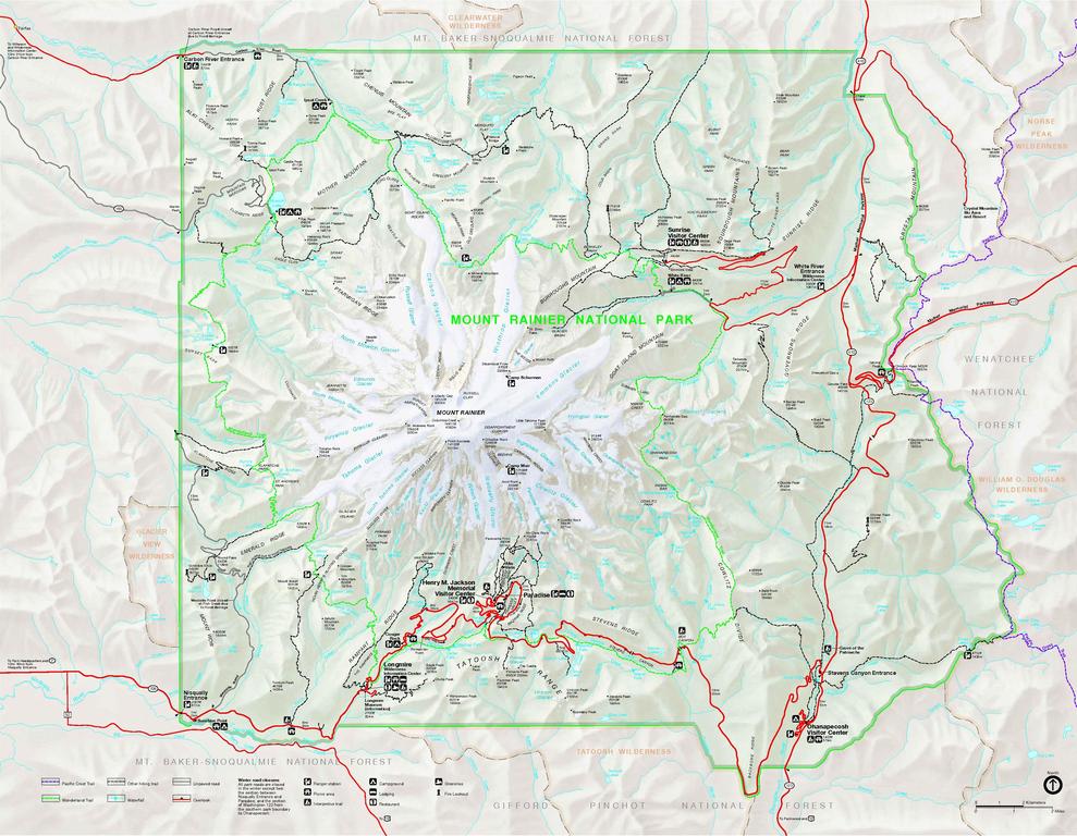
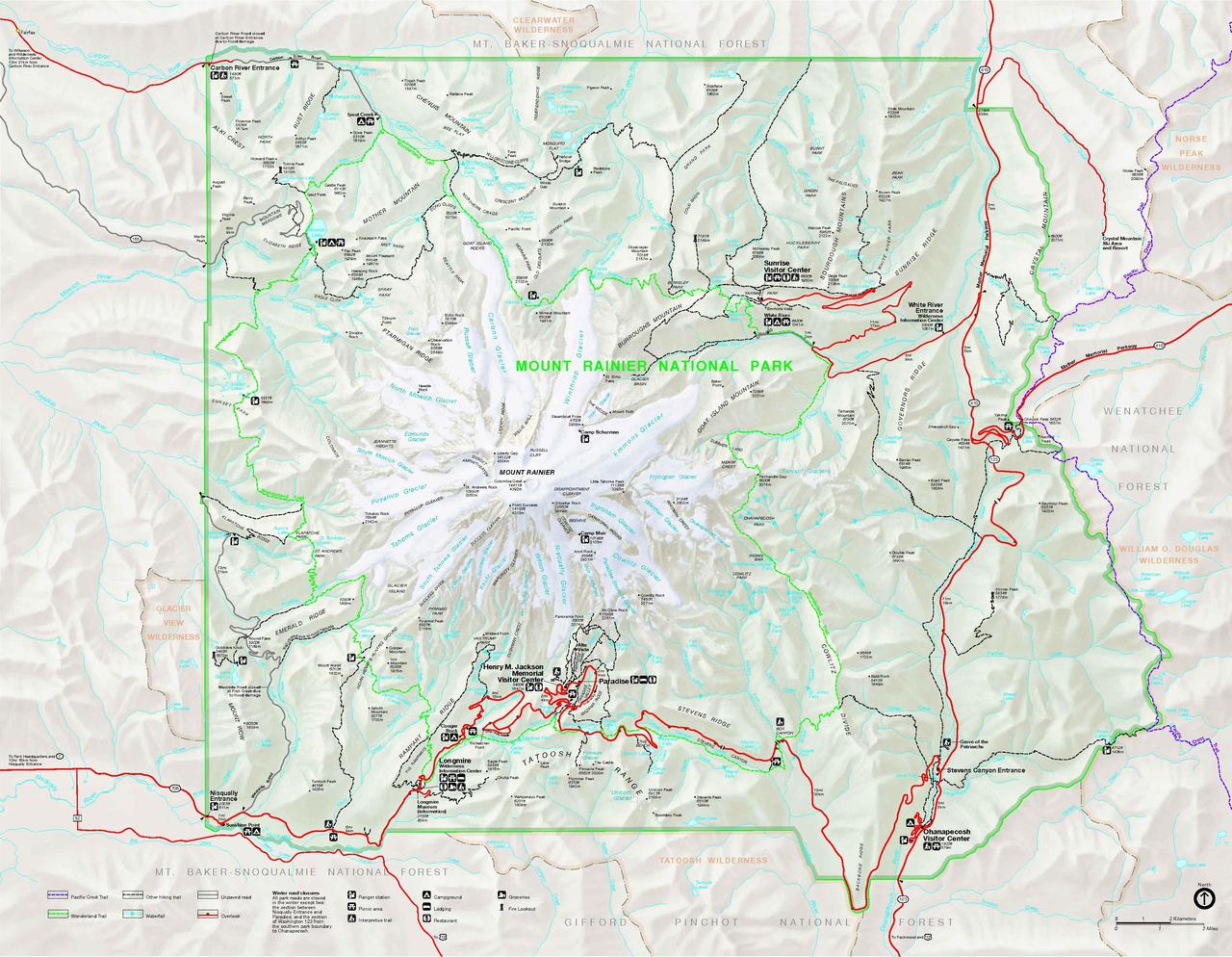
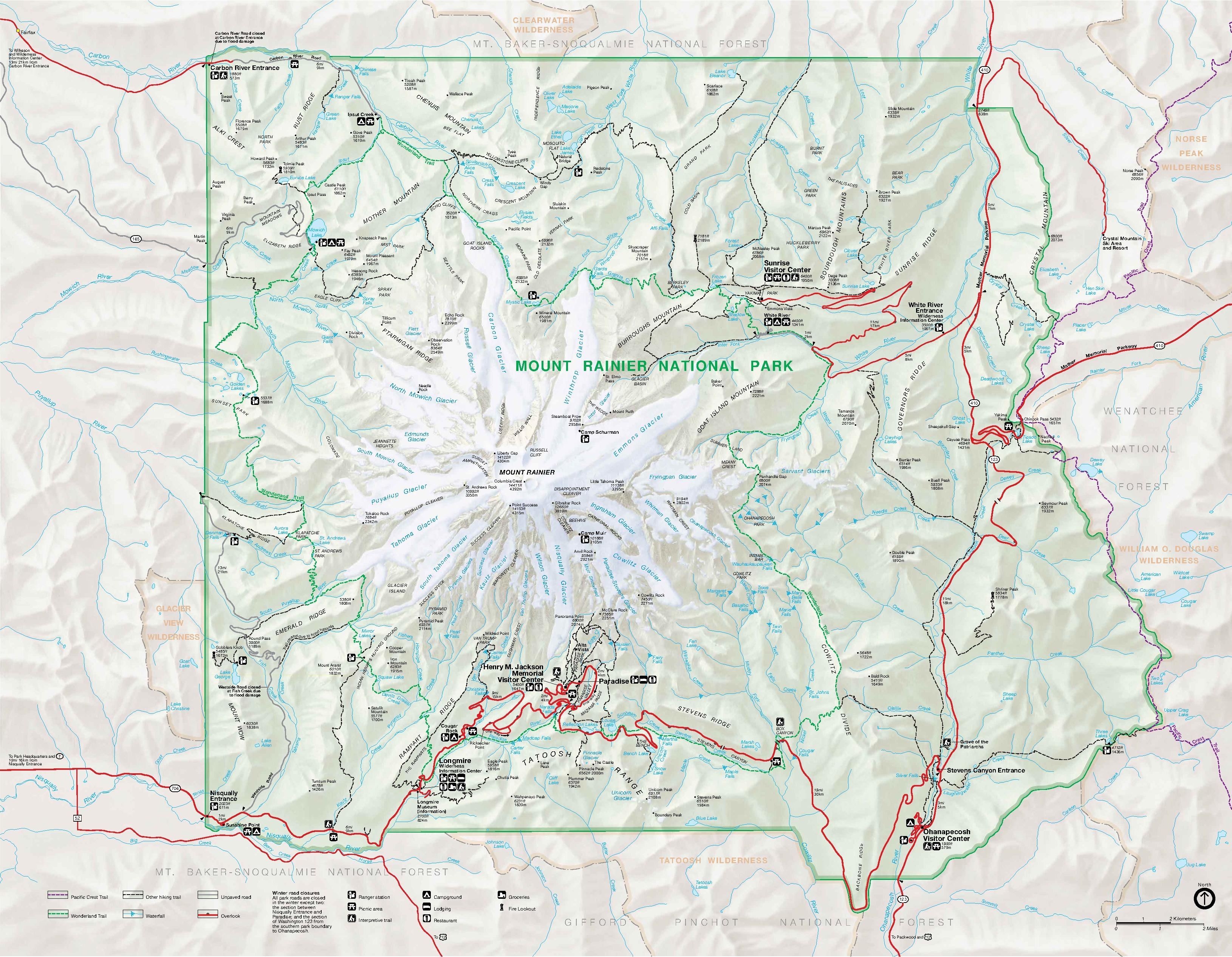
English: Map of Mount Rainier National Park. The PDF itself has overlays that are not visible in the preview/thumbnail. |
|||
| Date | Undated, accessed and uploaded . | |||
| Source | http://www.nps.gov/mora/planyourvisit/upload/mount%20rainier%20park%20map.pdf, linked from Mount Rainier National Park - Mount Rainier Maps, www.nps.gov. | |||
| Author | Apparently a U.S. National Park Service employee; not otherwise credited | |||
| Permission (Reusing this file) |
|
|||
| Other versions |
|

File history
Click on a date/time to view the file as it appeared at that time.
| Date/Time | Thumbnail | Dimensions | User | Comment | |
|---|---|---|---|---|---|
| current | 18:25, 7 January 2012 |  | 3,260 × 2,531 (739 KB) | Jmabel (talk | contribs) | {{Information |Description={{en|Map of Mount Rainier National Park}} |Source=http://www.nps.gov/mora/planyourvisit/upload/mount%20rainier%20park%20map.pdf, linked from [http://www.nps.gov/mora/planyourvisit/mount-rainier-maps.htm Mount Rainier National Pa |
You cannot overwrite this file.
File usage on Commons
The following page uses this file: