File:Map of Romania by Daniel Philippidis.png
Jump to navigation
Jump to search

Size of this preview: 758 × 599 pixels. Other resolutions: 304 × 240 pixels | 607 × 480 pixels | 971 × 768 pixels | 1,162 × 919 pixels.
Original file (1,162 × 919 pixels, file size: 2.28 MB, MIME type: image/png)
Captions
Captions
Add a one-line explanation of what this file represents
Summary[edit]
| Description |
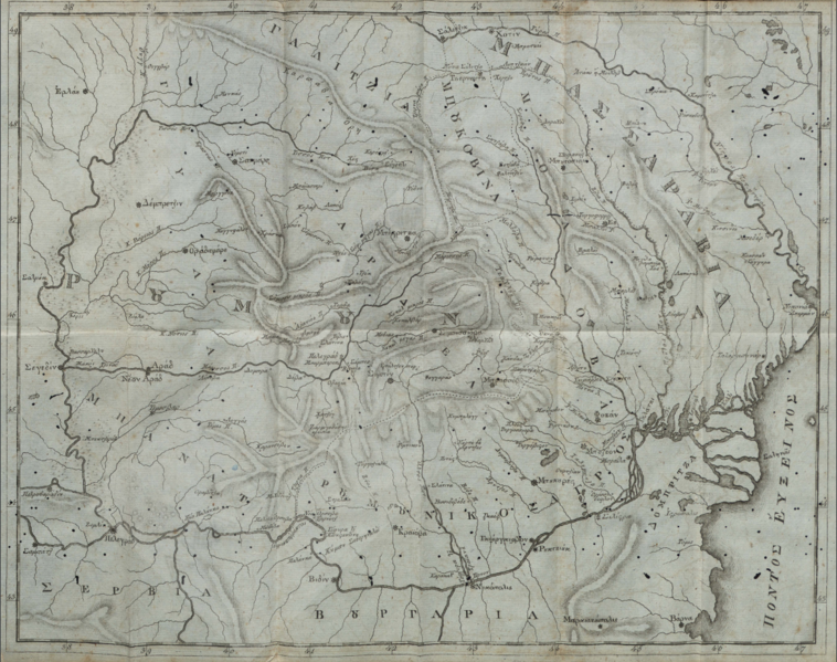
English: Map of Romania in Daniel Philippidis' work Ιστορία της Ρουµουνίας ("History of Romania"). According to him, Romania was the country between the Tisza, the Dniester and the Danube. |
| Date | |
| Source | Ιστορία της Ρουµουνίας ("History of Romania") |
| Author | Daniel Philippidis |
Licensing[edit]
|
This work is in the public domain in its country of origin and other countries and areas where the copyright term is the author's life plus 100 years or fewer. This work is in the public domain in the United States because it was published (or registered with the U.S. Copyright Office) before January 1, 1929. | |
| This file has been identified as being free of known restrictions under copyright law, including all related and neighboring rights. | |
File history
Click on a date/time to view the file as it appeared at that time.
| Date/Time | Thumbnail | Dimensions | User | Comment | |
|---|---|---|---|---|---|
| current | 17:07, 30 July 2020 | | 1,162 × 919 (2.28 MB) | Super Dromaeosaurus (talk | contribs) | Bigger |
| 17:07, 30 July 2020 |  | 867 × 690 (1.29 MB) | Super Dromaeosaurus (talk | contribs) | Uploaded a work by Daniel Philippidis from [http://editions.academyofathens.gr/epetirides/xmlui/handle/20.500.11855/591 Ιστορία της Ρουµουνίας] ("History of Romania") with UploadWizard |
You cannot overwrite this file.
File usage on Commons
The following page uses this file: