Category:Greek-language maps showing history
Jump to navigation
Jump to search
Subcategories
This category has the following 2 subcategories, out of 2 total.
Media in category "Greek-language maps showing history"
The following 26 files are in this category, out of 26 total.
-
 1914 albania cor el.JPG 546 × 1,024; 67 KB
-
 Ancient thessalia.PNG 482 × 351; 129 KB
-
 Battle of Gaza.png 1,264 × 1,096; 91 KB
-
 Battle of Greece - 15 April 1941 el.png 565 × 599; 311 KB
-
 Byzantium1081.png 550 × 375; 33 KB
-
 Carte Sicile el 380 BC.png 780 × 587; 38 KB
-
 Despotate of Morea 1450-el.svg 1,303 × 1,214; 186 KB
-
 Europe 1914 el.jpg 800 × 576; 71 KB
-
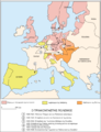
 Europe under Nazi domination-el.png 1,088 × 998; 182 KB
-
 Frankish Empire 481 to 814-el.png 792 × 600; 150 KB
-
 G - btv1b532005945.jpg 8,566 × 12,084; 19.52 MB
-
 G. 1 - 1 000 000 @ - btv1b532005962.jpg 8,865 × 12,384; 18.18 MB
-
 Golden Horde 1389 el.PNG 800 × 569; 107 KB
-
 Greekhistory el.gif 868 × 624; 118 KB
-
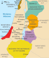 Kingdoms around Israel 830 map-el.svg 720 × 859; 509 KB
-
 Kingdoms of Israel and Judah map 830-el.svg 720 × 859; 510 KB
-
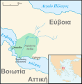 Lelantine War-el.svg 711 × 723; 345 KB
-
 Map administrative divisions of the First French Empire 1812-el.svg 2,189 × 1,843; 5.39 MB
-
 Map of Asia by Daniel Philippidis.png 1,360 × 923; 2.73 MB
-
 Map of Romania by Daniel Philippidis.png 1,162 × 919; 2.28 MB
-
 Map Thirty Years War-el.png 500 × 651; 123 KB
-
 Persian retreat during the Battle of Salamis-el.svg 800 × 484; 5.83 MB
-
 Reame di Siagrio (486)-el.png 642 × 599; 61 KB
-
 ΑποικιακήΑφρική.png 276 × 323; 10 KB
-
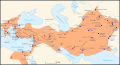
 Εκστρατείες του Μεγάλου Αλεξάνδρου.svg 1,243 × 673; 399 KB
-
 Πόλεις που ιδρύθηκαν από τον Μέγα Αλέξανδρο.svg 1,243 × 673; 183 KB


-el.png)


