File:Map-of-Ottoman-Empire-in-1900-Spanish.svg
Jump to navigation
Jump to search

Size of this PNG preview of this SVG file: 800 × 502 pixels. Other resolutions: 320 × 201 pixels | 640 × 401 pixels | 1,024 × 642 pixels | 1,280 × 803 pixels | 2,560 × 1,605 pixels | 2,647 × 1,660 pixels.
Original file (SVG file, nominally 2,647 × 1,660 pixels, file size: 124 KB)
Captions
Captions
Add a one-line explanation of what this file represents
| Description |
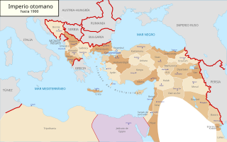
Deutsch: Karte des Osmanischen Reiches um 1900 in Spanisch. Español: Mapa del Imperio otomano (1900) en español. English: Map of Ottoman Empire (1900) in Spanish. |
| Date | B1mbo (talk) |
| Source | |
| Author |
|
| Permission (Reusing this file) |
I, the copyright holder of this work, hereby publish it under the following license: This file is licensed under the Creative Commons Attribution-ShareAlike 3.0 Chile license.
 |
| Other versions |
Derivative works of this file: Map-of-Ottoman-Empire-in-1900-sr.svg
Map-of-Ottoman-Empire-in-1900-Spanish.svg[]
|


Original upload log[edit]
This image is a derivative work of the following images:
- File:Map-of-Ottoman-Empire-in-1900-Latvian.svg licensed with PD-self
- 2008-01-30T21:53:09Z Juristiltins 885x557 (105823 Bytes) {{Information |Description=Map of Ottoman Empire (1900) in Latvian |Source=own work |Date=30 January 2008 |Author=Juris Tiltins |Permission=Free use and distribution permitted. |other_versions= }} [[Category:Maps of the Ottom
Uploaded with derivativeFX
File history
Click on a date/time to view the file as it appeared at that time.
| Date/Time | Thumbnail | Dimensions | User | Comment | |
|---|---|---|---|---|---|
| current | 16:56, 18 May 2018 | | 2,647 × 1,660 (124 KB) | NordNordWest (talk | contribs) | + Sicilia, Sardegna, Corse, Malta |
| 09:43, 25 May 2016 |  | 2,647 × 1,660 (143 KB) | Rowanwindwhistler (talk | contribs) | Coast added, borders in provinces. Imperio otomano | |
| 00:21, 22 August 2011 |  | 2,647 × 1,660 (106 KB) | B1mbo (talk | contribs) | m | |
| 00:20, 22 August 2011 |  | 2,647 × 1,660 (89 KB) | B1mbo (talk | contribs) | {{Information |Description={{de|Karte des Osmanischen Reiches um 1900 in Spanisch.}}{{es|Mapa del Imperio otomano (1900) en español.}}{{en|Map of Ottoman Empire (1900) in Spanish.}} |Source=*[[:File:Map-of-Ottoman-Empire-in-1900-Latvian.svg|Map-of-Ottoma |
You cannot overwrite this file.
File usage on Commons
The following 9 pages use this file:
- User:J budissin/Uploads/BiH/2016 May 21-31
- User:J budissin/Uploads/BiH/2018 May 11-20
- User:Jaqeli/Georgia
- File:Map-of-Ottoman-Empire-in-1900-German.svg
- File:Map-of-Ottoman-Empire-in-1900-Latvian.svg
- File:Map-of-Ottoman-Empire-in-1900-Spanish.svg
- File:Map-of-Ottoman-Empire-in-1900-sr.svg
- File:Map of Ottoman Empire in 1900-hu.svg
- Template:Other versions/Map of Ottoman Empire (1900)
File usage on other wikis
The following other wikis use this file:
- Usage on ast.wikipedia.org
- Usage on ckb.wikipedia.org
- Usage on es.wikipedia.org
- Usage on gl.wikipedia.org
- Usage on hu.wikipedia.org
- Usage on ro.wikipedia.org