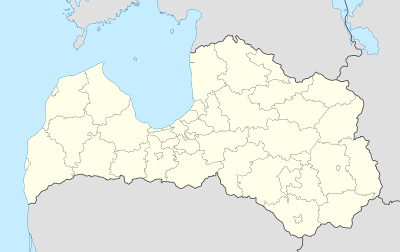
File:Latvia location map.svg
Jump to navigation
Jump to search

Size of this PNG preview of this SVG file: 800 × 504 pixels. Other resolutions: 320 × 201 pixels | 640 × 403 pixels | 1,024 × 645 pixels | 1,280 × 806 pixels | 2,560 × 1,612 pixels | 1,304 × 821 pixels.
Original file (SVG file, nominally 1,304 × 821 pixels, file size: 139 KB)
Captions
Captions
Add a one-line explanation of what this file represents
Summary[edit]
| Description |
Deutsch: Positionskarte von Lettland
Quadratische Plattkarte, N-S-Streckung 170 %. Geographische Begrenzung der Karte:
English: Location map of Latvia
Equirectangular projection, N/S stretching 170 %. Geographic limits of the map:
Latviešu: Latvijas novadu karte
Vienādintervāla projekcija, Z/D izstiepšana 170 %. Kartes ģeogrāfiskās robežas:
|
| Date | |
| Source | own work, using United States National Imagery and Mapping Agency data |
| Author | NordNordWest |
| Other versions |
Derivative works of this file: Relief Map of Latvia.jpg
|


|
This map has been made or improved in the German Kartenwerkstatt (Map Lab). You can propose maps to improve as well.
|
Licensing[edit]
I, the copyright holder of this work, hereby publish it under the following licenses:

|
Permission is granted to copy, distribute and/or modify this document under the terms of the GNU Free Documentation License, Version 1.2 or any later version published by the Free Software Foundation; with no Invariant Sections, no Front-Cover Texts, and no Back-Cover Texts. A copy of the license is included in the section entitled GNU Free Documentation License. |
This file is licensed under the Creative Commons Attribution-Share Alike 3.0 Unported license.
- You are free:
- to share – to copy, distribute and transmit the work
- to remix – to adapt the work
- Under the following conditions:
- attribution – You must give appropriate credit, provide a link to the license, and indicate if changes were made. You may do so in any reasonable manner, but not in any way that suggests the licensor endorses you or your use.
- share alike – If you remix, transform, or build upon the material, you must distribute your contributions under the same or compatible license as the original.
You may select the license of your choice.
File history
Click on a date/time to view the file as it appeared at that time.
| Date/Time | Thumbnail | Dimensions | User | Comment | |
|---|---|---|---|---|---|
| current | 16:38, 10 July 2021 | | 1,304 × 821 (139 KB) | Obivan Kenobi (talk | contribs) | New boundaries from July 1st 2021 |
| 11:07, 5 May 2017 |  | 1,304 × 821 (170 KB) | NordNordWest (talk | contribs) | Reverted to version as of 08:15, 5 May 2017 (UTC); you may find your way to the file discussion page _before_ changing this map | |
| 08:51, 5 May 2017 |  | 1,305 × 822 (316 KB) | Намѣсникъ (talk | contribs) | Reverted to version as of 02:37, 5 May 2017 (UTC) | |
| 08:15, 5 May 2017 |  | 1,304 × 821 (170 KB) | NordNordWest (talk | contribs) | sorry, no, the colours are standardized but the lines can be thinner | |
| 02:37, 5 May 2017 |  | 1,305 × 822 (316 KB) | Намѣсникъ (talk | contribs) | lighter adm. boundaries for Location maps in templates | |
| 12:34, 2 October 2012 |  | 1,304 × 821 (177 KB) | Palosirkka (talk | contribs) | Reverted to version as of 16:22, 15 June 2012 Location maps must remain very accurate | |
| 20:56, 1 October 2012 |  | 1,304 × 821 (167 KB) | Palosirkka (talk | contribs) | Scrubbed with http://codedread.com/scour/ | |
| 16:22, 15 June 2012 |  | 1,304 × 821 (177 KB) | NordNordWest (talk | contribs) | c | |
| 09:42, 15 August 2011 |  | 1,304 × 821 (176 KB) | NordNordWest (talk | contribs) | corr | |
| 13:16, 4 July 2009 |  | 1,305 × 822 (359 KB) | Glossologist (talk | contribs) | from July 1 the political map of Latvia is like that |
You cannot overwrite this file.
File usage on Commons
More than 100 pages use this file. The following list shows the first 100 pages that use this file only. A full list is available.
- User:NordNordWest/Gallery/Location maps
- File:Adazi in Latvia.svg
- File:Aglona in Latvia.svg
- File:Aizkraukle in Latvia.svg
- File:Aizpute in Latvia.svg
- File:Akniste in Latvia.svg
- File:Aloja in Latvia.svg
- File:Alsunga in Latvia.svg
- File:Aluksne in Latvia.svg
- File:Amata in Latvia.svg
- File:Ape in Latvia.svg
- File:Auce in Latvia.svg
- File:Babite in Latvia.svg
- File:Baldone in Latvia.svg
- File:Baltinava in Latvia.svg
- File:Balvi in Latvia.svg
- File:Bauska in Latvia.svg
- File:Beverina in Latvia.svg
- File:Broceni in Latvia.svg
- File:Burtnieki in Latvia.svg
- File:Carnikava in Latvia.svg
- File:Cesis in Latvia.svg
- File:Cesvaine in Latvia.svg
- File:Cibla in Latvia.svg
- File:Dagda in Latvia.svg
- File:Daugavpils (city) in Latvia.svg
- File:Daugavpils municipality in Latvia.svg
- File:Dobele in Latvia.svg
- File:Dundaga in Latvia.svg
- File:Durbe in Latvia.svg
- File:Engure in Latvia.svg
- File:Ergli in Latvia.svg
- File:Garkalne in Latvia.svg
- File:Grobina in Latvia.svg
- File:Gulbene in Latvia.svg
- File:Iecava in Latvia.svg
- File:Ikskile in Latvia.svg
- File:Ilukste in Latvia.svg
- File:Incukalns in Latvia.svg
- File:Jaunjelgava in Latvia.svg
- File:Jaunpiebalga in Latvia.svg
- File:Jaunpils in Latvia.svg
- File:Jekabpils (city) in Latvia.svg
- File:Jekabpils in Latvia.svg
- File:Jelgava (city) in Latvia.svg
- File:Jelgava in Latvia.svg
- File:Jurmala in Latvia.svg
- File:Kandava in Latvia.svg
- File:Karsava in Latvia.svg
- File:Kegums in Latvia.svg
- File:Kekava in Latvia.svg
- File:Koceni in Latvia.svg
- File:Koknese in Latvia.svg
- File:Kraslava in Latvia.svg
- File:Krimulda in Latvia.svg
- File:Krustpils in Latvia.svg
- File:Kuldiga in Latvia.svg
- File:Latvia relief location map.jpg
- File:Lielvarde in Latvia.svg
- File:Liepaja in Latvia.svg
- File:Ligatne in Latvia.svg
- File:Limbazi in Latvia.svg
- File:Livani in Latvia.svg
- File:Lubana in Latvia.svg
- File:Ludza in Latvia.svg
- File:Madona in Latvia.svg
- File:Malpils in Latvia.svg
- File:Marupe in Latvia.svg
- File:Mazsalaca in Latvia.svg
- File:Mersrags in Latvia.svg
- File:Naukseni in Latvia.svg
- File:Nereta in Latvia.svg
- File:Nica in Latvia.svg
- File:Ogre in Latvia.svg
- File:Olaine in Latvia.svg
- File:Ozolnieki in Latvia.svg
- File:Pargauja in Latvia.svg
- File:Pavilosta in Latvia.svg
- File:Plavinas in Latvia.svg
- File:Preili in Latvia.svg
- File:Priekule in Latvia.svg
- File:Priekuli in Latvia.svg
- File:Rauna in Latvia.svg
- File:Relief Map of Latvia.jpg
- File:Rezekne (city) in Latvia.svg
- File:Rezekne in Latvia.svg
- File:Riebini in Latvia.svg
- File:Riga in Latvia.svg
- File:Roja in Latvia.svg
- File:Ropazi in Latvia.svg
- File:Rucava in Latvia.svg
- File:Rugaji in Latvia.svg
- File:Rujiena in Latvia.svg
- File:Rundale in Latvia.svg
- File:Sala in Latvia.svg
- File:Salacgriva in Latvia.svg
- File:Salaspils in Latvia.svg
- File:Saldus in Latvia.svg
- File:Saulkrasti in Latvia.svg
- File:Seja in Latvia.svg
_in_Latvia.svg)
_in_Latvia.svg)
_in_Latvia.svg)
_in_Latvia.svg)
View more links to this file.
File usage on other wikis
The following other wikis use this file:
- Usage on af.wikipedia.org
- Usage on an.wikipedia.org
- Usage on ast.wikipedia.org
- Usage on azb.wikipedia.org
- Usage on be-tarask.wikipedia.org
- Usage on bn.wikipedia.org
- Usage on bs.wikipedia.org
- Usage on ckb.wikipedia.org
- Usage on de.wikipedia.org
- Usage on de.wikivoyage.org
- Usage on en.wikipedia.org
- Usage on eo.wikivoyage.org
- Usage on es.wikipedia.org
- Riga
- Liepāja
- Ventspils
- Rēzekne
- Jūrmala
- Aeropuerto Internacional de Riga
- Jelgava
- Jardín botánico de la Universidad de Letonia
- Jardín botánico nacional de Letonia
- Ikšķile
- Aeropuerto Internacional de Liepāja
- Aeropuerto Internacional de Ventspils
- Valmiera
- Jēkabpils
- Municipio de Mālpils
- Aizkraukle
- Aizpute
- Aknīste
- Alsunga
- Alūksne
- Baldone
- Balvi
- Bauska
View more global usage of this file.