File:Landsat 4 5 tm 6 mai 2007 (Dalälven) -cropped.jpeg
Jump to navigation
Jump to search

Size of this preview: 800 × 588 pixels. Other resolutions: 320 × 235 pixels | 640 × 470 pixels | 992 × 729 pixels.
Original file (992 × 729 pixels, file size: 738 KB, MIME type: image/jpeg)
Captions
Captions
Add a one-line explanation of what this file represents
Summary[edit]
_-cropped.jpeg&action=edit§ion=1)
| Description |
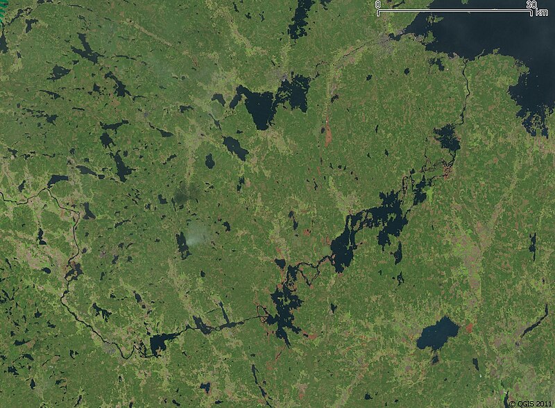
Français : Photo satellite découpée Landsat 4-5 TM du 6 mai 2007 : le lac Färnebofjärden et le fleuve Dalälven sont à leur niveau normal, avec apparaissant nettement en rose les zones noyées lors d'une crue importante.
Projection : SWEREF zon 16° 30' (information); système géodésique WGS84. |
| Date | |
| Source | Landsat 4-5 TM du 6 mai 2007 (scale : QGIS) |
| Author | NASA + Bourrichon (reprojection, découpage). Freeware QGIS. |
Licensing[edit]
_-cropped.jpeg&action=edit§ion=2)
| This file is in the public domain in the United States because it was solely created by NASA. NASA copyright policy states that "NASA material is not protected by copyright unless noted". (See Template:PD-USGov, NASA copyright policy page or JPL Image Use Policy.) | ||
 |
Warnings:
|
File history
Click on a date/time to view the file as it appeared at that time.
| Date/Time | Thumbnail | Dimensions | User | Comment | |
|---|---|---|---|---|---|
| current | 21:48, 2 November 2011 | | 992 × 729 (738 KB) | Bourrichon (talk | contribs) | =={{int:filedesc}}== {{Information |description={{fr|1=Photo satellite découpée Landsat 4-5 TM du 6 mai 2007 : le lac Färnebofjärden et le fleuve Dalälven sont à leur niveau normal, avec apparaissant nettem |
You cannot overwrite this file.
File usage on Commons
There are no pages that use this file.
File usage on other wikis
The following other wikis use this file:
- Usage on fr.wikipedia.org
_-cropped.jpeg&oldid=475594528)