File:Karnataka State fluoride content map.pdf
Jump to navigation
Jump to search

Size of this JPG preview of this PDF file: 776 × 600 pixels. Other resolutions: 311 × 240 pixels | 621 × 480 pixels | 994 × 768 pixels | 1,280 × 989 pixels | 1,650 × 1,275 pixels.
Original file (1,650 × 1,275 pixels, file size: 526 KB, MIME type: application/pdf)
Captions
Captions
Add a one-line explanation of what this file represents
Summary[edit]
| Description |
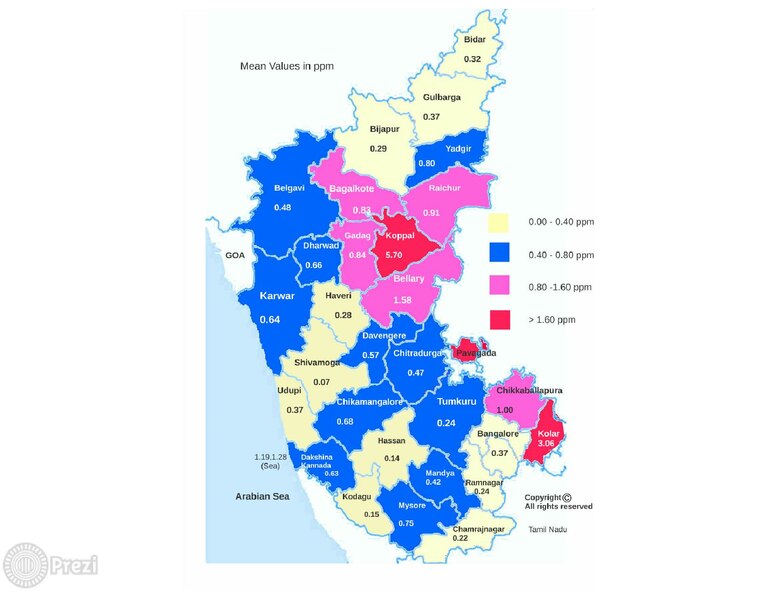
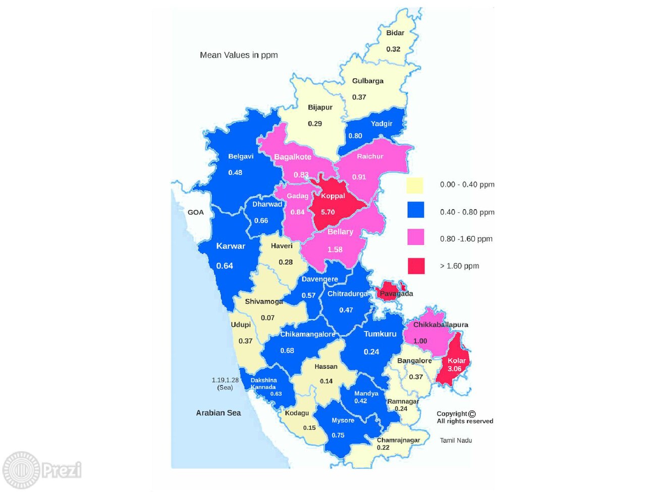
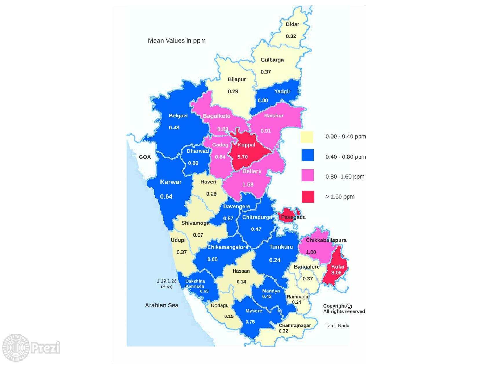
English: Geospatial drinking water source fluoride content colour map of the
Karnataka State of India showing the location of the 29 districts investigated. Districts with mean fluoride concentrations of 0.00–0.40, 0.40–0.80, 0.80–1.60 and >1.60 ppm F− are colour-coded as indicated |
| Date | |
| Source | Own work |
| Author | Shahnawaz Khijmatgar |
https://www.ncbi.nlm.nih.gov/pubmed/26842483
Licensing[edit]
I, the copyright holder of this work, hereby publish it under the following license:
This file is licensed under the Creative Commons Attribution-Share Alike 4.0 International license.
- You are free:
- to share – to copy, distribute and transmit the work
- to remix – to adapt the work
- Under the following conditions:
- attribution – You must give appropriate credit, provide a link to the license, and indicate if changes were made. You may do so in any reasonable manner, but not in any way that suggests the licensor endorses you or your use.
- share alike – If you remix, transform, or build upon the material, you must distribute your contributions under the same or compatible license as the original.
File history
Click on a date/time to view the file as it appeared at that time.
| Date/Time | Thumbnail | Dimensions | User | Comment | |
|---|---|---|---|---|---|
| current | 13:14, 3 December 2018 |  | 1,650 × 1,275 (526 KB) | Ziamzian 123 (talk | contribs) | User created page with UploadWizard |
You cannot overwrite this file.
File usage on Commons
The following page uses this file:
- File:Prezi-2-2.pdf (file redirect)