File:India Assam COVID-19 map.svg
Jump to navigation
Jump to search

Size of this PNG preview of this SVG file: 725 × 600 pixels. Other resolutions: 290 × 240 pixels | 580 × 480 pixels | 928 × 768 pixels | 1,238 × 1,024 pixels | 2,475 × 2,048 pixels | 765 × 633 pixels.
Original file (SVG file, nominally 765 × 633 pixels, file size: 771 KB)
Captions
Captions
Add a one-line explanation of what this file represents
Summary[edit]
| Description |
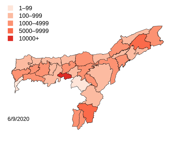
English: Districts with confirmed cases in the state of Assam. |
| Date | (UTC) |
| Source |
This file was derived from: Districts of Assam (2014).svg: |
| Author | Firos AK |
.svg)
| This is a retouched picture, which means that it has been digitally altered from its original version. Modifications: coloured map for COVID 19. The original can be viewed here: Districts of Assam (2014).svg:
|
Licensing[edit]
I, the copyright holder of this work, hereby publish it under the following licenses:
This file is licensed under the Creative Commons Attribution-Share Alike 3.0 Unported license.
- You are free:
- to share – to copy, distribute and transmit the work
- to remix – to adapt the work
- Under the following conditions:
- attribution – You must give appropriate credit, provide a link to the license, and indicate if changes were made. You may do so in any reasonable manner, but not in any way that suggests the licensor endorses you or your use.
- share alike – If you remix, transform, or build upon the material, you must distribute your contributions under the same or compatible license as the original.

|
Permission is granted to copy, distribute and/or modify this document under the terms of the GNU Free Documentation License, Version 1.2 or any later version published by the Free Software Foundation; with no Invariant Sections, no Front-Cover Texts, and no Back-Cover Texts. A copy of the license is included in the section entitled GNU Free Documentation License. |
You may select the license of your choice.
Original upload log[edit]
This image is a derivative work of the following images:
- File:Assam-districts-2001.svg licensed with Cc-by-sa-3.0, GFDL
- 2011-08-19T23:27:48Z Chaipau 631x530 (215961 Bytes) Corrected the following districts: Nalbari, Barpeta, Sivasagar, Tinsukia
- 2009-04-05T11:02:24Z Chaipau 631x530 (168954 Bytes) The image is cropped to exclude empty spaces.
- 2009-04-05T01:14:33Z Chaipau 744x1052 (168532 Bytes) {{Information |Description={{en|1=This file shows the districts of [[en:Assam]] as of 2001. The map is based on a free hand trace of [http://web.archive.org/web/20040606141014/www.censusindia.net/results/2001maps/assam01.htm
Uploaded with derivativeFX
File history
Click on a date/time to view the file as it appeared at that time.
| Date/Time | Thumbnail | Dimensions | User | Comment | |
|---|---|---|---|---|---|
| current | 04:41, 7 September 2020 | | 765 × 633 (771 KB) | Shanze1 (talk | contribs) | update |
| 05:03, 24 August 2020 |  | 765 × 633 (771 KB) | Shanze1 (talk | contribs) | update | |
| 04:01, 14 August 2020 |  | 765 × 633 (771 KB) | Shanze1 (talk | contribs) | update | |
| 02:39, 5 August 2020 |  | 765 × 633 (771 KB) | Shanze1 (talk | contribs) | update | |
| 04:25, 29 July 2020 |  | 765 × 633 (771 KB) | Shanze1 (talk | contribs) | update; legend | |
| 03:16, 21 July 2020 |  | 765 × 633 (769 KB) | Shanze1 (talk | contribs) | update | |
| 04:13, 14 July 2020 |  | 765 × 633 (769 KB) | Shanze1 (talk | contribs) | update | |
| 03:54, 9 July 2020 |  | 765 × 633 (769 KB) | Shanze1 (talk | contribs) | update | |
| 03:38, 4 July 2020 |  | 765 × 633 (769 KB) | Shanze1 (talk | contribs) | update; legend | |
| 03:21, 2 July 2020 |  | 765 × 633 (769 KB) | Shanze1 (talk | contribs) | update |
You cannot overwrite this file.
File usage on Commons
The following 17 pages use this file:
- User:Magog the Ogre/Multilingual legend/2020 April 1-10
- User:Magog the Ogre/Multilingual legend/2020 April 21-30
- User:Magog the Ogre/Multilingual legend/2020 August 1-10
- User:Magog the Ogre/Multilingual legend/2020 August 11-20
- User:Magog the Ogre/Multilingual legend/2020 August 21-31
- User:Magog the Ogre/Multilingual legend/2020 July 1-10
- User:Magog the Ogre/Multilingual legend/2020 July 11-20
- User:Magog the Ogre/Multilingual legend/2020 July 21-31
- User:Magog the Ogre/Multilingual legend/2020 June 1-10
- User:Magog the Ogre/Multilingual legend/2020 June 11-20
- User:Magog the Ogre/Multilingual legend/2020 June 21-30
- User:Magog the Ogre/Multilingual legend/2020 May 1-10
- User:Magog the Ogre/Multilingual legend/2020 May 11-20
- User:Magog the Ogre/Multilingual legend/2020 May 21-31
- User:Magog the Ogre/Multilingual legend/2020 September 1-10
- File:India Assam COVID-19 Death map.svg
- Category:COVID-19 pandemic in Assam
File usage on other wikis
The following other wikis use this file:
- Usage on bn.wikipedia.org
- Usage on id.wikipedia.org
- Usage on kn.wikipedia.org
- Usage on te.wikipedia.org
- Usage on www.wikidata.org