File:Ilgora Emankorraren mapa.png
Jump to navigation
Jump to search
Size of this preview: 488 × 599 pixels. Other resolutions: 195 × 240 pixels | 391 × 480 pixels | 625 × 768 pixels | 833 × 1,024 pixels | 1,996 × 2,452 pixels.
Original file (1,996 × 2,452 pixels, file size: 725 KB, MIME type: image/png)
Captions
Captions
Add a one-line explanation of what this file represents
| Description |
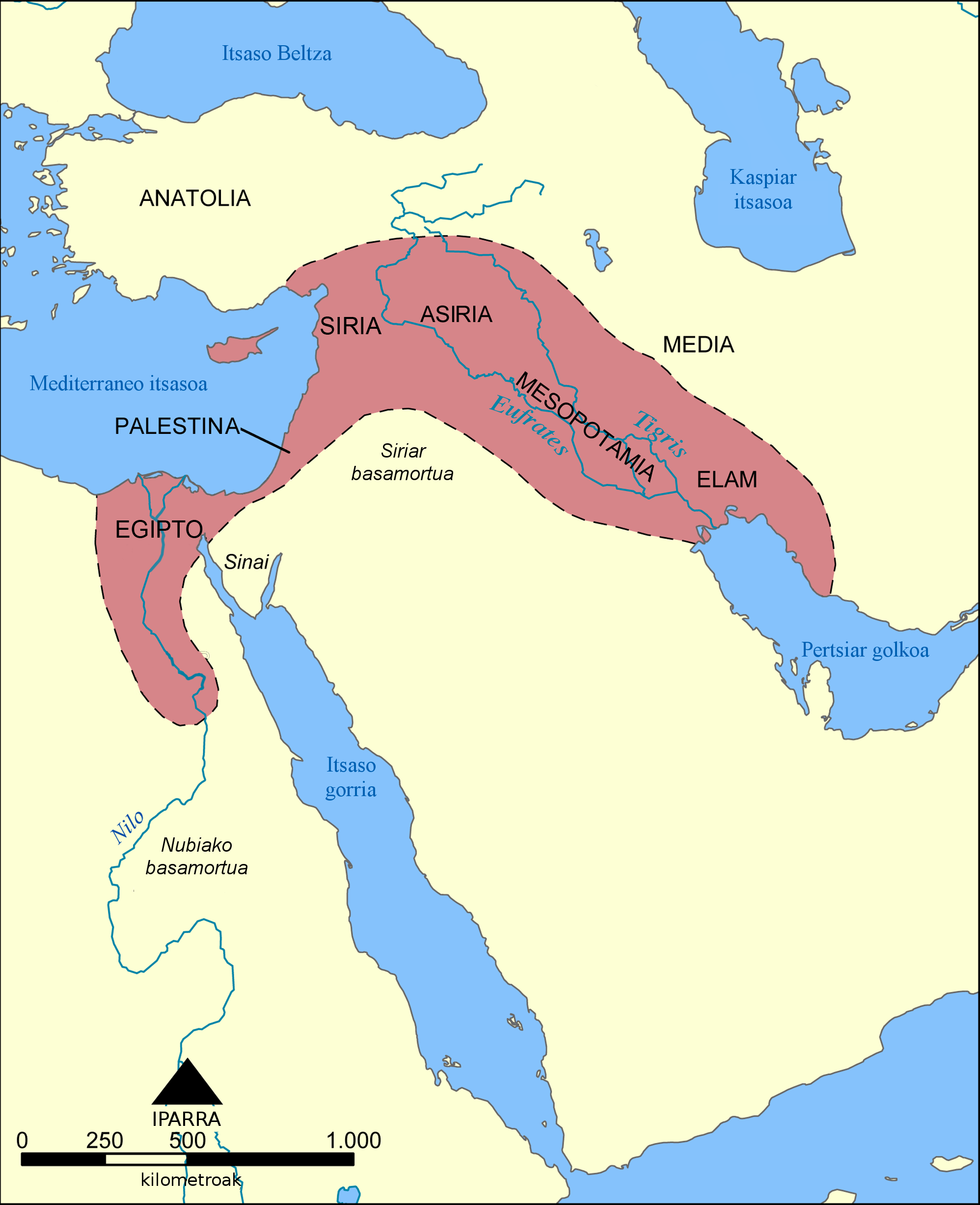
Euskara: Ilgora Emankorra deritzon eskualdearen kokalekua eta hedadura erakusten du mapa honek. |
| Date | (UTC) |
| Source | |
| Author |
|
| Other versions |
[]
See also:
|


| This is a retouched picture, which means that it has been digitally altered from its original version. Modifications: Translation into Basque language. The original can be viewed here: Mapa del Creciente Fértil.png:
|
I, the copyright holder of this work, hereby publish it under the following licenses:
| This file is licensed under the Creative Commons Attribution-Share Alike 3.0 Unported license. | ||
| ||
| This licensing tag was added to this file as part of the GFDL licensing update. |

|
Permission is granted to copy, distribute and/or modify this document under the terms of the GNU Free Documentation License, Version 1.2 or any later version published by the Free Software Foundation; with no Invariant Sections, no Front-Cover Texts, and no Back-Cover Texts. A copy of the license is included in the section entitled GNU Free Documentation License. |
You may select the license of your choice.
Original upload log[edit]
This image is a derivative work of the following images:
- File:Mapa_del_Creciente_Fértil.png licensed with Cc-by-sa-3.0-migrated, GFDL
- 2006-04-22T11:54:46Z Locutus Borg 1996x2452 (687847 Bytes) Este mapa muestra la localización y extensión del '''Creciente Fértil''', una región de Oriente Medio que abarcaba el Aniguo Egipto, el Levante mediterráneo, Meospotamia y otras civilizaciones. Creado por NormanEinstein
- 2006-04-22T00:19:58Z Locutus Borg 1996x2452 (683529 Bytes) Este mapa muestra la localización y extensión del '''Creciente Fértil''', una región de orient Medio que abarcaba el Aniguo Egipto, el Levante mediterráneo, Meospotamia y otras cibilizaciones. Creado por NormanEinstein,
Uploaded with derivativeFX
File history
Click on a date/time to view the file as it appeared at that time.
| Date/Time | Thumbnail | Dimensions | User | Comment | |
|---|---|---|---|---|---|
| current | 18:04, 21 June 2010 | | 1,996 × 2,452 (725 KB) | Xabier Armendaritz (talk | contribs) | Translation of untranslated text at the bottom |
| 14:06, 21 June 2010 |  | 1,996 × 2,452 (735 KB) | Xabier Armendaritz (talk | contribs) | {{Information |Description={{es|Este mapa muestra la localización y extensión del '''Creciente Fértil''', una región de Oriente Medio que abarcaba el Aniguo Egipto, el Levante mediterráneo, Meospotamia y otras civilizaciones.}} |Source=*[[:File:Mapa_ |
You cannot overwrite this file.
File usage on Commons
The following 8 pages use this file:
File usage on other wikis
The following other wikis use this file:
- Usage on eu.wikipedia.org