Category:Maps of the Fertile Crescent
Jump to navigation
Jump to search
Wikimedia category | |||||
| Upload media | |||||
| Instance of | |||||
|---|---|---|---|---|---|
| Category combines topics | |||||
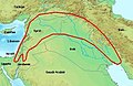
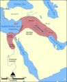
| Fertile Crescent | |||||
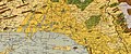
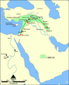
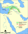
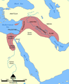
crescent-shaped geographic region of the Middle-East, containing the moist and fertile land of Western Asia, and the Nile Valley and Nile Delta of northeast Africa _-_The_beginning_of_the_%22Fertile_Crescent%22.JPG)  | |||||
| Instance of | |||||
| Part of | |||||
| Named after | |||||
| Location |
| ||||
| Has part(s) | |||||
 | |||||
Subcategories
This category has the following 6 subcategories, out of 6 total.
A
B
E
M
Media in category "Maps of the Fertile Crescent"
The following 59 files are in this category, out of 59 total.
-
 F Crescent.png 488 × 432; 51 KB
-
-
 AlterOrient.jpg 1,400 × 940; 454 KB
-
 Asirsko kraljestvo.PNG 837 × 728; 125 KB
-
 BC1781 Mesopotamia map.png 617 × 421; 21 KB
-
 C+B-Assyria-DetailedMap.JPG 1,897 × 1,350; 757 KB
-
 Croissant fertile carte.png 1,988 × 2,443; 763 KB
-
 Fertile Crescent 7500 BC ARA.png 1,200 × 1,473; 281 KB
-
 Fertile Crescent 7500 BC DAN.PNG 488 × 599; 111 KB
-
 Fertile Crescent 7500 BC Nor.PNG 1,200 × 1,473; 293 KB
-
 Fertile Crescent 7500 BC NOR.PNG 1,200 × 1,473; 298 KB
-
 Fertile Crescent 7500 BC.PNG 1,200 × 1,473; 294 KB
-
 Fertile Crescent and Hilly Flanks.png 1,600 × 1,200; 2.39 MB
-
 Fertile Crescent concept 1916.png 767 × 625; 268 KB
-
 Fertile Crescent map He.png 1,988 × 2,443; 668 KB
-
 Fertile Crescent map it.PNG 1,988 × 2,443; 729 KB
-
 Fertile Crescent map rus.png 1,988 × 2,443; 717 KB
-
 Fertile Crescent map.png 1,988 × 2,443; 717 KB
-
 Fertile crescent Neolithic B circa 7500 BC.jpg 1,050 × 1,087; 426 KB
-
 Fertile Crescent.png 1,251 × 879; 922 KB
-
 FertileCrescent11000BC.JPG 659 × 599; 74 KB
-
 Fruchtbarer Halbmond map deutsch.png 2,481 × 3,508; 786 KB
-
 Fruchtbarer Halbmond.JPG 487 × 315; 36 KB
-
 Hedelmallinen puolikuu ja joistakin ensimmäisia asutuskeskuksia.svg 993 × 515; 20.15 MB
-
 Hedelmällinen puolikuu.svg 2,250 × 2,250; 1.6 MB
-
 Ilgora Emankorraren mapa.png 1,996 × 2,452; 725 KB
-
 Khalid ibn al-Walid's Desert March to Syria, ca. April 634.png 1,266 × 1,057; 825 KB
-
 Map of fertile crescent lv.svg 512 × 629; 559 KB
-
 Map of fertile crescent-af.svg 1,987 × 2,441; 467 KB
-
 Map of fertile crescent-ar.svg 1,987 × 2,441; 781 KB
-
 Map of fertile crescent-bxr.svg 1,987 × 2,442; 568 KB
-
 Map of fertile crescent-pt.svg 765 × 990; 524 KB
-
 Map of fertile crescent-ru.svg 1,987 × 2,442; 626 KB
-
 Map of fertile crescent.svg 1,987 × 2,441; 729 KB
-
 Map of fertile cresent-es.svg 2,102 × 1,510; 478 KB
-
 Map of fertile cresent-sr.svg 1,987 × 2,441; 467 KB
-
 Map of fertile cresent-tr.svg 1,987 × 2,441; 467 KB
-
 Map of the Ancient Near East.jpg 3,540 × 2,938; 2.34 MB
-
 Mapa da crescente fértil.png 825 × 1,060; 185 KB
-
 Mapa del Creciente Fértil.png 1,996 × 2,452; 672 KB
-
 Mapa do Crecente Fertil en galego.png 3,850 × 4,730; 1.95 MB
-

-

-

-

-

-

-

-

-

-
-

-

-

-
-
 Mezzaluna fertile.png 840 × 2,692; 1.16 MB
-
 Vruchtbare sikkel.JPG 487 × 315; 36 KB
-
 Vruchtbare sikkel.PNG 1,201 × 1,474; 395 KB
-
 Vruchtbare sikkel.svg 1,129 × 1,385; 1.06 MB

,_%22Chaldeans%22_(7)_and_%22Jacobites%22_(8),_in_Maunsell%27s_map,_Pre-World_War_I_British_Ethnographical_Map_of_eastern_Turkey_in_Asia,_Syria_and_western_Persia_01_(cropped).jpg)


,_Chaldaeans,_and_Jacobites).jpg)
.jpg)
.jpg)


.jpg)
.jpg)
.jpg)
.jpg)
.jpg)
.jpg)
.jpg)
).jpg)
.jpg)
.jpg)