File:Iles Kerguelen 76.jpg
Jump to navigation
Jump to search

Size of this preview: 577 × 600 pixels. Other resolutions: 231 × 240 pixels | 462 × 480 pixels | 857 × 891 pixels.
Original file (857 × 891 pixels, file size: 170 KB, MIME type: image/jpeg)
Captions
Captions
Add a one-line explanation of what this file represents
Summary[edit]
| Description |
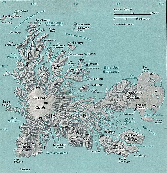
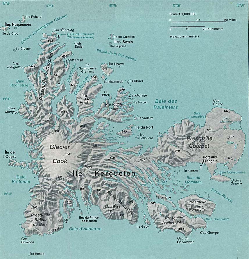
Deutsch: Karte des Kerguelen-Archipels im südlichen Indischen Ozean
English: Map of the Kerguelen Islands in the southern Indian Ocean |
| Date | |
| Source | http://www.lib.utexas.edu/maps/islands_oceans_poles/iles_kerguelen_76.jpg |
| Author | Taken from Perry-Castañeda Library (PCL), originally from CIA Indian Ocean Atlas |
Licensing[edit]
| This image is a work of a Central Intelligence Agency employee, taken or made as part of that person's official duties. As a Work of the United States Government, this image or media is in the public domain in the United States.
|

|
File history
Click on a date/time to view the file as it appeared at that time.
| Date/Time | Thumbnail | Dimensions | User | Comment | |
|---|---|---|---|---|---|
| current | 18:20, 19 December 2009 | | 857 × 891 (170 KB) | Telim tor (talk | contribs) | == {{int:filedesc}} == {{Information |Description= {{de|Karte des Kerguelen-Archipels im südlichen Indischen Ozean}} {{en|Map of the Kerguelen Islands in the southern Indian Ocean}} |Source=http://www.lib.utexas.edu/maps/islands_oceans_poles/iles_kerguel |
You cannot overwrite this file.
File usage on Commons
There are no pages that use this file.
File usage on other wikis
The following other wikis use this file:
- Usage on en.wikipedia.org
- Usage on hr.wikipedia.org