File:Ile aux Cochons Map.jpg
Jump to navigation
Jump to search

No higher resolution available.
Ile_aux_Cochons_Map.jpg (349 × 362 pixels, file size: 32 KB, MIME type: image/jpeg)
Captions
Captions
Add a one-line explanation of what this file represents
Summary[edit]
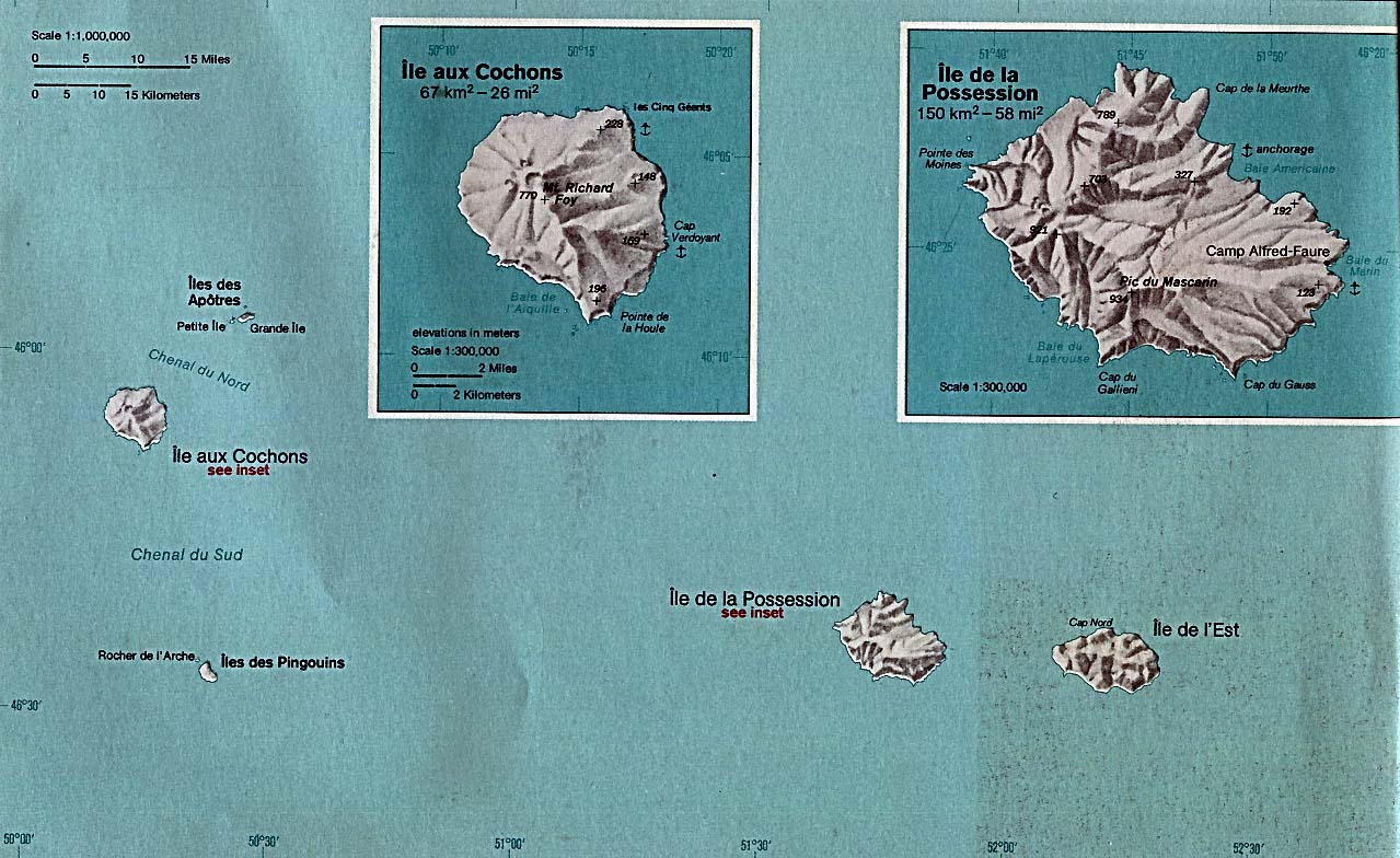
| Description |
English: Map of Île aux Cochons, Crozet Islands, TAAF |
| Date | |
| Source | Perry-Castañeda Library, originally from CIA's Indian Ocean Atlas |
| Author | Central Intelligence Agency |
| Other versions |

Licensing[edit]
| This image is a work of a Central Intelligence Agency employee, taken or made as part of that person's official duties. As a Work of the United States Government, this image or media is in the public domain in the United States.
|

|
File history
Click on a date/time to view the file as it appeared at that time.
| Date/Time | Thumbnail | Dimensions | User | Comment | |
|---|---|---|---|---|---|
| current | 13:17, 25 August 2009 | | 349 × 362 (32 KB) | Telim tor (talk | contribs) | == {{int:filedesc}} == {{Information |Description={{en|Map of Île aux Cochons, Crozet Islands, TAAF}} |Source=[http://www.lib.utexas.edu/maps/islands_oceans_poles/iles_crozet_76.jpg Perry-Castañeda Library], originally from CIA's Indian Ocean Atlas |Dat |
You cannot overwrite this file.
File usage on Commons
There are no pages that use this file.