File:Haute Alsace 1734 Map.png
Jump to navigation
Jump to search
Size of this preview: 800 × 582 pixels. Other resolutions: 320 × 233 pixels | 640 × 465 pixels | 1,024 × 744 pixels | 1,280 × 931 pixels | 2,560 × 1,861 pixels | 3,154 × 2,293 pixels.
Original file (3,154 × 2,293 pixels, file size: 17.36 MB, MIME type: image/png)
Captions
Captions
Add a one-line explanation of what this file represents
Summary[edit]
| Description |
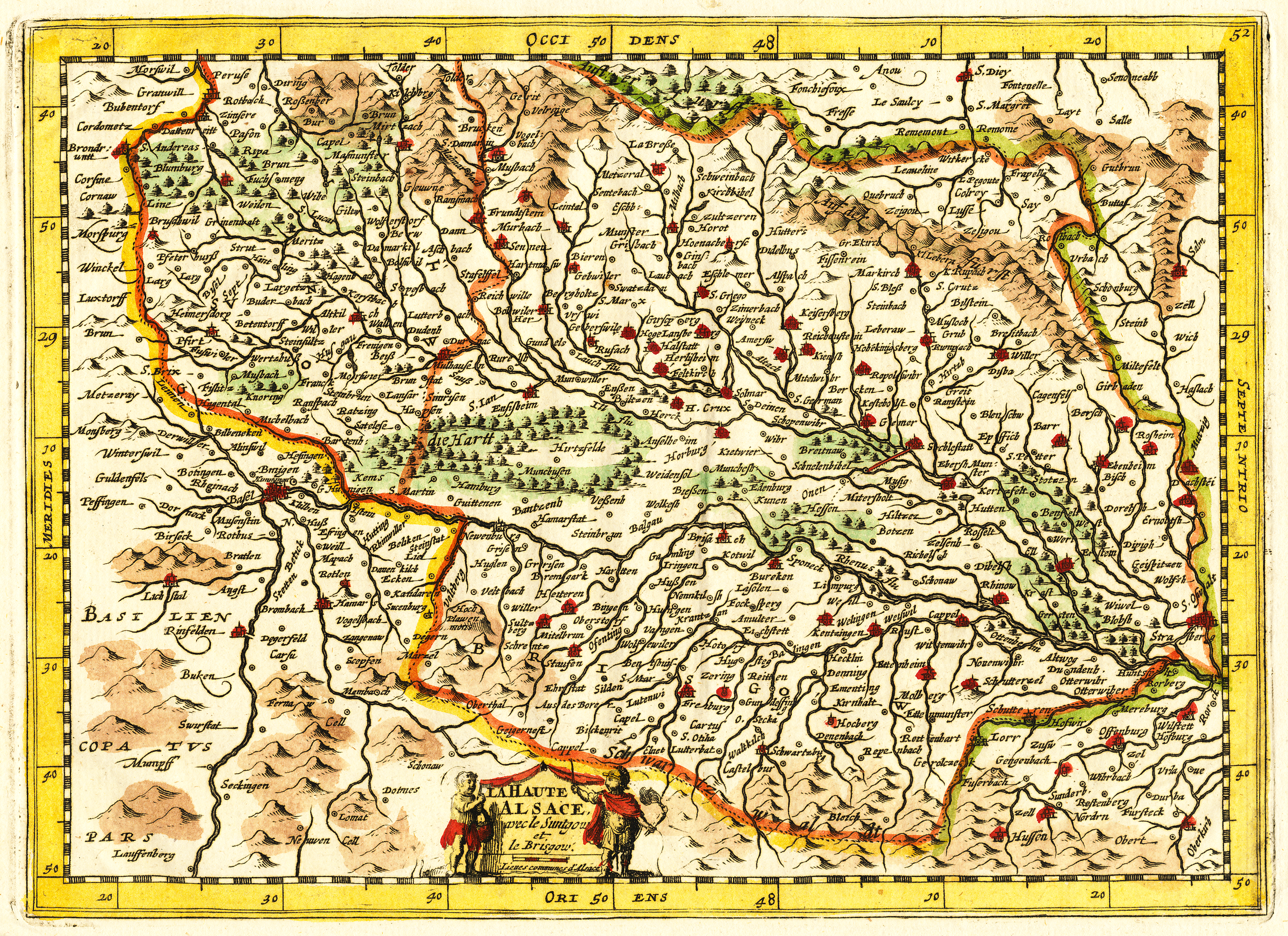
English: Map of Alsace from the 1734 Pocket Atlases of the World by Henri du Sauzet, published in Amsterdam |
| Date | |
| Source | Pocket Atlases of the World (1734) |
| Author | Henri du Sauzet |
Licensing[edit]
|
This work is in the public domain in its country of origin and other countries and areas where the copyright term is the author's life plus 100 years or fewer. | |
| This file has been identified as being free of known restrictions under copyright law, including all related and neighboring rights. | |
File history
Click on a date/time to view the file as it appeared at that time.
| Date/Time | Thumbnail | Dimensions | User | Comment | |
|---|---|---|---|---|---|
| current | 20:25, 24 July 2011 | | 3,154 × 2,293 (17.36 MB) | Kitsumefox (talk | contribs) |
You cannot overwrite this file.
File usage on Commons
There are no pages that use this file.