File:Guyane department location map.svg
Jump to navigation
Jump to search

Size of this PNG preview of this SVG file: 497 × 600 pixels. Other resolutions: 199 × 240 pixels | 398 × 480 pixels | 637 × 768 pixels | 849 × 1,024 pixels | 1,698 × 2,048 pixels | 1,183 × 1,427 pixels.
Original file (SVG file, nominally 1,183 × 1,427 pixels, file size: 433 KB)
Captions
Captions
Add a one-line explanation of what this file represents
Summary[edit]
| Camera location | | View this and other nearby images on: OpenStreetMap |
|---|
| Description |
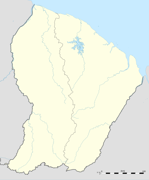
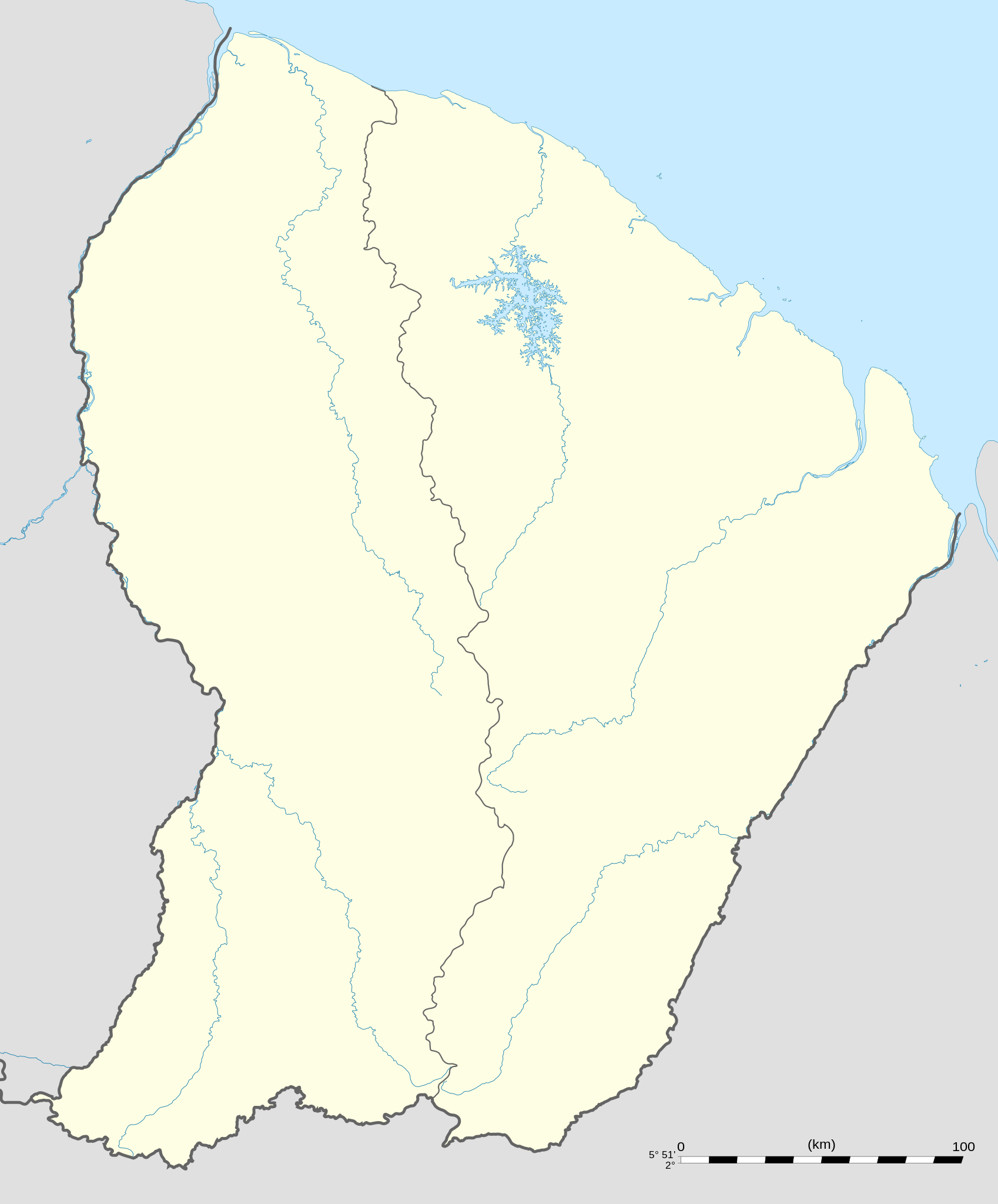
English: Blank administrative map of the region and department of the French Guiana, France, for geo-location purpose, with arrondissements boundaries.
Français : Carte administrative vierge de la région et département de Guyane, France, destinée à la géolocalisation, avec limite des arrondissements. Equirectangular projection, WGS84 datum
Geographic limits of the map:
|
||
| Date | |||
| Source |
Own work
|
||
| Author | Eric Gaba (Sting - fr:Sting) | ||
| Permission (Reusing this file) |
|
||
| Other versions |
|

Licensing[edit]
I, the copyright holder of this work, hereby publish it under the following licenses:
This file is licensed under the Creative Commons Attribution-Share Alike 3.0 Unported license.
- You are free:
- to share – to copy, distribute and transmit the work
- to remix – to adapt the work
- Under the following conditions:
- attribution – You must give appropriate credit, provide a link to the license, and indicate if changes were made. You may do so in any reasonable manner, but not in any way that suggests the licensor endorses you or your use.
- share alike – If you remix, transform, or build upon the material, you must distribute your contributions under the same or compatible license as the original.

|
Permission is granted to copy, distribute and/or modify this document under the terms of the GNU Free Documentation License, Version 1.2 or any later version published by the Free Software Foundation; with no Invariant Sections, no Front-Cover Texts, and no Back-Cover Texts. A copy of the license is included in the section entitled GNU Free Documentation License. |
You may select the license of your choice.
File history
Click on a date/time to view the file as it appeared at that time.
| Date/Time | Thumbnail | Dimensions | User | Comment | |
|---|---|---|---|---|---|
| current | 00:18, 19 September 2008 | | 1,183 × 1,427 (433 KB) | Sting (talk | contribs) | == Summary == {{Location|03|55|30|N|53|06|00|W|scale:4000000}} <br/> {{Information |Description={{en|Blank administrative map of the region and department of the French Guiana, France, for geo-location purpose, with distinct boundari |
You cannot overwrite this file.
File usage on Commons
The following 16 pages use this file:
- Location maps of departments of France
- Location maps of regions of France
- User:Sting/Gallery: Location and locator maps
- User:Wikisoft*/Localisation cartes des regions de France
- File:EU Member states and Candidate countries map.svg
- File:EU Member states and Candidate countries map 17 March 2015.svg
- File:France, administrative divisions - Nmbrs (+overseas).svg
- File:France, administrative divisions - Nmbrs (+overseas) - colored.svg
- File:France, administrative divisions - de (+overseas).svg
- File:France, administrative divisions - de (+overseas) - colored.svg
- File:France, administrative divisions until 2015 - de (+overseas) - colored, Noto font.svg
- File:France, administrative divisions until 2015 - en (+overseas) - colored.svg
- File:France, administrative divisions until 2015 - es (+overseas) - colored.svg
- File:France, administrative divisions until 2015 - fr (+overseas) - colored.svg
- File:France (+overseas), administrative divisions - Nmbrs (zoom).svg
- File:Mapa del Caribe (límites marinos).svg
.svg)
_-_colored.svg)
.svg)
_-_colored.svg)
_-_colored,_Noto_font.svg)
_-_colored.svg)
_-_colored.svg)
_-_colored.svg)
,_administrative_divisions_-_Nmbrs_(zoom).svg)
.svg)
File usage on other wikis
The following other wikis use this file:
- Usage on af.wikipedia.org
- Usage on als.wikipedia.org
- Usage on an.wikipedia.org
- Usage on ar.wikipedia.org
- Usage on ast.wikipedia.org
- Usage on be-tarask.wikipedia.org
- Usage on be.wikipedia.org
- Usage on bg.wikipedia.org
- Usage on bs.wikipedia.org
- Usage on ca.wikipedia.org
- Usage on ceb.wikipedia.org
- Plantilya:Location map French Guiana
- Rocky Point
- Mana (pagklaro)
- Montravel
- Saint-Georges (pagklaro)
- Canal de l'Écluse
- Kourou (pagklaro)
- Kouro
- Canal de l'Ouest
- Crique Coco
- Devils Island
- Kayen
- White Rocks
- Tako
- Cascade River
- Bonnet Rock
- Monkey Mountain
- Kouloumouli Itou
- Rio Oiapoque
- Îlet Alice
- Saut Moura
- Grand Lac
- French Point
- Pointe Française
- Yaou
- Roches Blanches
- Les Mamelles
- Maroni
- Anse de l'Hôpital
- Anse de l'Hopital
- Branche Nord
- Branche Sud
- Crique Alphonse
View more global usage of this file.