File:Guicciardini Map of Holland.png
Jump to navigation
Jump to search
Size of this preview: 770 × 600 pixels. Other resolutions: 308 × 240 pixels | 616 × 480 pixels | 986 × 768 pixels | 1,280 × 997 pixels | 1,951 × 1,520 pixels.
Original file (1,951 × 1,520 pixels, file size: 4.99 MB, MIME type: image/png)
Captions
Captions
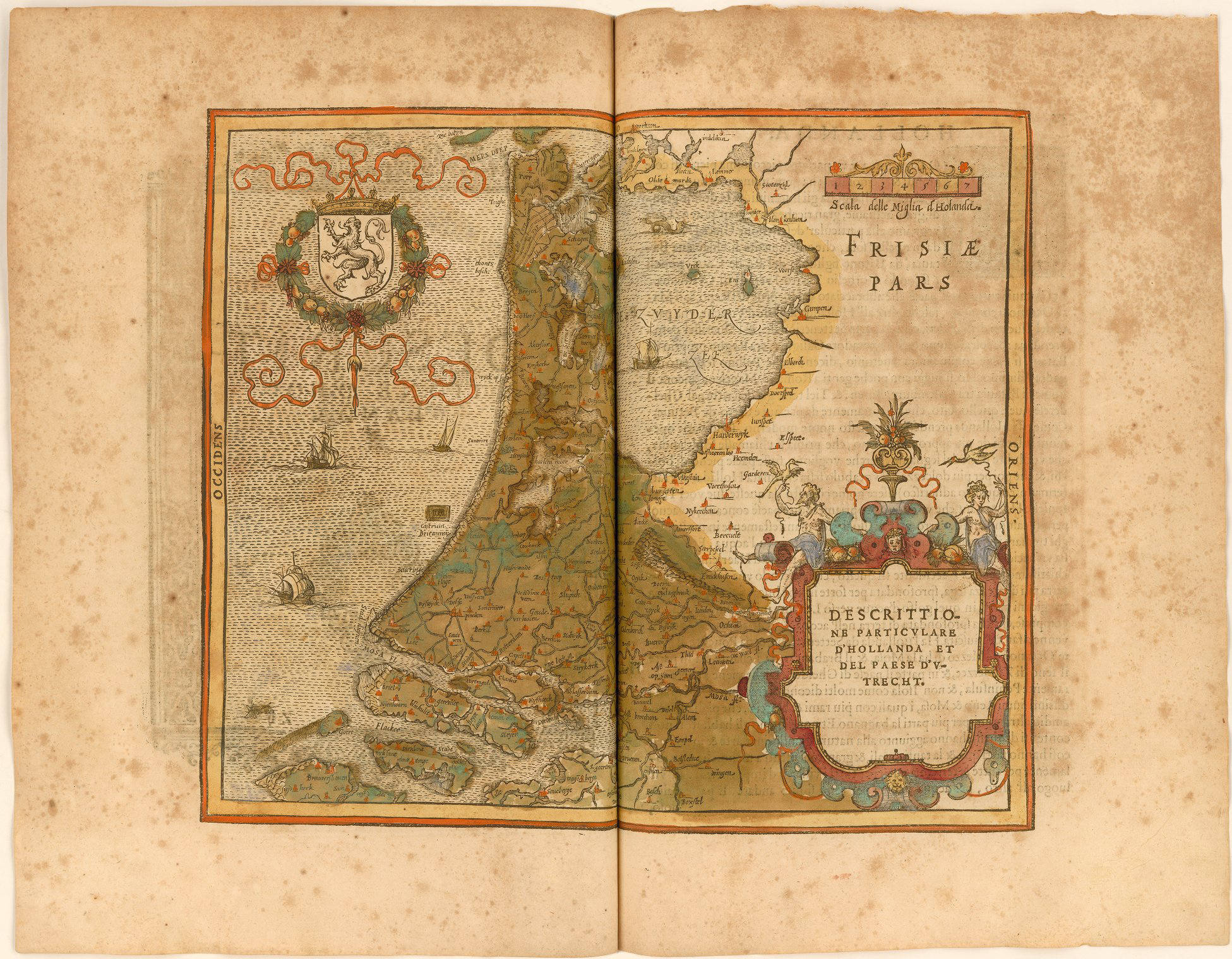
Descrittione particulare d'Hollanda et del paese d'Utrecht
Summary
[edit]
| Description |
English: Map of southern Holland from Dordrecht to the Zuider Zee. Also includes the coat of arms of Holland. Text in Italian. Published in Antwerp. |
| Date | |
| Source | Descrittione di m. Lodouico Guicciardini patritio fiorentino, di tutti i Paesi Bassi, altrimenti detti Germania inferiore. Con piu carte de geographia del paese, & col ritratto naturale di piu terre principali. Con amplissimo indice di tutte le cose piu memorabili |
| Author | Lodovico Guicciardini |
Licensing
[edit]
This file is licensed under the Creative Commons Attribution-Share Alike 4.0 International license.
- You are free:
- to share – to copy, distribute and transmit the work
- to remix – to adapt the work
- Under the following conditions:
- attribution – You must give appropriate credit, provide a link to the license, and indicate if changes were made. You may do so in any reasonable manner, but not in any way that suggests the licensor endorses you or your use.
- share alike – If you remix, transform, or build upon the material, you must distribute your contributions under the same or compatible license as the original.
File history
Click on a date/time to view the file as it appeared at that time.
| Date/Time | Thumbnail | Dimensions | User | Comment | |
|---|---|---|---|---|---|
| current | 20:58, 9 September 2019 | | 1,951 × 1,520 (4.99 MB) | Gpcantu (talk | contribs) | User created page with UploadWizard |
You cannot overwrite this file.
File usage on Commons
There are no pages that use this file.
File usage on other wikis
The following other wikis use this file:
- Usage on en.wikipedia.org
- Usage on tr.wikipedia.org