Category:Old maps of Holland
Jump to navigation
Jump to search
Use the appropriate category for maps showing all or a large part of Holland. See subcategories for smaller areas:
| If the map shows | Category to use |
|---|---|
| Holland on a recently created map | Category:Maps of Holland or its subcategories |
| Holland on a map created more than 70 years ago | Category:Old maps of Holland or its subcategories |
| the history of Holland on a recently created map | Category:Maps of the history of Holland or its subcategories |
| the history of Holland on a map created more than 70 years ago | Category:Old maps of the history of Holland or its subcategories |
Subcategories
This category has the following 4 subcategories, out of 4 total.
Media in category "Old maps of Holland"
The following 38 files are in this category, out of 38 total.
-

-
 "Rhenolandiae et Amstellandiae exactisima tabula. " (22243848682).jpg 3,614 × 2,981; 3.1 MB
-

-
 1558 Hollandt v Deventer.jpg 2,820 × 3,746; 9.63 MB
-
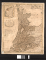
 Historische kaart Nederlandse kust.jpg 2,340 × 1,672; 928 KB
-
 Hollandiae 1570 Ortelius.jpg 6,712 × 5,062; 27.3 MB
-
 Atlas Ortelius KB PPN369376781-035av-035br.jpg 3,000 × 2,194; 4.75 MB
-
 1596 Hollandia Comitatus Kaerius.jpg 2,235 × 2,731; 2.91 MB
-
 1606 Mercator Map of Holland ( Netherlands ) - Geographicus - Hollandt-mercator-1606.jpg 5,770 × 4,240; 5.21 MB
-
 4' 1608 Com Hollandia Blaeu HR.jpg 7,609 × 5,843; 31.12 MB
-
 Rerum et urbis Amstelodamensium historia - no-nb digibok 2009032513001-14.jpg 5,121 × 4,332; 4.32 MB
-
 1628 Kaart van Holland en Utrecht.jpg 6,272 × 4,845; 8.3 MB
-
 Helmink Antique map of Holland by Anonymous 3rd state by Frederick de Wit 1630.jpg 6,946 × 5,728; 40 MB
-
 Gnephoek1665.JPG 539 × 556; 100 KB
-
 COMITATUS HOLLANDIAE 1682.jpg 4,400 × 3,653; 4.19 MB
-
-
 Broad Fourteens delisle 1743.jpg 888 × 864; 242 KB
-
 Isaak Tirion.jpg 1,500 × 1,333; 2.4 MB
-
-
 Holland 1400.png 378 × 429; 447 KB
-
 Holland1477.png 336 × 333; 188 KB
-
 43411 blaeu-1612-kaart-04.jpg 6,638 × 3,050; 3.67 MB
-

-

-
 Atlas Blaeu Erfgoed Leiden en Omstreken, p254.jpg 9,562 × 7,176; 14.79 MB
-

-

-
 Guicciardini Map of Holland.png 1,951 × 1,520; 4.99 MB
-
 Holland 1580 (26794719660).jpg 1,835 × 2,604; 1.61 MB
-
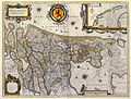
 Hollandia Comitatus 1634.jpg 1,388 × 1,159; 1.32 MB
-

-
 Kaart van het noordelijke stroomgebied van de Amstel.jpg 2,048 × 1,456; 478 KB
-
 Karta över del av Holland utefter floden Meuse, från 1747 - Skoklosters slott - 97997.tif 4,739 × 3,744; 50.78 MB
-
 Maas, Waal en Merwede (3381207595).jpg 2,000 × 1,007; 452 KB
-
 Map of Holland by Abraham Ortelius.jpeg 1,584 × 1,178; 636 KB
-
 Reproductie van topografische kaart - Unknown - 20401109 - RCE.jpg 885 × 1,200; 379 KB
-
 Rijnland amstelland atlasmaior.jpg 3,679 × 3,089; 5.14 MB
-
 Willem Blaeu - Hollandia Comitatus.jpg 2,126 × 1,605; 3.5 MB
.jpg)
.jpg)


_-_Geographicus_-_Hollandt-mercator-1606.jpg)


_-_Geographicus_-_Holland-coronelli-1692.jpg)


.jpg)
.jpg)


.jpg)


.jpg)


.jpg)