File:Guatemala and its region.png
Jump to navigation
Jump to search

Size of this preview: 620 × 600 pixels. Other resolutions: 248 × 240 pixels | 496 × 480 pixels | 713 × 690 pixels.
Original file (713 × 690 pixels, file size: 92 KB, MIME type: image/png)
Captions
Captions
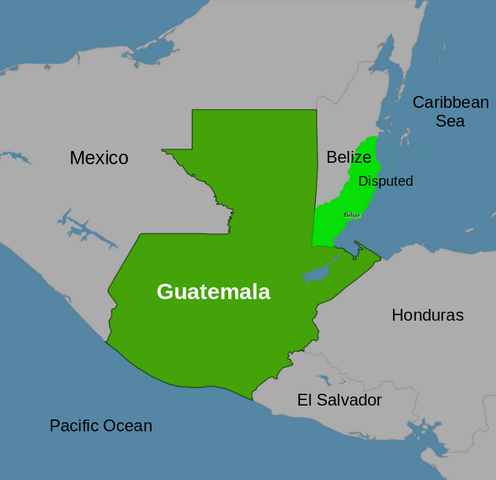
Guatemala and its surrounding region
Summary[edit]
| Description |
English: Labeled map of the region where Guatemala is located. |
|||
| Date | ||||
| Source | Modified File:Guatemala disputed w1 countrymap.svg | |||
| Author | Thinker78, based on map by Sanjay Rao | |||
| Permission (Reusing this file) |
This file is licensed under the Creative Commons Attribution 4.0 International license. Attribution: Thinker78 (based on Sanjay Rao)
|
|||
| Other versions |
|
Licensing[edit]
This file is licensed under the Creative Commons Attribution 4.0 International license.
Attribution: Thinker78
- You are free:
- to share – to copy, distribute and transmit the work
- to remix – to adapt the work
- Under the following conditions:
- attribution – You must give appropriate credit, provide a link to the license, and indicate if changes were made. You may do so in any reasonable manner, but not in any way that suggests the licensor endorses you or your use.
File history
Click on a date/time to view the file as it appeared at that time.
| Date/Time | Thumbnail | Dimensions | User | Comment | |
|---|---|---|---|---|---|
| current | 06:04, 14 May 2023 | | 713 × 690 (92 KB) | Thinker78 (talk | contribs) | Uploaded a work by Thinker78, Sanjay Rao from File:Guatemala disputed w1 countrymap.svg with UploadWizard |
You cannot overwrite this file.
File usage on Commons
The following page uses this file: