Category:Maps of borders of Guatemala
Jump to navigation
Jump to search
Media in category "Maps of borders of Guatemala"
The following 35 files are in this category, out of 35 total.
-
 Caribbean maritime boundaries map zh.svg 3,561 × 2,221; 2.87 MB
-
 Caribbean maritime boundaries map.svg 3,561 × 2,221; 2.78 MB
-
 Caribbean maritime boundaries map mk.svg 3,561 × 2,221; 5.52 MB
-
 Mapa das Caraíbas (fronteiras marítimas).svg 3,561 × 2,221; 2.86 MB
-
 Mapa del Caribe (límites marinos).svg 5,340 × 3,660; 3.02 MB
-
 Mapa del Mar Caribe (límites marinos)-fr.svg 3,587 × 2,221; 1.91 MB
-
 Mapa del Mar Caribe (límites marinos).svg 3,587 × 2,221; 1.98 MB
-
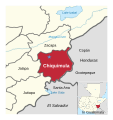 Chiquimula department and its neighbors.svg 698 × 741; 233 KB
-
 Disputed territory between Belize and Guatemala de.svg 504 × 700; 78 KB
-
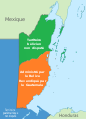 Disputed territory between Belize and Guatemala-fr.svg 840 × 1,165; 112 KB
-
 Disputed territory between Belize and Guatemala.svg 840 × 1,165; 257 KB
-
 El Salvador-Guatemala border.png 874 × 1,179; 402 KB
-
 FRONTERA ENTRE BLZ-MEX.png 988 × 628; 46 KB
-
 Guatemala and its region.png 713 × 690; 92 KB
-
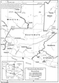
 Guatemala-Honduras border.png 856 × 1,194; 355 KB
-
 Guatemala-Mexico border.png 1,000 × 1,392; 178 KB
-
 Huehuetenango and its neighbors.svg 610 × 738; 70 KB
-
 Izabal and its neighbors.svg 744 × 667; 306 KB
-
 Jutiapa department and its neighbors.svg 780 × 745; 221 KB
-
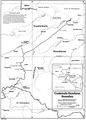
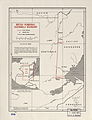 Map of British Honduras-Guatemala boundary.jpg 3,354 × 4,377; 2.19 MB
-

-
 Mapa de la frontera México-Guatemala (1546).svg 1,089 × 816; 196 KB
-
 Mapa de la frontera México-Guatemala (1790).svg 1,089 × 816; 196 KB
-
 Mapa de la frontera México-Guatemala (1866 guatemalteca).svg 1,089 × 816; 196 KB
-
 Mapa de la frontera México-Guatemala (1866 mexicana).svg 1,089 × 816; 194 KB
-
 Mapa de la frontera México-Guatemala (concesiones).svg 1,089 × 816; 195 KB
-
 Mapa de la frontera México-Guatemala.svg 801 × 626; 110 KB
-
 Mapaguatelimites.JPG 383 × 484; 43 KB
-
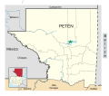 Petén and its neighbors.svg 764 × 673; 156 KB
-
 Quiché and its neighbors.svg 709 × 1,042; 67 KB
-
 San Marcos department and its neighbors.svg 523 × 740; 248 KB
-
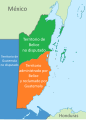 Territorio en disputa entre Belice y Guatemala.svg 840 × 1,165; 284 KB
-
 Wyke–Aycinena Treaty Map.png 4,186 × 6,131; 15.57 MB
-
 Zacapa and its neighbors.svg 886 × 742; 239 KB
-
 Área en disputa entre las repúblicas de Guatemala y Belice.png 4,456 × 4,752; 370 KB


.svg)
.svg)
-fr.svg)
.svg)


.svg)
.svg)
.svg)
.svg)
.svg)


