File:Greene Co., Virginia LOC 2003630502.tif
Jump to navigation
Jump to search

Size of this JPG preview of this TIF file: 421 × 599 pixels. Other resolutions: 168 × 240 pixels | 337 × 480 pixels | 539 × 768 pixels | 719 × 1,024 pixels | 1,438 × 2,048 pixels | 2,589 × 3,686 pixels.
Original file (2,589 × 3,686 pixels, file size: 27.3 MB, MIME type: image/tiff)
Captions
Captions
Add a one-line explanation of what this file represents
Summary[edit]
| Description |
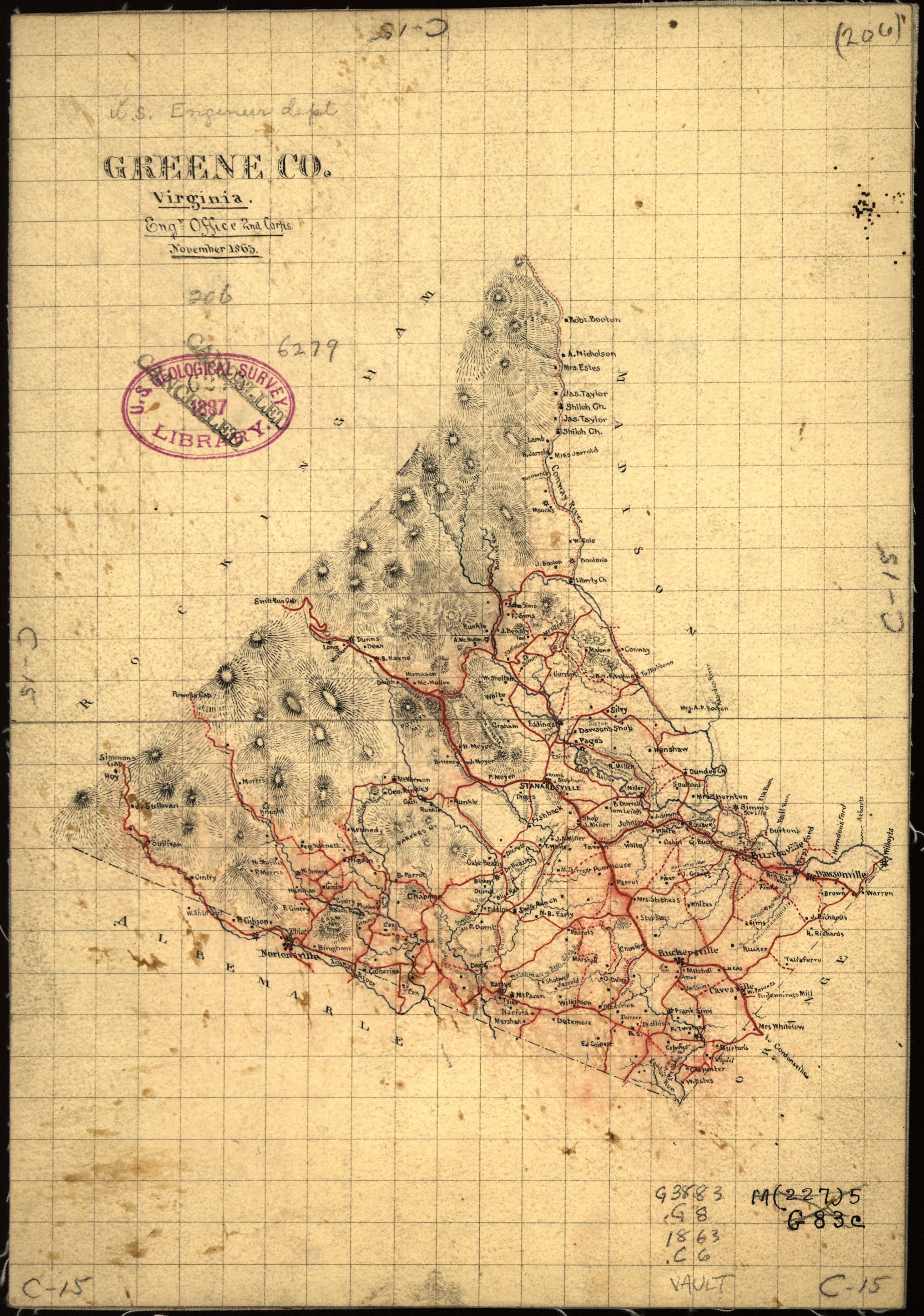
English: Shows roads, settlements, rural householders' names, and streams. Does not show military features. Relief shown by hachures. "November 1863." Believed to have been prepared by Jedediah Hotchkiss. Pen-and-ink (black and red) and lead pencil. Drawn on an approx. 1-cm. grid. Rubber-stamped on recto: U.S. Geological Survey Library 1887--cancelled. Annotated in lead pencil at edges: C-15; in lead pencil in upper right corner: (206); in black ink at lower right: M(227)5 G83c. LC Civil War maps (2nd ed.), 558.5 Available also through the Library of Congress Web site as a raster image. Transfer; U.S. Geological Survey; Sept. 23, 1964. |
||
| Title | Greene Co., Virginia | ||
| Shelf ID | G3883.G8 1863 .C6 | ||
| Date | |||
| Source | https://www.loc.gov/item/2003630502/ | ||
| Author | Confederate States Of America. Army Of Northern Virginia. Corps, 2Nd. Engineer Office; Hotchkiss, Jedediah | ||
| Permission (Reusing this file) |
|
||
| Other versions |
|
||
| Location | United States · Greene County · Virginia | ||
| Part of | Military Battles And Campaigns · American Memory · Civil War Maps · Catalog · Geography And Map Division | ||
| Subject | Maps, Manuscript · Greene County · Virginia · United States · Maps · Greene County (Va.) · Maps, Physical · Landowners |


Licensing[edit]
|
This is a faithful photographic reproduction of a two-dimensional, public domain work of art. The work of art itself is in the public domain for the following reason:
The official position taken by the Wikimedia Foundation is that "faithful reproductions of two-dimensional public domain works of art are public domain".
This photographic reproduction is therefore also considered to be in the public domain in the United States. In other jurisdictions, re-use of this content may be restricted; see Reuse of PD-Art photographs for details. | ||||
File history
Click on a date/time to view the file as it appeared at that time.
| Date/Time | Thumbnail | Dimensions | User | Comment | |
|---|---|---|---|---|---|
| current | 13:14, 17 May 2018 |  | 2,589 × 3,686 (27.3 MB) | Fæ (talk | contribs) | LOC Maps https://www.loc.gov/item/2003630502/ #10203 |
You cannot overwrite this file.
File usage on Commons
The following page uses this file: